This area provides a wide list of success stories categorized according to the United Nations Sustainable Development Goals (UN SDGs). This area allows interested EO user communities to identify EO applications based on the SDGs. The UN SDGs are at the heart of the UN 2030 Agenda for Sustainable Development, providing a blueprint for the people, planet, and its resources now and in the future.
Only the SDGs where EO can make a sound contribution have been displayed. To know more about the success stories linked to products or applications, you can refer to the EO in Action section, selecting the appropriate product page.
In September 2015, the UN General Assembly ratified the 2030 Agenda on Sustainable Development, a new transformative, integrated and universal agenda that aims to end poverty, promote prosperity and people’s well-being while protecting the environment. The core of the 2030 agenda is the 17 sustainable development goals (SDGs) and their 169 associated targets, which should be achieved by 2030. The SDGs are being launched with an emphasis on collecting data that will be extensive and specific enough to serve these needs. They are designed to balance the three dimensions of sustainable development: the economic, social and environmental.
Earth observation (EO) is a powerful instrument to support the reporting on Sustainable Development Goals (SDGs) and indicators and the provision of relevant information to effectively monitor progress towards the SDG targets, and the degree of compliance with the International Agreements. It helps on the provision of critical information on natural resources, government operations, public services, or population demographics. This actionable information helps on the SDG implementation role, monitoring, reporting, and the facilitation and shaping of reporting methods, policy and tools. These insights can inform national priorities and help determine the most effective paths for action on national issues. EO is a critical data source for monitoring and driving progress against the SDGs.
Effective monitoring of the SDG and reporting of the progress towards the SDG targets require the use of multiple types of data such as EO which together with modern data processing and analytics, offer new opportunities to track sustainable development.
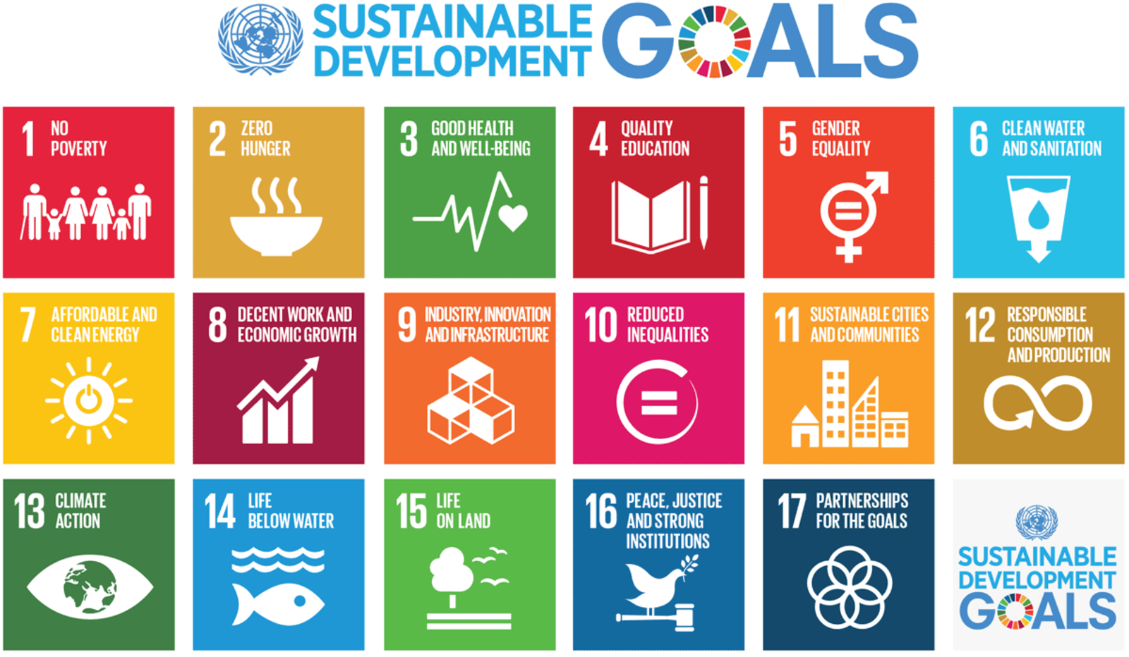
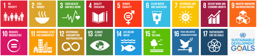
The 17 Sustainable Development Goals (SDGs) of the 2030 Agenda Goal 1. End poverty in all its forms everywhere. Goal 2. End hunger, achieve food security and improved nutrition and promote sustainable agriculture. Goal 3. Ensure healthy lives and promote well-being for all at all ages. Goal 4. Ensure inclusive and equitable quality education and promote lifelong learning opportunities for all. Goal 5. Achieve gender equality and empower all women and girls. Goal 6. Ensure availability and sustainable management of water and sanitation for all. Goal 7. Ensure access to affordable, reliable, sustainable and modern energy for all. Goal 8. Promote sustained, inclusive and sustainable economic growth, full and productive employment and decent work for all. Goal 9. Build resilient infrastructure, promote inclusive and sustainable industrialization and foster innovation. Goal 10. Reduce inequality within and among countries. Goal 11. Make cities and human settlements inclusive, safe, resilient and sustainable. Goal 12. Ensure sustainable consumption and production patterns. Goal 13. Take urgent action to combat climate change and its impacts. Goal 14. Conserve and sustainably use the oceans, seas and marine resources for sustainable development. Goal 15. Protect, restore and promote sustainable use of terrestrial ecosystems, sustainably manage forests, combat desertification, and halt and reverse land degradation and halt biodiversity loss. Goal 16. Promote peaceful and inclusive societies for sustainable development, provide access to justice for all and build effective, accountable and inclusive institutions at all levels. Goal 17. Strengthen the means of implementation and revitalize the global partnership for sustainable development. |

EO Products/Services supporting the SDGs
Goal: End poverty in all its forms everywhere.
EO data offer an invaluable opportunity for better-informing development policies and quantifying various targets. How can EO be used to help countries achieve specific targets? Source: ESA compendium of EO contributions to the SDG Targets and Indicators
Target 1.1: By 2030, eradicate extreme poverty for all people everywhere, currently measured as people living on less than $1.25 a day. (eo services focus on: Mapping spatial distribution of risk of poverty) Target 1.2: By 2030, reduce at least by half the proportion of men, women and children of all ages living in poverty in all its dimensions according to national definitions. Earth Observation (EO) data can be used to track and target poverty, and aid the allocation of scarce resources which can help improve human livelihoods. EO can be used to map spatial distribution of socioeconomic deprivations, as well as providing information that may indicate areas at risk of poverty (e.g. contribute towards famine early warning systems) (NASA, 2018). EO data can be used to forecast weather, monitor fires, determine populations at risk from flooding/landslides, analyse climate change and map land cover change (e.g. deforestation and degradation). These factors can all help identify areas currently at risk from poverty, and in the future. Satellite images can also be used to estimate economic activity (e.g. through monitoring night lights) and mapping houses (e.g. slums), which can be identified through satellite images using physical parameters, clustering of structures with or without a road network, irregular and haphazardly grouped temporary, poorly-constructed or semi-permanent households (Montana et al., 2016). Further, these datasets can be combined with in-field survey data (from socioeconomic household surveys, social media, mobile phone networks) (Leidig & Teeuw, 2015), and often by additionally using machine learning algorithms (Jean et al., 2016), can estimate consumption expenditure and asset wealth of the region analysed. Such approaches can assist efforts to track and target poverty. (eo services focus on: Estimate economic activity, mapping areas and its resources) |
Target 1.4: By 2030, ensure that all men and women, in particular the poor and the vulnerable, have equal rights to economic resources, as well as access to basic services, ownership and control over land and other forms of property, inheritance, natural resources, appropriate new technology and financial services, including microfinance. Improving human well-being and access to services, EO data can help develop various proxy indicators of human well-being, for example access to services such as electric power, as well as patterns of human interaction Remote sensing and call data records can help monitor access to basic services. Call Data Records (CDR) provide information on where, when, how and with whom someone made a mobile phone call – mainly used for billing purposes, but also provide spatial information on patterns of human interaction. Mobile phone usage and movement can indicate household access to financial resources and services, for example, via electronic money schemes such as M-Pesa. Remote sensing can capture information on biophysical properties such as rainfall, temperature and vegetation cover as well to variables such as infrastructure (e.g. railway, main roads, waterways), distance to water sources and power plants, electricity use, agriculture productivity and distance to roads and urban areas (which reflects access to markets and information). The state of the road network (e.g. if it’s a dirt track or an impervious road) can be derived through Open Street Map, but can be combined with remote sensing data to provide a more detailed picture. (eo services focus on: Estimate economic activity and access to basic services) |
Target 1.5: By 2030, build the resilience of the poor and those in vulnerable situations and reduce their exposure and vulnerability to climate-related extreme events and other economic, social and environmental shocks and disasters. The frequency and severity of natural disasters have been increasing in the last decades. Research has revealed that it is generally the poor who tend to suffer worst from disasters. The fact that climate change is expected to increase the frequency and intensity of these events threaten to derail international efforts to eradicate poverty. The importance of EO in disaster management and assessment has gained increasing significance over the past years. One of the ways EO can contribute to build resilience of vulnerable populations is through disaster-risk reduction. EO datasets and methods can contribute to disaster risk management and reduction by providing relevant information to the full cycle of disaster and environmental shock management: mitigation, preparedness, warning and response. EO has proven successful for a wide range of disaster types, particularly for flooding, extreme drought events, earthquakes, landslides and volcanic eruptions. In fact, EO data is providing a reliable data basis for deriving useful information such as the extent of damaged area along with the land-use types as well as the population affected. This can be done through hazard mapping and risk modelling, real time monitoring, producing input data for feeding early warning systems, or for producing maps to support disaster response actions. For a comprehensive review on how EO can contribute to disaster-risk management, see ESA (2015). EO data lies also at the heart of climate modelling, which represent key tools to inform actions aiming to reduce vulnerability to climate change. (eo services focus on: Build resilience of vulnerable populations contributing to management of disaster risk reduction. Indicator 1.5.2: Disaster Damage) |

EO Products/Services supporting the SDGs
Goal: End hunger, achieve food security and improved nutrition and promote sustainable agriculture.
EO data offer an invaluable opportunity for better-informing development policies and quantifying various targets. How can EO be used to help countries achieve specific targets? Source: ESA compendium of EO contributions to the SDG Targets and Indicators
Target 2.3: By 2030, double the agricultural productivity and incomes of small-scale food producers, in particular women, indigenous peoples, family farmers, pastoralists and fishers, including through secure and equal access to land, other productive resources and inputs, knowledge, financial services, markets and opportunities for value addition and non-farm employment. Smallholder farmers play a key role in global food production, particularly in developing countries. Is estimated that small-scale farming systems provide up to 80 percent of the food supply in Asian and sub-Saharan Africa. These systems usually host the majority of poor and hungry people worldwide. Therefore, increasing agricultural productivity in these systems would be key to achieve food security. Even though EO has been proven potentially useful to contribute to the management of farming, pastoral and forestry systems at regional scales, particularly by generating data to feed crop simulation models and early warning systems, it still has limitations to provide the type of fine scale data needed to feed models operating at the farm scale. This is mainly due to the need for high spatial and temporal resolution and repeat monitoring on demand, which satellites cannot yet guarantee (Jin et al. 2018, Kasampalis et al. 2018). The Global Ecosystem Dynamics Investigation Lidar (GEDI), to be launched in 2018, is expected to produce promising data to fill this gap, at least for forestry systems. Further efforts are needed in order to implement ways to put the information derived from crop simulation models and early warning systems in the hands of small-scale food producers, as required by this target. Recent pilot cases suggest that information derived from EO, such as weather forecasts, can be made accessible to small-scale food producers even in isolated areas in a way that can inform crop management decisions, such as the time to plant and crop variety selection (UNDP, 2016). As this indicator is classified as Tier 3, no internationally established methodology or standards are yet available. (eo services focus on Management of farming) |
Target 2.4: By 2030, ensure sustainable food production systems and implement resilient agricultural practices that increase productivity and production, that help maintain ecosystems, that strengthen capacity for adaptation to climate change, extreme weather, drought, flooding and other disasters and that progressively improve land and soil quality. Continuing population and consumption growth is likely to increase the global demand for food in the next decades. The achievement of food security will require profound changes in the global food and agriculture system. At the same time, unsustainable agriculture expansion has created numerous environmental problems, such as soil erosion, water pollution as well as greenhouse gases emissions. This target aims to contribute to this goal by increasing the economic, social and environmental sustainability of agricultural practices, including through enhancing the resilience to climate change and extreme whether events. EO methods can play an important role in increasing agricultural productivity as well as minimising the environmental impact of the agricultural sector. Some of the ways EO has proven successful to contribute to increase the sustainability of agricultural production include: (1) yield estimation, (2) vegetation vigour and drought stress monitoring, (3) assessment of crop phenological development, (4) crop acreage estimation and cropland mapping and (5) mapping of disturbances and land use/land cover (LULC) changes (Atzberger, 2014). EO datasets can also be used by countries to inform spatial land use planning and minimize the potential environmental impact of crop expansion through optimizing the allocation of lands (Laurence et al. 2014). In addition to crops, satellite remote sensing techniques can also be applied for rangeland monitoring and management (Ali et al. 2016). EO data and methods can be useful for assessing the future exposure to climate change as well as to extreme weather events, as explained in the 1.5.2 indicator factsheet. (eo services focus on Agricultural productivity & env. impact of agriculture. Indicator 2.4.1: Sustainable agriculture) |

EO Products/Services supporting the SDGs
Goal: Ensure healthy lives and promote well-being for all at all ages.
EO data offer an invaluable opportunity for better-informing development policies and quantifying various targets. How can EO be used to help countries achieve specific targets? Source: ESA compendium of EO contributions to the SDG Targets and Indicators
Target 3.3: By 2030, end the epidemics of AIDS, tuberculosis, malaria and neglected tropical diseases and combat hepatitis, water-borne diseases and other communicable diseases. This target aims to end three of the world’s major epidemics, which combined claim millions of lives per year (Murray et al., 2014). This makes this target one of the SDG targets with the greatest potential impact in terms of reducing mortality. The utility of EO methods for improving the understanding, prevention, and control of vector- borne diseases has been extensively demonstrated, particularly for malaria (Gebreslasie,2015). EO data has been used, for instance, to derive environmental data to feed malaria risk models, identification of potential vector habitats and to inform the development of early warning systems. Some of the EO-derived data that have been applied to malaria epidemiology include: land cover, land and sea surface temperature vegetation indices such as NDVI and enhanced vegetation index, precipitation and actual evapotranspiration. Results of the models developed with EO-derived data can be useful to identify locations where the risk of disease is highest and direct resources to the population most in need. EO-derived data can also be applied to develop risk models for other tropical diseases such as dengue or schistosomiasis, among others. (eo services focus on Assessment of diseases) |
Target 3.9: By 2030, substantially reduce the number of deaths and illnesses from hazardous chemicals and air, water and soil pollution and contamination. EO data can be used to monitor the level of air quality data (e.g. PM2.5, CO2, CO, NOx, SO2) (van Donkelaar et al., 2010) water quality data (E.g. Chlorophyll-a, turbidity) (Mohamed, 2015), as well as soil pollution data (e.g. concentration of hydrocarbons) (Karkush et al., 2014). These can be correlated with census data on human health and mortality to monitor progress towards reducing the number of deaths and illness from hazardous chemicals and air, water and soil and contamination. In order to reduce the number of deaths by creating public awareness, a wider forecasting system based on modelling EO data for the likely risk of danger from hazardous chemicals and air, water and soil pollution and contamination is needed. (eo services focus on Monitor the level of air quality data) |
Relevant Success Stories
EO Products/Services supporting the SDGs
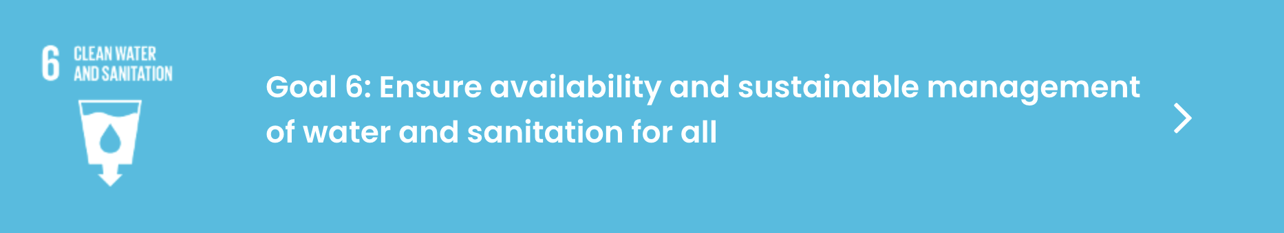
Goal: Ensure availability and sustainable management of water and sanitation for all.
EO data offer an invaluable opportunity for better-informing development policies and quantifying various targets. How can EO be used to help countries achieve specific targets? Source: ESA compendium of EO contributions to the SDG Targets and Indicators
Target 6.1: By 2030, achieve universal and equitable access to safe and affordable drinking water for all. One of the most essential uses of water is for domestic consumption within households. This purpose is captured in target 6.1, which seeks to guarantee safe and affordable drinking water for drinking and hygiene purposes for all. Households are an important share of total water use and therefore represent a significant sector in achievement of target 6.4 on water use efficiency. “Safe” water is considered to be free of contaminants and is determined by the quality of untreated water prior to human consumption. The necessity of the target, for a supply of high water quality in the first place, is threatened by conversion of wetlands, forests and woodlands to agriculture around populated areas and water catchments. This target is therefore linked to the protection of the water catchment which is the focus of target 6.6 and the quality of water in target 6.3. The use of land cover change data, particularly in models to estimate the impact on water supplies in the event of widespread deforestation and land conversion, is a powerful way to show how drinking water becomes both unsafe and unaffordable in the event of a water supply being compromised by the conversion of natural ecosystems which regulate it. As EO-based observations are primary inputs to such models, countries can be supported towards achievement of target 6.1 by implementing such models and to plan for better baseline water quality through regulation of land use in water catchments. (eo services based on Assess water use efficiency) |
Target 6.3: By 2030, improve water quality by reducing pollution, eliminating dumping and minimizing release of hazardous chemicals and materials, halving the proportion of untreated wastewater and substantially increasing recycling and safe reuse globally. Target 6.3 aims to improve ambient water quality, important for protecting both ecosystem health and human health, by eliminating, minimizing and significantly reducing different streams of pollution into water bodies. The main sources of water pollution include wastewater from households, commercial establishments and industries (point sources), as well as run-off from urban and agricultural land (non-point sources). Water quality can be measured in different ways and EO methods of water quality detection differ from those based on in-situ assessment. Therefore EO support to this target will be limited by what can be detected based on current sensor technology. EO is important in ongoing, routine water quality monitoring of large water bodies, ideally in combination with in situ sampling. Yet it is feasible, although challenging, to use EO as a monitoring tool for illegal contamination of water supplies. The release of certain hazardous chemicals and materials, for example, can alter the opacity, turbidity and colour of lakes, rivers or other water bodies, which can be sensed from a multispectral or hyperspectral sensor. Armed with this EO-derived information on sudden declines in water quality, e.g. due to dumping of hazardous materials, water management authorities could track down polluters. However, the spatial resolution of the Sentinel 3 Ocean and Land Colour Imager (OLCI) is likely to be too coarse to accurately detect such events, while the Sentinel 2 Multi Spectral Imager (MSI), although better suited in terms of spatial resolution, is too sparse in terms of revisit time (5 days). A combination of commercial and free sensors (OLCI, S-2, L8, SPOT, RapidEye, IKONOS) could be an option for targeted, local efforts at detection of pollution events. EO can also support countries with the target by assessment of the risk of eutrophication of a country’s water bodies by monitoring ambient nutrient pollution in standing waters. (eo services based on Water quality detection & monitoring. Indicator 6.3.2: Ambient water quality) |
Target 6.4: By 2030, substantially increase water-use efficiency across all sectors and ensure sustainable withdrawals and supply of freshwater to address water scarcity and substantially reduce the number of people suffering from water scarcity. Target 6.4 addresses water scarcity, aiming to ensure there is sufficient water for the population, the economy and the environment by increasing water-use efficiency across all sectors of society. Finding a balance between demands for water from environmental requirements and human demand is essential to maintaining ecosystem health and resilience. An imbalance due to unsustainable levels of demand can result in water stress with negative effects on economic development, increasing competition and potential conflict among users. This requires effective supply and demand management policies and an increase in water-use efficiency. EO has an obvious – if yet unrecognised – contribution to the monitoring of the target in quantifying surface water changes over time, water consumed by key water-user sector such as agriculture, as well as soil moisture deficits. Therefore EO can help countries achieve water use efficiency gain targets by identify areas of current and future surface water deficits, e.g. through hydrological models, based on EO parameters such as evapotranspiration, soil moisture and surface water, and by modelling supply and demand across sectors based on land use change. In agricultural areas, EO can monitor how effectively water uptake by vegetation is translated into crop yield, using a metric that is referred to as agriculture water productivity (yield/m3 of water consumed). This can ultimately help countries to plan for water deficits in advance of stresses such as climate extremes or when demand is excessive. The number of people suffering from or potentially affected by such water deficits could then be calculated based on demographic statistics A range of options exists for coping with water scarcity that address the supply side or the demand side or a combination of the two, depending on the bio-physical and socio-economic context. (eo services based on Water user efficiency. Indicator 6.4.1: Water user efficiency & 6.4.2: Water stress) |
Target 6.6: By 2020, protect and restore water-related ecosystems, including mountains, forests, wetlands, rivers, aquifers and lakes. For the purposes of this target, water-related ecosystems are grouped into five categories: 1) vegetated wetlands, 2) rivers and estuaries, 3) lakes, 4) aquifers, and 5) artificial waterbodies. Water-related ecosystems contain and maintain the global stock of freshwater, from which water related services flow to society. They are characterised by high biodiversity and because biodiversity and because they are carbon-rich, are important for climate change mitigation. In terms of services they provide micro climate regulation, e.g. minimising the negative impacts of urban heat islands. They capture and store water and maintain water quality since they can decompose and /or absorb water pollutants. Therefore this target promotes the sustainable management of water catchment ecosystems such as wetlands, rivers, lakes, reservoirs and groundwater, as well as water-related forests and mountains, which are crucial for provision of these services. The ecosystem based approach is important for flood regulation, public water supply and access to clean drinking water. In this respect, target 6.6 is the starting point for other water-related targets as it aims to protect water at source. As water-related ecosystems are often highly complex and very diverse, management is challenging and monitoring is expensive and time consuming. Therefore EO provides a standardised monitoring approach which can capture the multiple dimensions of change from hydrological to biophysical processes. However as this target is focused on the watershed EO at high spatial resolution, e.g. Landsat and Sentinel-1/-2 (10-30m) should be acquired. For example, high resolution land cover change can be used to track changes in water- related ecosystems, to assess the success of catchment-wide restoration efforts and the effectiveness of protection measures or to identify threats to sensitive habitat. Other EO products such as the extent of water bodies and their temporal dynamics, as well as digital terrain models, are inputs to models that assess the availability of surface and ground water. (eo services based on Monitoring the extent of water related ecosystems over time. Indicator 6.6.1: Water-related ecosystems) |
Relevant Success Stories
EO Products/Services supporting the SDGs
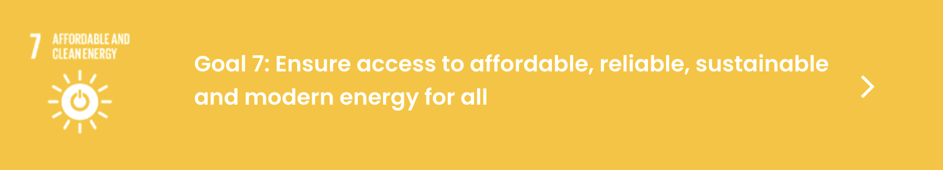
Goal: Ensure access to affordable, reliable, sustainable and modern energy for all.
EO data offer an invaluable opportunity for better-informing development policies and quantifying various targets. How can EO be used to help countries achieve specific targets? Source: ESA compendium of EO contributions to the SDG Targets and Indicators
Target 7.1: By 2030, ensure universal access to affordable, reliable and modern energy services. Approximately 1 billion people still have no access to electricity, 50% of which live in sub- Saharan Africa. Access to energy is essential for achieving many sustainable development goals, from poverty reduction, improved health care, gender equity, and education to combating climate change. Energy accounts for around 60% of total global greenhouse gas emissions and while energy sources are transitioning from coal, to natural gas, to renewables, global energy use is still primarily based on fossil fuels. In this context, Target 7.1 can be achieved and monitored with the integration of EO data. Applicable on a larger scale, remote sensing data is able to give information that by field surveys alone would be more time consuming and often difficult to gain because of the accessibility of many locations. The regular collection of EO ensures the long-term availability of data to monitor the status of remote and rural settlements. A useful data source is nigh-time luminosity data, which can collect daily variations at sufficiently low light levels to detect artificial lights at night across remote and rural areas. Night time lights products have been used for a vast range of purposes for more than 50 years, including to map the distribution of economic activity, poverty levels and to generate CO2 emission maps. In particular, the NASA’s Black Marble product suite can be used to monitor in near-real time areas not reached by centralized electricity services, and then inform the development of investment and implementation plans for electrical infrastructures aiming to protect and/or increase energy access by the highest number of people in a country. EO-based technologies for monitoring access to different types of energy resources varies depending on the details of the information needed. For instance, the type of energy source (e.g. solar panels, diesel power generators, nationwide electrical networks) can only be acquired using high resolution EO data in combination with sophisticated statistical techniques, but various use cases (e.g., from Zambia to Pakistan) show the high potential that EO have to monitor several aspects of this target. (eo services based on Access to energy (status of settlements). Indicator 7.1.1: Access to electricity) |

EO Products/Services supporting the SDGs
Goal: Ensure access to affordable, reliable, sustainable and modern energy for all.
EO data offer an invaluable opportunity for better-informing development policies and quantifying various targets. How can EO be used to help countries achieve specific targets? Source: ESA compendium of EO contributions to the SDG Targets and Indicators
Target 8.2: Achieve higher levels of productivity of economies through diversification, technological upgrading and innovation, including through a focus on high value added and labor-intensive sectors Digital connectivity and EO-based technologies for monitoring access to different types of natural resources. (eo services based on sustainable management of a defined labor intensive sector such agriculture) |
Relevant Success Stories

EO Products/Services supporting the SDGs
Goal: Build resilient infrastructure, promote inclusive and sustainable industrialisation and foster innovation.
EO data offer an invaluable opportunity for better-informing development policies and quantifying various targets. How can EO be used to help countries achieve specific targets? Source: ESA compendium of EO contributions to the SDG Targets and Indicators
Target 9.1: Develop quality, reliable, sustainable and resilient infrastructure, including regional and trans- border infrastructure, to support economic development and human well-being, with a focus on affordable and equitable access for all. Infrastructures that are sustainable, durable and disaster-resilient, provide the basic and essential structures to a country to effectively function, but also allow to generate employment and wealth and drive economic development. This target is strongly linked to other sustainable development goals, including zero hunger, no poverty, good health and well-being, as well as quality education. Rural development processes, including access to markets, education and health services, cannot succeed without a reliable access to roads year-round. EO data can inform the production of efficient and effective plans for infrastructures development and management. The global coverage of remote sensing images allows the identification of areas currently lacking infrastructures for transportation or energy access. These data coupled with information on topography, land cover, precipitation patterns, climate change scenarios, can support the development of climate resilient infrastructures. EO data has been widely used to extract infrastructures such as urban areas, roads and dams using data at different spatial resolution (e.g. rural roads can be detected just with high resolution images) and different techniques (e.g. supervised and unsupervised classification, neural networks, and mathematical morphology). Research is also currently focused on using high resolution or radar data to monitor the status of infrastructures, particularly in areas prone to natural disasters, such as flooding, but also in areas affected by conflicts. The need to plan for regional and trans-border infrastructure is also well served by EO since it is technology that crosses borders and is not limited by a single country’s or region’s national data collection systems. In theory, open access EO data should help countries collaborate on shared infrastructure projects. (eo services based on Inform on infrastructures development & planning. Indicator 9.1.1: All season roads) |
Target 9.4: By 2030, upgrade infrastructure and retrofit industries to make them sustainable, with increased resource-use efficiency and greater adoption of clean and environmentally sound technologies and industrial processes, with all countries taking action in accordance with their respective capabilities. EO data can be used to measure pollutants that arise from industries and infrastructure. Satellite data can also be used to locate potential pollutant hotspots through analysis of global emissions, and monitoring pollution plumes. Satellites also collect weather and climate data, which can aid decision-making in relation to clean energy installations. For example, satellites can be used to forecast surface wind field data to guide operations of wind turbines, and predict their energy input into power grids. It can also be used to map photovoltaic solar electricity potential, based on solar irradiance climatology – which can be used to aid solar energy installation. (eo services based on Mapping & measurement of pollutants emissions) |
Relevant Success Stories
EO Products/Services supporting the SDGs
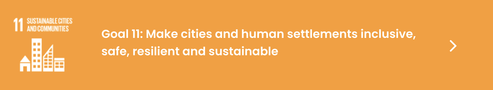
Goal: Make cities and human settlements inclusive, safe, resilient and sustainable.
EO data offer an invaluable opportunity for better-informing development policies and quantifying various targets. How can EO be used to help countries achieve specific targets? Source: ESA compendium of EO contributions to the SDG Targets and Indicators
Target 11.1: By 2030, ensure access for all to adequate, safe and affordable housing and basic services and upgrade slums. “Currently, an estimated 1.6 billion people live in inadequate housing globally, of which 1 billion live in slums and informal settlements”. The rapid urban growth of recent decades has led to an increase of slums and informal settlements, as well as air pollution and inadequate basic services and infrastructure. The lack of proper urban planning and management can bring tenure insecurity, increase poverty, pollution, health risks, as well as a higher vulnerability and exposure to natural and technological hazards. To make urban spaces more inclusive, safe, resilient and sustainable the development, monitoring and management of better forms of urban plans are urgently needed. Many local governments ignore the extent of slums. “Slums disappear not through being removed, but by being transformed”, and in order to carry out this transformation the extent, the physical characteristics as well as the dynamics of slums, such as their densification and expansion, need to be understood and monitored. EO can help both understanding and monitoring slums, but can also link their morphology with socio-economic data, as well as help to identify hazardous areas where many of these settlements are located. An increased number of studies in the last 15 years have been published on the use of EO to understand geography and dynamics of slums, thanks to the availability of very-high-resolution (VHR) data and the advances in the methodologies to analyse them. The use of EO can support monitoring of slums and informal settlements growth, thanks to their frequent coverage of large areas, for which it would be difficult to regularly undertake on the ground household surveys. By knowing the dynamics and the extent of slums, sustainable urban plans and slum improvement polices can be developed and monitored, including the improvement of the building structures, access to water, electricity and other basic needs. VHR images are also increasingly used by slum communities and NGOs as a basis for mapping and enumeration, who then use the data to negotiate for recognition and their right to the city and its services. (eo services based on Understand and monitor slums & informal settlements. Indicator 11.1.1: Informal settlements) |
Target 11.2: By 2030, provide access to safe, affordable, accessible and sustainable transport systems for all, improving road safety, notably by expanding public transport, with special attention to the needs of those in vulnerable situations, women, children, persons with disabilities and older persons. EO data can inform the production of efficient and effective plans for road infrastructures and shipping routes (although, the global coverage of remote sensing images allows the identification of areas currently lacking infrastructures for transportation. This data can be combined with census data to provide more detailed information on public transport that cannot be measured through EO (e.g. railways and subways), as well as data on vulnerable people. EO data has been widely used to extract infrastructures such as urban areas, roads and dams using data at different spatial resolution (e.g. rural roads can be detected just with high resolution images) and different techniques (e.g. supervised and unsupervised classification, neural networks, and mathematical morphology). Research is also currently focused on using high resolution or radar data to monitor the status of infrastructures, particularly in areas prone to natural disasters, such as flooding, but also in areas affected by conflicts (Roberts et al., 2006). The need to plan for regional and trans-border infrastructure is also well served by EO since it is technology that crosses borders and is not limited by a single country’s or region’s national data collection systems. In theory, open access EO data should help countries collaborate on shared infrastructure projects. (eo services based on Assess production & efficiency for road infrastructures & shipping routes) |
Target 11.3: By 2030, enhance inclusive and sustainable urbanization and capacity for participatory, integrated and sustainable human settlement planning and management in all countries. Urban areas are rapidly expanding to accommodate the growing number of people moving to cities. “From 2000 to 2015, in all regions of the world, the expansion of urban land outpaced the growth of urban populations”. An uncontrolled urban sprawl can lead to the increase of carbon emissions, poverty, health and safety risks, social inequalities, and vulnerability to natural disasters. The achievement of this target will ensure that land is used efficiently, allowing sustainability and inclusiveness, but it also provides the foundation for attaining other sustainable development goals related to health, food security, energy, safety and poverty. Urban growth needs to be monitored and managed to ensure the sustainable use of land. The improvement of EO technology and the availability of high temporal and spatial resolution images, as well as the advancement in the methodologies proposed to identify built up areas from satellite images, have created a good opportunity to plan and monitor urban development. EO has been used for the direct monitoring and dynamic simulation of urban expansion since the ‘60s and new models and methods are continually being proposed and tested. Remote sensing data can support the generation of country specific urban expansion models and inform the development of sustainable urban plans. In particular, they can inform the development of urban plans that include the increase of green spaces where these are lacking, identify where these spaces have the capacity to mitigate natural hazard such as floods, and therefore should be prioritise for protection, which are the most vulnerable areas to disaster, as well as to enhance infrastructures such as roads or access to energy, in poorer areas of the city, to include its inclusiveness. The effectiveness of these plans can then be regularly monitored and adapted through EO. (eo services based on Urban growth monitoring for sustainable use of land. Indicator 11.3.1: Land consumption) |
Target 11.5: By 2030, significantly reduce the number of deaths and the number of people affected and substantially decrease the direct economic losses relative to global gross domestic product caused by disasters, including water-related disasters, with a focus on protecting the poor and people in vulnerable situations. This target seeks to reduce the adverse effects of natural disasters. It recognises the growing impact of natural disasters around the world and the heightened risk, especially to vulnerable populations, e.g. in unplanned urban settlements without adequate protection or planning. It targets both slow-onset, climate related disasters such as sea level rise and extreme weather events. Human loss is the main focus of the target, both in terms of mortality and injury, and negative economic impacts of disasters. This target also relates to targets 1.3, 1.5, 3.6, 3.9, (eo services based on Mapping of vulnerable disaster areas & early warning systems) |
Target 11.6: By 2030, reduce the adverse per capita environmental impact of cities, including by paying special attention to air quality and municipal and other waste management. Minimising the per capita environmental impact of cities is challenged by traffic congestion, lack of funds to provide basic services, a shortage of adequate housing, declining infrastructure and rising air pollution within cities. This target covers aspects of waste generated by cities and aims to reduce the amount of solid waste generated and air polluted, while encouraging better waste management. Therefore EO can be used in three major aspects of this target – the spatial mapping of cities and the sources of pollution, the identification and treatment of waste in and around cities and in planning better waste management for per capita pollution reduction. Firstly, satellite observations of human settlement are increasingly more sophisticated allowing the impact of cities to be assessed based on their spatial extent and density. EO-derived maps of cities allow the size, shape and other metrics of urban setting (e.g. monitored from which likely environmental impact could be inferred. Within cities there are identifiable sources of aerosol emissions such as power plants and various industrial processes. urban population) to be These sources generate significant amounts of particulates, e.g. fine particulate matter (PM2.5), which can have adverse effects on human health. Remote sensing of dry PM2.5 mass concentration near the ground is now feasible. In addition to particulates, trace gases that affect air quality are now routinely monitored over large urban areas. In addition to air pollution, solid waste management can be supported in cities by using EO as a tool to evaluate the impact of different phases of the waste cycle. In particular, very high resolution EO has been shown to be effective in the detection of illegal waste disposal sites through visual image interpretation and classification as well as the monitoring of the spread of municipal landfill sites using multi-temporal thermal Landsat imagery. (eo services based on Spatial mapping of cities & waste management. Indicator 11.6.2: Urban air quality) |
Target 11.7: By 2030, provide universal access to safe, inclusive and accessible, green and public spaces, in particular for women and children, older persons and persons with disabilities. Green and public spaces in cities are important for human well-being and economic development and should be sustainable spaces for all to use equally. Increasingly there are inadequate, poorly designed, or privatized public spaces in cities that generate exclusion and marginalization for inhabitants, especially those who are vulnerable. This target addresses the drastic reduction in the quality of green and public space in cities and seeks to make them safe and inclusive for all regardless of gender, age or level of mobility. Public space is made of streets and green and open spaces in public use. EO can help countries to achieve this target because it is a useful tool to establish the extent of urban areas as well as to do an inventory of open space in cities, especially green open space. The challenge in using EO to complete the target will be in discerning what private and public space is as they will have the same spatial characteristics from an EO point of view. Furthermore the notion of access is complicated as it implies freedom of movement and this not a practically measurable quantity from EO. Therefore while certain aspects of the target can be planned for using EO, much will depend on other in situ data sources or local ancillary data such as cadastral records, land use or basic topography. (eo services based on Mapping extend of urban areas) |
Relevant Success Stories
EO Products/Services supporting the SDGs
Goal: Responsible Consumption and Production
EO data offer an invaluable opportunity for better-informing development policies and quantifying various targets. How can EO be used to help countries achieve specific targets? Source: ESA compendium of EO contributions to the SDG Targets and Indicators
Target 12.4: By 2020, achieve the environmentally sound management of chemicals and all wastes throughout their life cycle, in accordance with agreed international frameworks, and significantly reduce their release to air, water and soil in order to minimize their adverse impacts on human health and the environment (eo services based on assessmennt of air, water or soil quality pollution parameters on the human health) |
Relevant Success Stories
There is no content with the specified labels
EO Product/Service supporting the SDGs
Goal: Take urgent action to combat climate change and its impacts.
EO data offer an invaluable opportunity for better-informing development policies and quantifying various targets. How can EO be used to help countries achieve specific targets? Source: ESA compendium of EO contributions to the SDG Targets and Indicators
Target 13.1: Strengthen resilience and adaptive capacity to climate-related hazards and natural disasters in all countries. This target is complementary to the global targets of the Sendai Framework for Disaster Risk Reduction, specifically targets A and B. The definition of hazard, according to the open-ended intergovernmental expert working group of the UNISDR (United Nations Office for Disaster Risk Reduction (UNISDR) and United Nations General Assembly (UNGA), 2016), is “a process, phenomenon or human activity that may cause loss of life, injury or other health impacts, property damage, social and economic disruption or environmental degradation”. Hazards may be natural, anthropogenic or socio-natural in origin. EO can be used by countries in two ways, both in planning for the target, though a more robust system of identifying, monitoring and preparing for climate related hazards and natural disasters and in achieving the target, through improved resilience to disasters through ecosystem-based adaptation strategies. For the former, EO is a powerful monitoring technology to track natural, anthropogenic or socio-natural hazards on the land or sea surface. Populations in the path of disasters can be prepared and alert to disasters before they occur if EO is used effectively in an early warning system, e.g. in tracking hurricanes approaching coastlines, tracking wildfires near human settlements or in detecting terrain movements prior to volcanic eruptions. For the latter, strengthening resilience and adaptive capacity to disasters requires longer term planning. Ecosystem-based approaches to climate change adaptation are included in many disaster risk reduction strategies as they provide a natural buffer to hazards while providing other ecosystem services to surrounding communities. EO is useful as a national planning tool for the target in ecosystem-based adaptation to natural disasters because it can map the extent of such ecosystems as well as potential areas for increasing the extent and composition of these ecosystems to strengthen resilience. For example coastal ecosystems such as mangroves are readily mapped through EO and can be conserved and resorted to strengthen resilience to coastal hazards such as storm surges and wave damage. (eo services based on Identifying, monitoring and preparing for climate related hazards) |
Relevant Success Stories
EO Product/Service supporting the SDGs
Goal: Conserve and sustainably use the oceans, seas and marine resources for sustainable development.
EO data offer an invaluable opportunity for better-informing development policies and quantifying various targets. How can EO be used to help countries achieve specific targets? Source: ESA compendium of EO contributions to the SDG Targets and Indicators
Target 14.1: By 2025, prevent and significantly reduce marine pollution of all kinds, in particular from land- based activities, including marine debris and nutrient pollution. This target addresses the need to reduce marine pollution by recognising the land-based sources that emit pollutants such as nutrients and plastic debris. It is therefore an interconnected target that seeks to join land and sea based approaches to pollution reduction and prevention. In setting a deadline for achievement of this target by 2025, the community must act quickly towards global pollution reduction. EO is useful in relation to this target because it has both land, sea and coastal coverage thereby enabling integrated monitoring, e.g. of land based debris which accumulates on shorelines before being transported seaward. Equally, EO can monitor the location and extent of inland waterways, including their water quality as mentioned in relation to SDG 6, enabling the transport of land based, water-dissolved pollutants such as excessive nutrients to be monitored. At sea, the detection of surface, coarse marine debris is an experimental area for EO but with increasing sophistication this technique could yield results in being able to map large debris fields and plot their movement for subsequent intervention and clean up. Evaluation of coastal eutrophication status, anomalies and trends is a challenging but evolving application of EO and contributes to the land-based pollution reduction aspect of this target. (eo services based on Integrate data & monitoring for marine pollution. Indicator 14.1.1: Coastal marine pollution) |
Target 14.3: Minimize and address the impacts of ocean acidification, including through enhanced scientific cooperation at all levels. As the ocean’s biology and biochemistry is largely under sampled, this target presents a significant challenge for countries hence the stated need to enhance scientific cooperation at all levels. Nevertheless, this enhanced scientific cooperation should involve the remote sensing community, at least at the target level. For instance, EO can support countries in planning for and setting targets on minimising ocean acidification, as part of a wider climate change monitoring/management strategy. EO could help countries with significant marine areas to identify areas at risk from acidification and estimate their extent, e.g. of waters with aragonite close to its saturation level, below which organisms find it more difficult to form and retain their shells. EO can also be used as a diagnostic tool, e.g. to map the impacts of ocean acidification on coral reefs. The utility of the satellite measurements comes in obtaining a synoptic view where few or no in situ measurements of the carbonate system exist. Although EO is limited to the ocean surface layer, these observations are important because the change in carbonate chemistry due to atmospheric CO2 occurs in the ocean surface first. (eo services based on Planning for setting targets for ocean acidification. Indicator 14.3.1: Ocean acidification) |
Target 14.4: By 2020, effectively regulate harvesting and end overfishing, illegal, unreported and unregulated fishing and destructive fishing practices and implement science-based management plans, in order to restore fish stocks in the shortest time feasible, at least to levels that can produce maximum sustainable yield as determined by their biological characteristics This target is aimed at regulation through consistent reporting of overfishing as well as restoration of already depleted fish stocks. The most conservative estimates suggest that illegal, unreported and unregulated (IUU) fishing on the high seas, affecting species such as tunas and sharks, is worth US$1.25 billion annually (Global Ocean Commission, 2014). Current measures taken for implementing, monitoring and enforcing plans for fish stock conservation at the national level are mostly inadequate. Satellite remote sensing has the potential to improve plans for monitoring and management of fisheries in a number of ways (Stuart et al. 2011a). For example satellite data on ocean parameters such as temperature, salinity, phytoplankton and chlorophyll- a concentrations can help identify ocean areas where fish tend to aggregate (e.g. thermal fronts) and to estimate primary production. Studies have shown that satellite remote sensing of primary production in the ocean could be used to support fish stock assessments, for example, using ocean colour images to infer primary production and estimate global fish biomass. This would be particularly useful for this target given that the fish stock assessments demand high levels of technically capacity and data, which is currently lacking at country level. However, the uptake of satellite remote sensing in fisheries management has so far been limited. This is due to a number of reasons, including the spatial and temporal inadequacy of available ocean colour data for fisheries management purposes, lack of technical capacity to analyse remote sensing data sets, and the limited accuracy of ocean colour algorithms for coastal areas, where most fishing activities take place (Stuart et al. 2011b, Wilson 2011). (eo services based on Support fish stocks assessments) |
Relevant Success Stories
EO Products/Services supporting the SDGs
Goal: Protect, restore and promote sustainable use of terrestrial ecosystems, sustainably manage forests, combat desertification, and halt and reverse land degradation and halt biodiversity loss.
EO data offer an invaluable opportunity for better-informing development policies and quantifying various targets. How can EO be used to help countries achieve specific targets? Source: ESA compendium of EO contributions to the SDG Targets and Indicators
Target 15.1: By 2020, ensure the conservation, restoration and sustainable use of terrestrial and inland freshwater ecosystems and their services, in particular forests, wetlands, mountains and drylands, in line with obligations under international agreements. This target aims to ensure sustainable management and monitoring, and use of terrestrial ecosystems including freshwater ecosystems and their restoration. It is an ambitious target which considers the interrelatedness of life in different elements of terrestrial ecosystems - mountains, wetlands, arid lands and forests and that the health of one part impacts the other. EO can play multiple roles in achieving the target as it is a crucial part of the monitoring strategies for conservation, restoration and sustainable use of terrestrial ecosystems. The availability of multi-decadal time series datasets of the (global) land surface from multiple satellite sensors means that there are fewer remote sensing data gaps and greater ability to monitor long term changes over greater areas. Multi-scale land-cover information can be retrieved over whole countries which, complemented with field data, can support integrated land use plans, including evaluation of the services provided by terrestrial and freshwater ecosystems. Remote sensing data coupled with modelling tools can support the identification of priority areas for ecosystem services provision that needs specific management activities. It can also be used to monitor the effectiveness of restoration activities planned for these sites or to assess their status over time. Optical or radar sensors, or a combination of the two, can detect not just forest cover area, but also other attributes as wetlands, lakes and to estimate their biophysical parameters, as well as surface and volume measures. Existing indicators primarily report on the extent to which areas are conserved (15.1.2) or sustainably used (15.1.1), therefore, there is a gap for an indicator on the restoration of these ecosystems. For example, indicator 15.1.1 only includes forest areas – drylands and mountains are considered under indicators 15.3.1, 15.4.1 and 15.4.2. Similarly, freshwater ecosystems are monitored using indicator 6.6.1 – so are not considered under target 15.1. EO has a lot of potential here as it can effectively monitor land cover change over time with high accuracy both at very high to high spatial resolution. The identification of terrestrial and inland freshwater ecosystems which have been modified by humans paves the way for a tool that could identify areas for habitat restoration. Moreover, FAO is custodian of these SDGs and will work closely with other partners. (eo services based on Monitor land use and land cover change on land ecosystems. Indicator 15.1.1: Forest areas) |
Target 15.2: By 2020, promote the implementation of sustainable management of all types of forests, halt deforestation, restore degraded forests and substantially increase afforestation and reforestation globally. Forests are a key terrestrial ecosystem, providing various ecosystem services, including food, biodiversity, protection from soil erosion, climate change mitigation. This ecosystem is rapidly disappearing, “thirteen million hectares of forests are being lost every year while the persistent degradation of drylands has led to the desertification of 3.6 billion hectares”, and this indicates the need for effective strategies to reduce deforestation and implement sustainable forest and land management practices. Together with target 15.1, this target ensures that forests are efficiently managed, and a sustainable balance between conservation and the use of natural resources is achieved. EO can be used to assess the change in forest extent and quality (e.g. degradation), but also to plan for the effective implementation of activities aiming to achieve the sustainable management of forest. Satellite images and subsequent analyses can help to identify sites where to implement reforestation and afforestation activities, as well as areas that are at higher risk of deforestation because of past forest clearing for agriculture or because of the proximity to infrastructures such as roads, and their protection should be prioritised. Different types of EO sensor systems are available (optical, radar and LiDAR) and can be used to map forest change based on type of forest, climatic conditions, technical capacity available in the country. Mapping forest degradation and biomass change is generally more challenging than monitoring forest extent, but new promising methods are being developed and tested. (eo services based on Progress towards sustainable forest management (biomass, area of change, etc) Indicator 15.2.1: Sustainable forest management) |
Target 15.3: By 2030, combat desertification, restore degraded land and soil, including land affected by desertification, drought and floods, and strive to achieve a land degradation-neutral world. Land degradation, defined as “a state whereby the amount and quality of land resources necessary to support ecosystem functions and services and enhance food security remain stable or increase within specified temporal and spatial scales and ecosystems” (decision 3/COP.12, UNCCD, 2015a) is negatively impacting the well-being of billions of people (IPBES, 2018). Already at this point, there have been a number of global initiatives aiming to halt land degradation and restore degraded land. The global community’s efforts to halt desertification, maintain and restore land and soil productivity, and to mitigate the effects of drought are spearheaded by the United Nations Convention to Combat Desertification (UNCCD) which was adopted in Paris on 17 June 1994. As the dynamics of land, climate and biodiversity are intimately connected, the UNCCD collaborates closely with the other two Rio Conventions; the Convention on Biological Diversity (CBD) and the United Nations Framework Convention on Climate Change (UNFCCC). The vision of the UNCCD aligns in particular with the CBD’s Aichi Biodiversity Target 15, which aim to restore at least 15% of degraded ecosystems; the Bonn Challenge (2011) and its regional initiatives to restore more than 150 million hectares; and most recently, the UN Sustainable Development Goals (SDGs) (Sims et al. 2017). Target 15.3 is strongly aligned with the land degradation neutrality (LDN) target setting process of the UNCCD which is supporting interested countries (now) through a dedicated target setting programme (TSP), including the definition of national baselines, targets and associated measures to achieve LDN by 2030. While 120 countries are in the process of setting voluntary targets, 80 countries already have. As part of the TSP, the UNCCD has selected data partners to assist countries with data for target setting in the absence of national data. These include the ISRIC soil grids, the JRC Land productivity dynamics data layer and the ESA-CCI land cover. All of these global datasets are reliant on EO data as inputs thereby directly contributing to countries in the LDN Target Setting Program. (eo based on Proportion of land degradated (land cover, productivity and carbon stocks)) |
Target 15.4: By 2030, ensure the conservation of mountain ecosystems, including their biodiversity, in order to enhance their capacity to provide benefits that are essential for sustainable development. Mountain ecosystems are hotspots of biodiversity and provide essential ecosystem services for population living in and beyond mountain areas. Accordingly, their safeguard is of primary importance to help achieving certain SGDs. This is explicitly recognized in SDG 15 through this target, which is fully dedicated to conserving mountain ecosystems so that their biodiversity and the services that flow from them are not in peril and are sustained in the long term. EO can help support the conservation and sustainable management of mountain ecosystems through multiple ways. The applicability of EO to monitor land use dynamics and the drivers of land use change, such as expansion of human settlements or crop conversion, as well as their implications for biodiversity, has been extensively proven. EO data, such as Digital Elevation Models (DEMs) or data on climate and dynamic processes, can also be used to feed models that assess the supply of and demand for mountain ecosystem services. These models, in turn, could be combined with information derived from climate or land use change scenarios to assess how the provision of ecosystems services could be affected by them, allowing to identify priority areas to implement adaptation actions. (eo based on Conservation & sustainable management of mountain ecosystems (protected areas, green cover) Indicator 15.4.2: Mountain green cover) |
Relevant Success Stories

EO Products/Services supporting the SDGs
Goal: Promote peaceful and inclusive societies for sustainable development, provide access to justice for all and build effective, accountable and inclusive institutions at all levels.
EO data offer an invaluable opportunity for better-informing development policies and quantifying various targets. How can EO be used to help countries achieve specific targets? Source: ESA compendium of EO contributions to the SDG Targets and Indicators
Target 16.1: Significantly reduce all forms of violence and related deaths everywhere. (eo services focus on: Monitoring critical assets) |
Relevant Success Stories
There is no content with the specified labels
EO data offer an invaluable opportunity for better-informing development policies and quantifying various targets. How can EO be used to help countries achieve specific targets? Source: ESA compendium of EO contributions to the SDG Targets and Indicators
Cross contribution to achieve Sustainable Development Goals
EO Products/Services supporting the SDGs
Relevant Success Stories
There is no content with the specified labels
This page has no comments.