| Name
|
Size
|
Creator |
Creation Date
|
Last Modification Date
|
Labels |
Attached To |
|
JPEG File Presentation1.jpg |
22 kB |
Francesca Piatto |
Apr 15, 2022 13:20 |
Apr 15, 2022 13:20 |
|
Page: How satellite Earth Observation can help with monitoring for the Water Framework Directive
|
|
JPEG File Presentation1.jpg |
22 kB |
Francesca Piatto |
Apr 15, 2022 14:32 |
Apr 15, 2022 14:32 |
|
Page: A live map of mountain hazards for the Alps and the world
|
|
JPEG File Presentation1.jpg |
22 kB |
Francesca Piatto |
May 10, 2022 12:02 |
May 10, 2022 12:02 |
|
Page: Valorising long-term observation data
|
|
JPEG File Presentation1.jpg |
22 kB |
Francesca Piatto |
Jun 10, 2022 16:12 |
Jun 10, 2022 16:12 |
|
Page: A complete meteo-hydrological chain to support early warning systems from weather scenarios to flooded areas: the Apollo medicane use case
|
|
JPEG File Presentation1.jpg |
22 kB |
Francesca Piatto |
Jul 28, 2022 09:42 |
Jul 28, 2022 09:42 |
|
Page: Flood Risk & Impact assessment through automatic change detection of S-1+S-2 images (FRIEND pilot)
|
|
JPEG File Presentation1.jpg |
22 kB |
Francesca Piatto |
Jul 28, 2022 09:20 |
Jul 28, 2022 09:20 |
|
Page: How observations of sargassum west of Africa helps the Caribbean to prepare for seasonal influxes of Sargassum
|
|
JPEG File Presentation1.jpg |
22 kB |
Francesca Piatto |
Jul 28, 2022 10:04 |
Jul 28, 2022 10:04 |
|
Page: Improved well-field management with Sentinel-1 SAR data
|
|
JPEG File Presentation1.jpg |
22 kB |
Francesca Piatto |
Aug 16, 2022 14:15 |
Aug 16, 2022 14:15 |
|
Page: CRITERION service
|
|
JPEG File Presentation1.jpg |
22 kB |
Francesca Piatto |
Aug 17, 2022 09:48 |
Aug 17, 2022 09:48 |
|
Page: Sub-seasonal to seasonal predictions for tyre companies
|
|
JPEG File Presentation1.jpg |
22 kB |
Francesca Piatto |
Mar 28, 2023 13:38 |
Mar 28, 2023 13:38 |
|
Page: Optimizing Biodiversity Conservation in the Tropical Andes: Tailoring Essential Biodiversity Variables to Policy Needs
|
|
JPEG File Presentation1.jpg |
22 kB |
Christopher Oligschläger |
Jun 10, 2020 12:43 |
Jun 10, 2020 12:43 |
|
Page: The Food Security & Sustainable Agriculture showcase; Remote sensing based crop monitoring for Early Warning - The GEOGLAM Crop Monitor Impact
|
|
JPEG File Presentation1.jpg |
22 kB |
Christopher Oligschläger |
Jun 10, 2020 12:43 |
Jun 10, 2020 12:43 |
|
Page: The Food Security & Sustainable Agriculture showcase; Supporting Agro industry with data
|
|
JPEG File cls-case5-fig1.jpg |
22 kB |
Christopher Oligschläger |
Jun 10, 2020 12:43 |
Jun 10, 2020 12:43 |
|
Page: Bering Sea Project
|
|
JPEG File cls-case5-fig1.jpg |
22 kB |
Christopher Oligschläger |
Jun 10, 2020 12:43 |
Jun 10, 2020 12:43 |
|
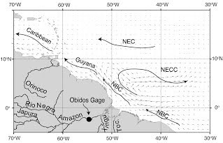
Page: Ocean Model Circulation Operational Validation
|
|
JPEG File 3D Path Profile using digital elevation model and … |
22 kB |
Christopher Oligschläger |
Jun 10, 2020 12:43 |
Jun 10, 2020 12:43 |
|
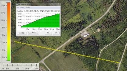
Page: Shale Development: Using Imagery and DEMs to Improve Operation Efficiency
|
|
JPEG File Bathymetry_mexico.jpg |
22 kB |
Christopher Oligschläger |
Jun 10, 2020 12:43 |
Jun 10, 2020 12:43 |
|
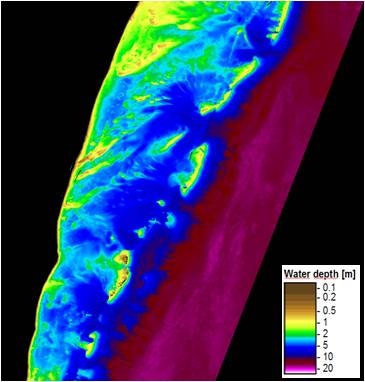
Page: Map water depth or charting
|
|
JPEG File seafloor_small.jpg |
22 kB |
Christopher Oligschläger |
Jun 10, 2020 12:43 |
Jun 10, 2020 12:43 |
|
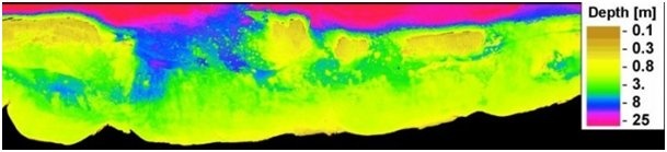
Page: Sea floor mapping- satellite based benthic habitat mapping
|
|
JPEG File seafloor_breit.jpg |
22 kB |
Christopher Oligschläger |
Jun 10, 2020 12:43 |
Jun 10, 2020 12:43 |
|
Page: Sea floor mapping- satellite based benthic habitat mapping
|
|
PNG File text case Surface Deformation Monitoring with InSA… |
22 kB |
Christopher Oligschläger |
Jun 10, 2020 12:43 |
Jun 10, 2020 12:43 |
|
Page: Surface Deformation Monitoring with InSAR
|
|
JPEG File CS2-CLS.jpg |
22 kB |
Christopher Oligschläger |
Jun 10, 2020 12:43 |
Jun 10, 2020 12:43 |
|
Page: Ocean Model validation
|