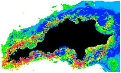
Sea floor mapping- satellite based benthic habitat mapping
Industrial offshore activities, coastal developments and climate change are just some of the significant pressures to coastal environments. Effective management and monitoring of large aquatic and coastal areas requires detailed baseline data on the distribution of sea floor habitats. Clear shallow waters, coral reefs, or other coastal areas lend themselves to the application of optical remote sensing for gathering data on benthic cover.
Environmental monitoring using satellite or airborne imagery with sophisticated processing methods is both cost and time effective. By combining different multispectral satellite or hyperspectral data sources, improved efficiencies and greater cost effectiveness can be achieved for long term monitoring and change detection.
Hyperspectral seafloor mapping
Hyperspectral seafloor mapping represent an example of a remote sensing technique that can be used to generate maps of the seafloor and the bathymetry in littoral zones (up to 20 m.). This technique is also called Hyperspectral Mapping (HyMap).
Habitat mapping | Habitat mapping using hyperspectral imagery[1] | Habitat, Hyperspectral |
Hyperspectral seafloor mapping and bathymetry calculation [2] | Hyperspectral, Bathymetry] |
References:
[1] Kobryn,H.T., Wouters, K. and Beckley, L.E. 2011. Ningaloo Collaboration Cluster: Habitats of the Ningaloo Reef and adjacent coastal areas determined through hyperspectral imagery. Final report No 1b. CSIRO, pp. 211. (ISBN 978-0-86905-951-7)
[2] Heege, T., Hausknecht, P, Kobryn, H. (2007): Hyperspectral seafloor mapping and direct bathymetry calculation using HyMap data from the Ningaloo reef and Rottnest Island areas in Western Australia. Proceedings 5th EARSeL Workshop on Imaging Spectroscopy. Bruges, Belgium, April 23-25 2007, p. 1-8


This page has no comments.