| Name
|
Size
|
Creator |
Creation Date
|
Last Modification Date
|
Labels |
Attached To |
|
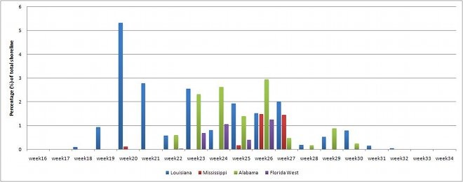
JPEG File OilSpill_perHabitat_Graph(660).jpg |
26 kB |
Christopher Oligschläger |
Jun 10, 2020 12:43 |
Jun 10, 2020 12:43 |
|
Page: Satellite based oil spill detection and impact assessment – The chronology of the Deepwater Horizon Accident
|
|
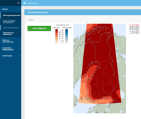
PNG File image2022-8-17_11-52-47.png |
26 kB |
Francesca Piatto |
Aug 17, 2022 09:52 |
Aug 17, 2022 09:52 |
|
Page: Sub-seasonal to seasonal predictions for tyre companies
|
|
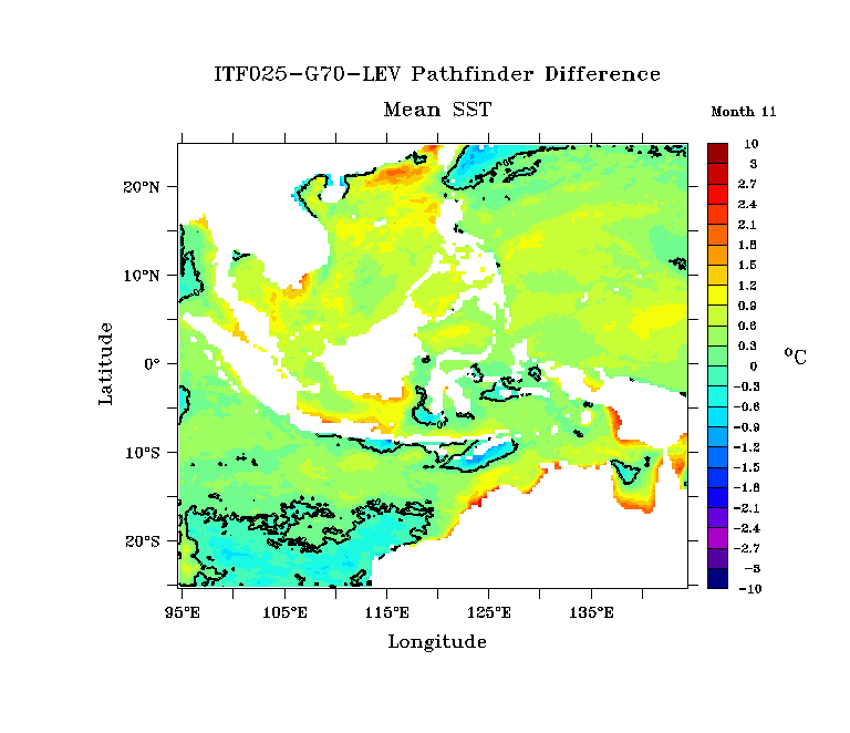
GIF File fig2c-case2.gif |
25 kB |
Christopher Oligschläger |
Jun 10, 2020 12:43 |
Jun 10, 2020 12:43 |
|
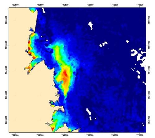
Page: Ocean Model validation
|
|
PNG File AnsuR-logo.png |
25 kB |
Christopher Oligschläger |
Jun 10, 2020 12:43 |
Jun 10, 2020 12:43 |
|
Page: UAV ASIGN for near-real time oil-pipe monitoring
|
|
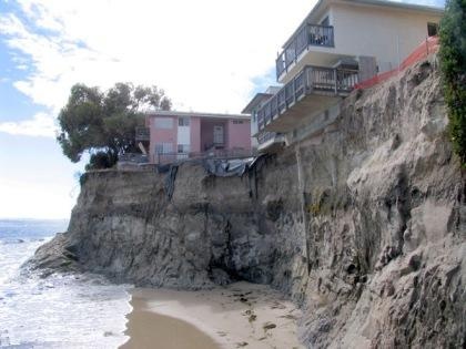
JPEG File CoastErosion1.jpg |
25 kB |
Christopher Oligschläger |
Jun 10, 2020 12:43 |
Jun 10, 2020 12:43 |
|
Page: Coastal erosion monitoring
|
|
JPEG File Imagen4eomap.jpg |
25 kB |
Christopher Oligschläger |
Jun 10, 2020 12:43 |
Jun 10, 2020 12:43 |
|
Page: Monitoring Dredging Plumes and Water Quality
|
|
JPEG File detect and monitor oil slicks.JPG |
25 kB |
Christopher Oligschläger |
Jun 10, 2020 12:43 |
Jun 10, 2020 12:43 |
|
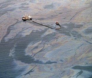
Page: EO in Action
|
|
PNG File image-2024-6-26_14-39-15-1.png |
25 kB |
Francesco Casaril |
Jun 26, 2024 12:39 |
Jun 26, 2024 12:39 |
|
Page: Best Practices
|
|
JPEG File tanks.jpg |
25 kB |
Christopher Oligschläger |
Jun 10, 2020 12:43 |
Jun 10, 2020 12:43 |
|
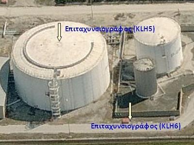
Page: INnovative multi-sensor network for DEformation and Seismic Monitoring of Urban Subsidence-prone Areas
|
|
JPEG File CLS-case9-Sum.jpg |
24 kB |
Christopher Oligschläger |
Jun 10, 2020 12:43 |
Jun 10, 2020 12:43 |
|
Page: Measuring surface wind with high resolution radar
|
|
PNG File e-shape.png |
24 kB |
Christopher Oligschläger |
Jun 10, 2020 12:43 |
Jun 10, 2020 12:43 |
|
Page: Proactive Pipeline Maintenance with Rheticus® Network Alert.
|
|
PNG File e-shape.png |
24 kB |
Christopher Oligschläger |
Jun 10, 2020 12:43 |
Jun 10, 2020 12:43 |
|
Page: The GOS4M Knowledge Hub designed for end-users to assess the effectiveness of measures undertaken under the Minamata Convention on Mercury.
|
|
PNG File e-shape.png |
24 kB |
Francesca Piatto |
Apr 15, 2022 13:47 |
Apr 15, 2022 13:47 |
|
Page: Identification of synergetic SDGs using heterogeneous data and deep learning models
|
|
PNG File e-shape.png |
24 kB |
Francesca Piatto |
May 11, 2022 21:35 |
May 11, 2022 21:35 |
|
Page: DynaCrop – unlocking EO services for the food production value chain
|
|
PNG File e-shape.png |
24 kB |
Francesca Piatto |
Jun 13, 2022 09:07 |
Jun 13, 2022 09:07 |
|
Page: Integration of EO and model data for the monitoring of volcanic plumes critical to aviation: the Mt Etna case of 12 March 2021
|
|
PNG File e-shape.png |
24 kB |
Francesca Piatto |
Sep 06, 2022 09:09 |
Sep 06, 2022 09:09 |
|
Page: European Earth Observations Leading Global Vineyard Innovation
|
|
PNG File e-shape.png |
24 kB |
Christopher Oligschläger |
Jun 10, 2020 12:43 |
Jun 10, 2020 12:43 |
|
Page: EOs adding value to historical water availability and quality information services
|
|
PNG File e-shape.png |
24 kB |
Francesca Piatto |
Sep 07, 2021 09:53 |
Sep 07, 2021 09:53 |
|
Page: Successful Integration of EO-Based Observations and Machine Learning in Spring Peak Flow Forecasting
|
|
PNG File e-shape.png |
24 kB |
Francesca Piatto |
Sep 07, 2021 09:14 |
Sep 07, 2021 09:14 |
|
Page: Agrowth: A satellite based crop monitoring platform
|
|
PNG File e-shape.png |
24 kB |
Christopher Oligschläger |
Sep 07, 2021 07:46 |
Sep 07, 2021 07:46 |
|
Page: Draft
|