 Coastal erosion has become a serious issue for coastal communities and ecosystems around the world. Coastlines are increasingly subject to natural and anthropogenic influences such as global warming related sea level rises and storms and changing land-use patterns e.g. construction, deforestation and agriculture. Intensification of shoreline erosion resulting from higher waves and storm intensity leave large areas completely submerged. Coastal communities are experiencing more frequent and destructive flooding, degraded water quality and smaller/ fewer beaches.
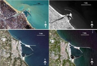
Hence monitoring shoreline changes that result from coastal erosion is essential and forms an important aspect of coastal zone management. The use of remote sensing, integrated with GIS and erosion models greatly contributes to our understanding of coastal dynamics. Improved detection and prediction of shoreline changes is now possible through spatial and temporal analyses. Complementing detection and comparison from ground based and airborne techniques such as LiDAR, topographic surveys and aerial photography, satellite imagery provides repeated acquisitions over a large area, showing detailed evolution of the coastline.
Soil erosion rates depend on many factors e.g. vegetation cover, rainfall amount and intensity, soil characteristics and topographic features (ground slope, slope length). Soil erosion from water can be classified according to different processes. Splash erosion caused by falling raindrops results in detached and transported soil particles. Sheet erosion occurs when splash erosion and surface run-off coincide, removing soil in layers. Rill erosion is represented by disappearance of soil particles due to impacts of concentrated flowing water. Gully erosion occurs when higher water flow concentration leaves deeper and wider incisions than rills. Gully dynamics are also influenced by subsurface flow, tunnelling and side wall inconsistencies.
 Detailed mapping of erosion patterns is highly dependent on the regional context and image resolution. Sheet and rill erosion features for example have small partial sizes and therefore require high resolution data. High resolution space borne technologies such as GeoEye, Worldview, Quickbird, IKONOS, SPOT, Landsat, ENVISAT ASAR and ASTER have proven to be very valuable in providing data for detailed erosion assessments. Multi-temporal satellite imagery allows detection of complex spatio-temporal variability of the coastline, caused by various natural and human-induced factors such as ploughing and pasture renovation, gullies and differential seasonal dynamics of vegetation. The observation and prediction of erosion typically involves the use of empirical models and algorithms that yield atmospheric and topographic correction.
The Mediterranean is particularly prone to erosion because it suffers from long dry periods followed by heavy rains. The Italian Space Agency (ASI) has developed the COSMO-Skymed constellation (Constellation of small Satellites for the Mediterranean basin Observation) which has a high resolution and is capable of frequently acquiring data over the same area. Integration of historically generated satellite imagery from ENVISAT and ERS with new optical high resolution acquisitions from FORMOSAT-2, KOMPSAT-2, World View II and high resolution data (IKONOS, PRISM) has been used to monitor the Abruzzo coastline in Italy. Especially in coastal areas where high resolution optical remote sensing may be compromised by atmospheric interruption such as cloud cover, data acquired by this constellation has proven to be an asset.
Increasing numbers of modern satellites with improved ground resolution and revisiting capacity provide time-series of varying coastline positions which contributes to improved analyses of coastal processes. A wide range of programs and projects has been implemented which directly or indirectly contribute to the control of soil erosion. Application of remote sensing greatly contributes to the estimation of overall costs attributable to erosion and to the identification of areas where remedial action needs to be taken. Many institutions and organizations are involved such as the United Nations Food and Agriculture Organization (FAO), European Environment Agency (EEA), EC Joint Research Centre (JRC) which provides the European Soil Portal with Soil data and Information Systems, World Meteorological Organization (WMO), Institute for Environment and Sustainability (ies), European Confederation of Soil Science Societies (ECSSS).
This page has no comments.