| Name
|
Size
|
Creator |
Creation Date
|
Last Modification Date
|
Labels |
Attached To |
|
PNG File ICON Oilfield performance study .png |
486 kB |
Christopher Oligschläger |
Jun 10, 2020 12:43 |
Jun 10, 2020 12:43 |
|
Page: Oilfield performance study: Ghawar oilfield (Saudi Arabia)
|
|
PNG File ICON Surface Deformation Monitoring with InSAR In … |
485 kB |
Christopher Oligschläger |
Jun 10, 2020 12:43 |
Jun 10, 2020 12:43 |
|
Page: Surface Deformation Monitoring with InSAR
|
|
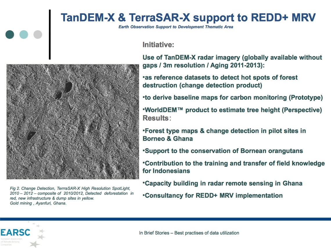
JPEG File TanDEM-X & TerraSAR-X support to REDD+MRV, develom… |
485 kB |
Christopher Oligschläger |
Jun 10, 2020 12:43 |
Jun 10, 2020 12:43 |
|
Page: EO in Action
|
|
PNG File ocean model validation incon cls.png |
485 kB |
Christopher Oligschläger |
Jun 10, 2020 12:43 |
Jun 10, 2020 12:43 |
|
Page: Ocean Model validation
|
|
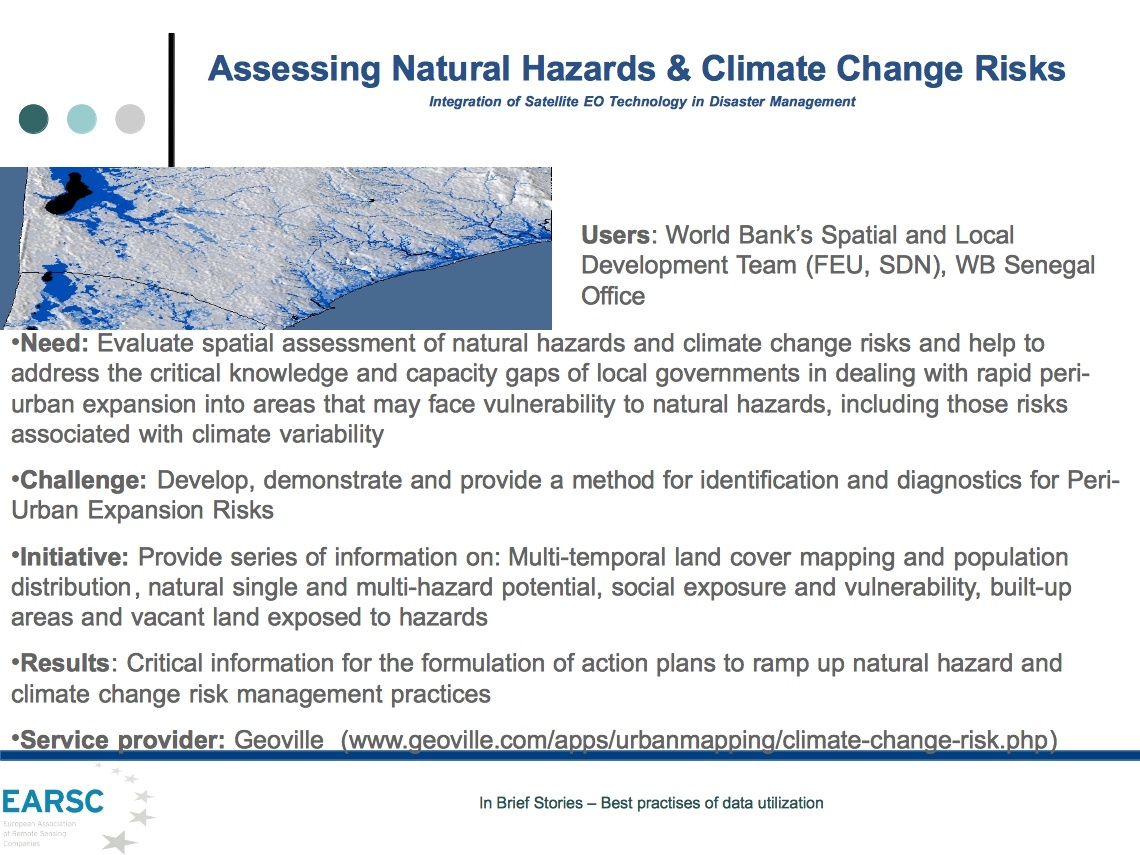
JPEG File Assessing natural hazards & climate change risks (… |
478 kB |
Christopher Oligschläger |
Jun 10, 2020 12:43 |
Jun 10, 2020 12:43 |
|
Page: EO in Action
|
|
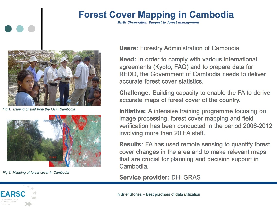
JPEG File Forest cover mapping in Cambodia (DHI-GRAS).jpg |
478 kB |
Christopher Oligschläger |
Jun 10, 2020 12:43 |
Jun 10, 2020 12:43 |
|
Page: EO in Action
|
|
File zamg_rgb_WBM_normal_lang 2013.eps |
475 kB |
Christopher Oligschläger |
Jun 10, 2020 12:44 |
Jun 10, 2020 12:44 |
|
Page: Research Institutes
|
|
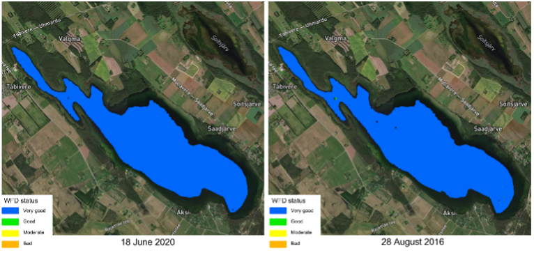
PNG File Picture 2.png |
470 kB |
Francesca Piatto |
Apr 15, 2022 13:44 |
Apr 15, 2022 13:44 |
|
Page: How satellite Earth Observation can help with monitoring for the Water Framework Directive
|
|
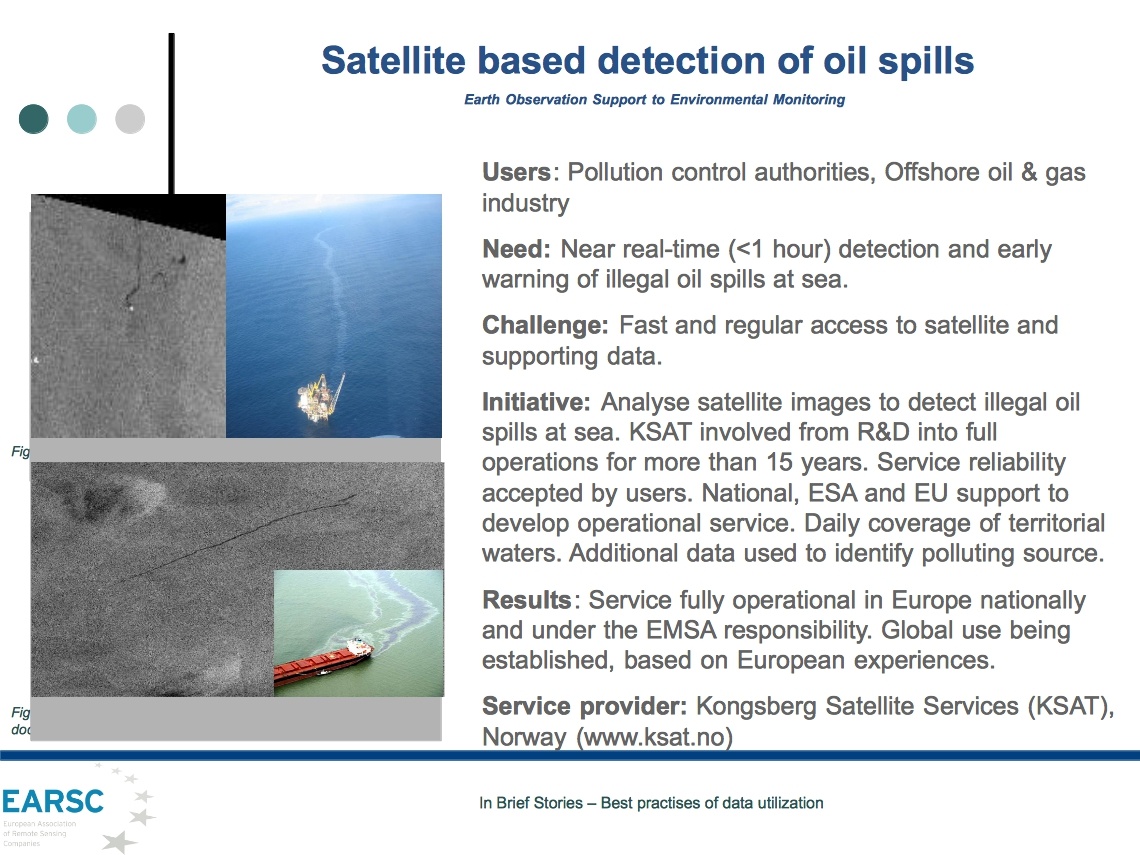
JPEG File Satellite based detection of oil spills (Ksat).jpg |
465 kB |
Christopher Oligschläger |
Jun 10, 2020 12:43 |
Jun 10, 2020 12:43 |
|
Page: EO in Action
|
|
PDF File e-geos_CLEOS.pdf |
463 kB |
Christopher Oligschläger |
Oct 15, 2021 10:48 |
Oct 15, 2021 10:48 |
|
Page: Cross-SDGs
|
|
JPEG File The power of the wind (Planetek).jpg |
462 kB |
Christopher Oligschläger |
Jun 10, 2020 12:43 |
Jun 10, 2020 12:43 |
|
Page: EO in Action
|
|
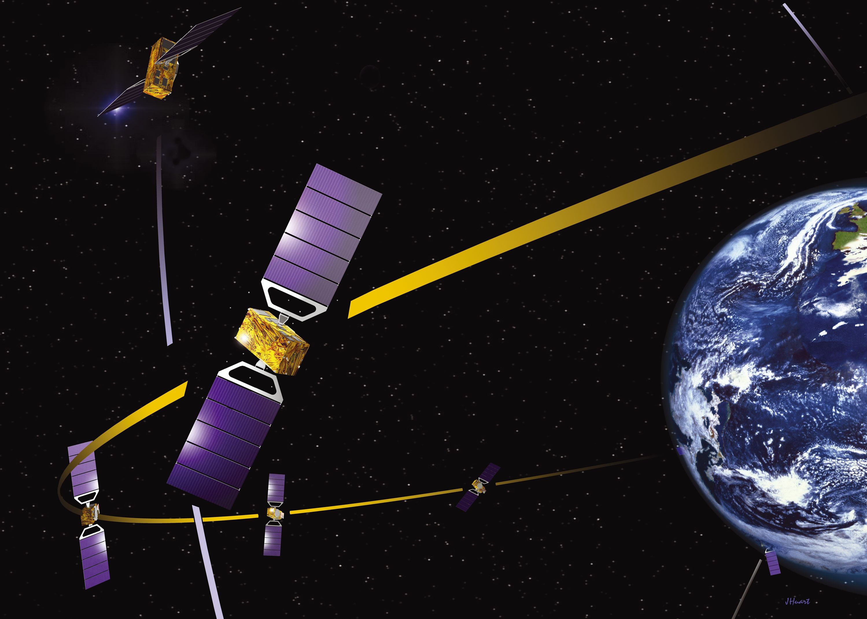
JPEG File Satellite_Galileo.jpg |
462 kB |
Christopher Oligschläger |
Jun 10, 2020 12:44 |
Jun 10, 2020 12:44 |
|
Page: Satellite positioning: GNSS & Satellite-AIS
|
|
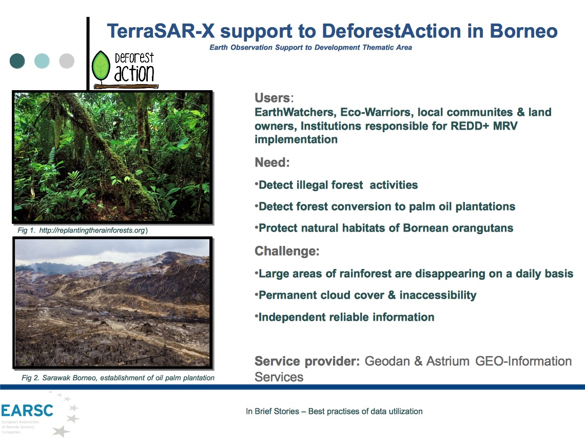
JPEG File TerraSAR-X support to deforestAction in Borneo (Ai… |
460 kB |
Christopher Oligschläger |
Jun 10, 2020 12:43 |
Jun 10, 2020 12:43 |
|
Page: EO in Action
|
|
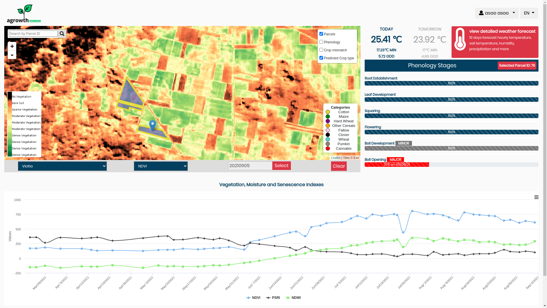
PNG File agrowth692021_a.png |
458 kB |
Francesca Piatto |
Apr 08, 2022 10:44 |
Apr 08, 2022 10:44 |
|
Page: High PV Penetration in urban area
|
|
PNG File agrowth692021_a.png |
458 kB |
Francesca Piatto |
May 10, 2022 12:02 |
May 10, 2022 12:02 |
|
Page: Valorising long-term observation data
|
|
PNG File agrowth692021_a.png |
458 kB |
Francesca Piatto |
Jul 28, 2022 09:20 |
Jul 28, 2022 09:20 |
|
Page: How observations of sargassum west of Africa helps the Caribbean to prepare for seasonal influxes of Sargassum
|
|
PNG File agrowth692021_a.png |
458 kB |
Francesca Piatto |
Jul 28, 2022 09:42 |
Jul 28, 2022 09:42 |
|
Page: Flood Risk & Impact assessment through automatic change detection of S-1+S-2 images (FRIEND pilot)
|
|
PNG File agrowth692021_a.png |
458 kB |
Francesca Piatto |
Aug 17, 2022 09:48 |
Aug 17, 2022 09:48 |
|
Page: Sub-seasonal to seasonal predictions for tyre companies
|
|
PNG File agrowth692021_a.png |
458 kB |
Francesca Piatto |
Sep 28, 2021 09:55 |
Sep 28, 2021 09:55 |
|
Page: Agrowth: A satellite based crop monitoring platform
|
|
PNG File agrowth692021_a.png |
458 kB |
Christopher Oligschläger |
Apr 07, 2022 08:01 |
Apr 07, 2022 08:01 |
|
Page: EYWA- Early Warning System for Mosquito Borne Diseases
|