| Name
|
Size
|
Creator |
Creation Date
|
Last Modification Date
|
Labels |
Attached To |
|
Microsoft Word 97 Document HCP-4108.doc |
50 kB |
user-ff2aa |
Jul 26, 2014 11:14 |
Jul 26, 2014 11:15 |
|
Page: Hatfield-4108: Assess habitat quality for key species for environmental baseline and/or impact assessment
|
|
Microsoft Word 97 Document HCP-3101.doc |
50 kB |
user-ff2aa |
Jul 25, 2014 16:19 |
Jul 25, 2014 16:20 |
|
Page: Hatfield-3101: Baseline and monitoring of areas with active faults and subsidence
|
|
Microsoft Word 97 Document HCP-2505.doc |
50 kB |
user-ff2aa |
Jul 25, 2014 16:10 |
Jul 25, 2014 16:11 |
|
Page: Hatfield-2505: Identify geophysical properties of the subsurface
|
|
Microsoft Word 97 Document HCP-2504.doc |
50 kB |
user-ff2aa |
Jul 25, 2014 16:06 |
Jul 25, 2014 16:06 |
|
Page: Hatfield-2504: Identification of slope instability
|
|
Microsoft Word 97 Document HCP-2503.doc |
50 kB |
user-ff2aa |
Jul 25, 2014 16:03 |
Jul 25, 2014 16:03 |
|
Page: Hatfield-2503: Assessment of duricrusts and rock excavability
|
|
Microsoft Word 97 Document HCP-2502.doc |
50 kB |
user-ff2aa |
Jul 25, 2014 15:47 |
Jul 25, 2014 15:48 |
|
Page: Hatfield-2502: Identification of problem soils
|
|
Microsoft Word 97 Document HCP-2501.doc |
50 kB |
user-ff2aa |
Jul 25, 2014 15:43 |
Jul 25, 2014 15:43 |
|
Page: Hatfield-2501: Characterization of surface/near-surface structural geological properties for infrastructure planning
|
|
Microsoft Word 97 Document HCP-2102.doc |
50 kB |
user-ff2aa |
Jul 25, 2014 15:07 |
Jul 25, 2014 15:07 |
|
Page: Hatfield-2102: Understanding hydrogeology
|
|
Microsoft Word 97 Document HCP-1303.doc |
50 kB |
user-ff2aa |
Jul 25, 2014 14:25 |
Jul 25, 2014 14:25 |
|
Page: Hatfield-1303: Planning heliports, camps, and drop zones in forested areas
|
|
Microsoft Word 97 Document HCP-1212.doc |
49 kB |
user-ff2aa |
Jul 25, 2014 13:45 |
Jul 25, 2014 13:45 |
|
Page: Hatfield-1212: Identify sabkahs / salt lake areas
|
|
Microsoft Word 97 Document HCP-1210.doc |
49 kB |
user-ff2aa |
Jul 25, 2014 12:41 |
Jul 25, 2014 12:47 |
|
Page: Hatfield-1210: Identify soft ground to reduce environmental impacts
|
|
Microsoft Word 97 Document HCP-1207.doc |
49 kB |
user-ff2aa |
Jul 25, 2014 12:01 |
Jul 25, 2014 12:01 |
|
Page: Hatfield-1207: Identify claypan surfaces to be avoided
|
|
Microsoft Word 97 Document HCP-1105.doc |
49 kB |
user-ff2aa |
Jul 25, 2014 10:47 |
Jul 25, 2014 10:47 |
|
Page: Hatfield-1105: Identify permafrost zone for data analysis
|
|
Microsoft Word 97 Document HCP-1104.doc |
49 kB |
user-ff2aa |
Jul 25, 2014 10:26 |
Jul 25, 2014 10:26 |
|
Page: Hatfield-1104: Identify lake, river and coastal ice grounding status for data quality
|
|
Microsoft Word 97 Document HCP-1103.doc |
50 kB |
user-ff2aa |
Jul 25, 2014 10:22 |
Jul 25, 2014 10:22 |
|
Page: Hatfield-1103: Identify soft and hard ground as areas of potentially poor source and receiver coupling
|
|
Microsoft Word 97 Document HCP-1101.doc |
50 kB |
user-ff2aa |
Jul 25, 2014 09:40 |
Jul 25, 2014 09:40 |
|
Page: Hatfield-1101: Identify areas with soft sediments to avoid strong attenuation
|
|
PNG File OTM Challenges summary.png |
8 kB |
administrator |
Jul 15, 2014 17:14 |
Jul 15, 2014 17:14 |
|
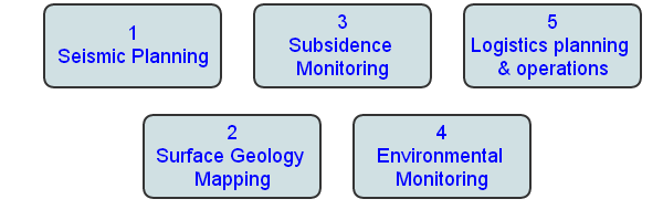
Page: On-shore Project - OTM
|
|
File OTM Challenges summary |
8 kB |
administrator |
Jul 15, 2014 17:14 |
Jul 15, 2014 17:14 |
|
Page: On-shore Project - OTM
|
|
PDF File Challenge tree.pdf |
463 kB |
administrator |
Jul 14, 2014 16:12 |
Jul 14, 2014 16:12 |
|
Page: On-shore Project - OTM
|
|
PNG File OTM Challenges 4.png |
112 kB |
administrator |
Jul 13, 2014 15:39 |
Jul 13, 2014 15:39 |
|
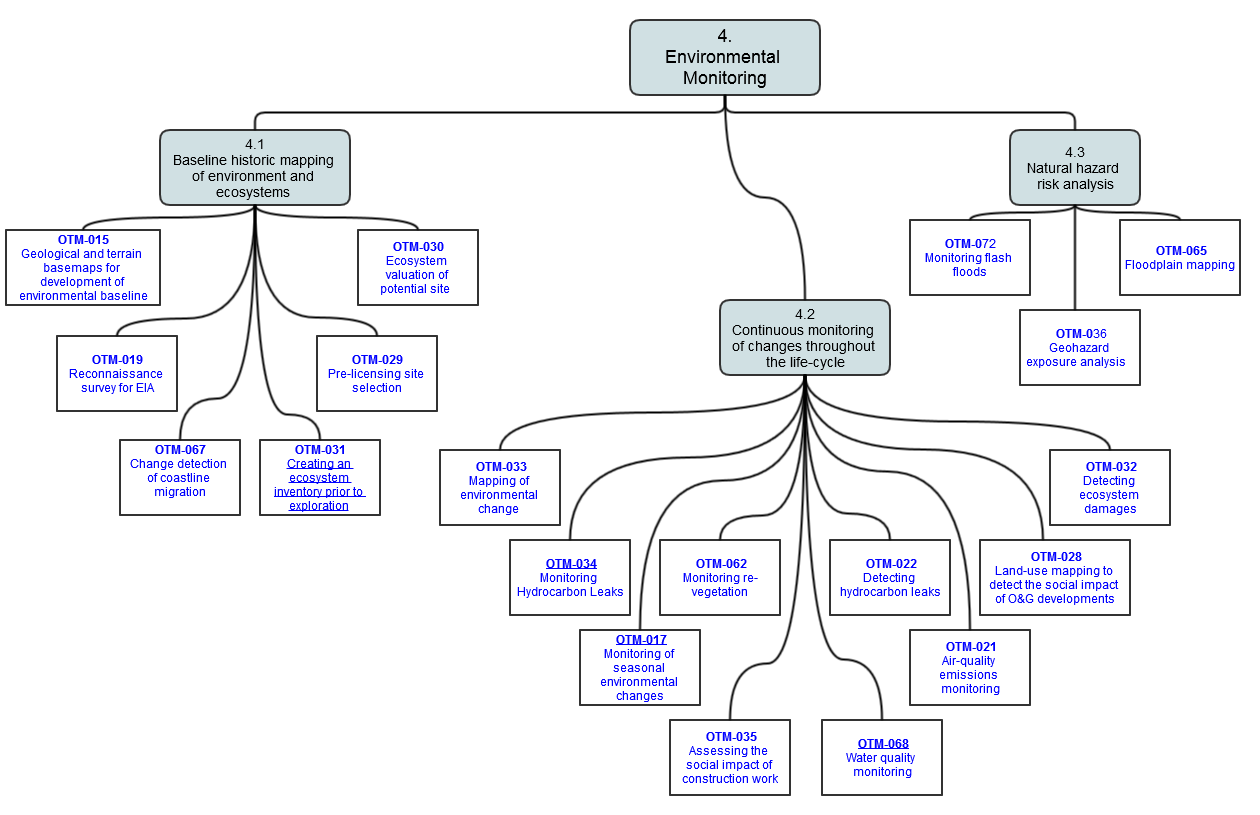
Page: OTM Challenges 4
|