| Name
|
Size
|
Creator |
Creation Date
|
Last Modification Date
|
Labels |
Attached To |
|
PNG File polarview.png |
38 kB |
Christopher Oligschläger |
Jun 10, 2020 12:43 |
Jun 10, 2020 12:43 |
|
Page: Polar Thematic Exploitation Platform (P-TEP)
|
|
JPEG File location indes.jpg |
532 kB |
Christopher Oligschläger |
Jun 10, 2020 12:43 |
Jun 10, 2020 12:43 |
|
Page: INnovative multi-sensor network for DEformation and Seismic Monitoring of Urban Subsidence-prone Areas
|
|
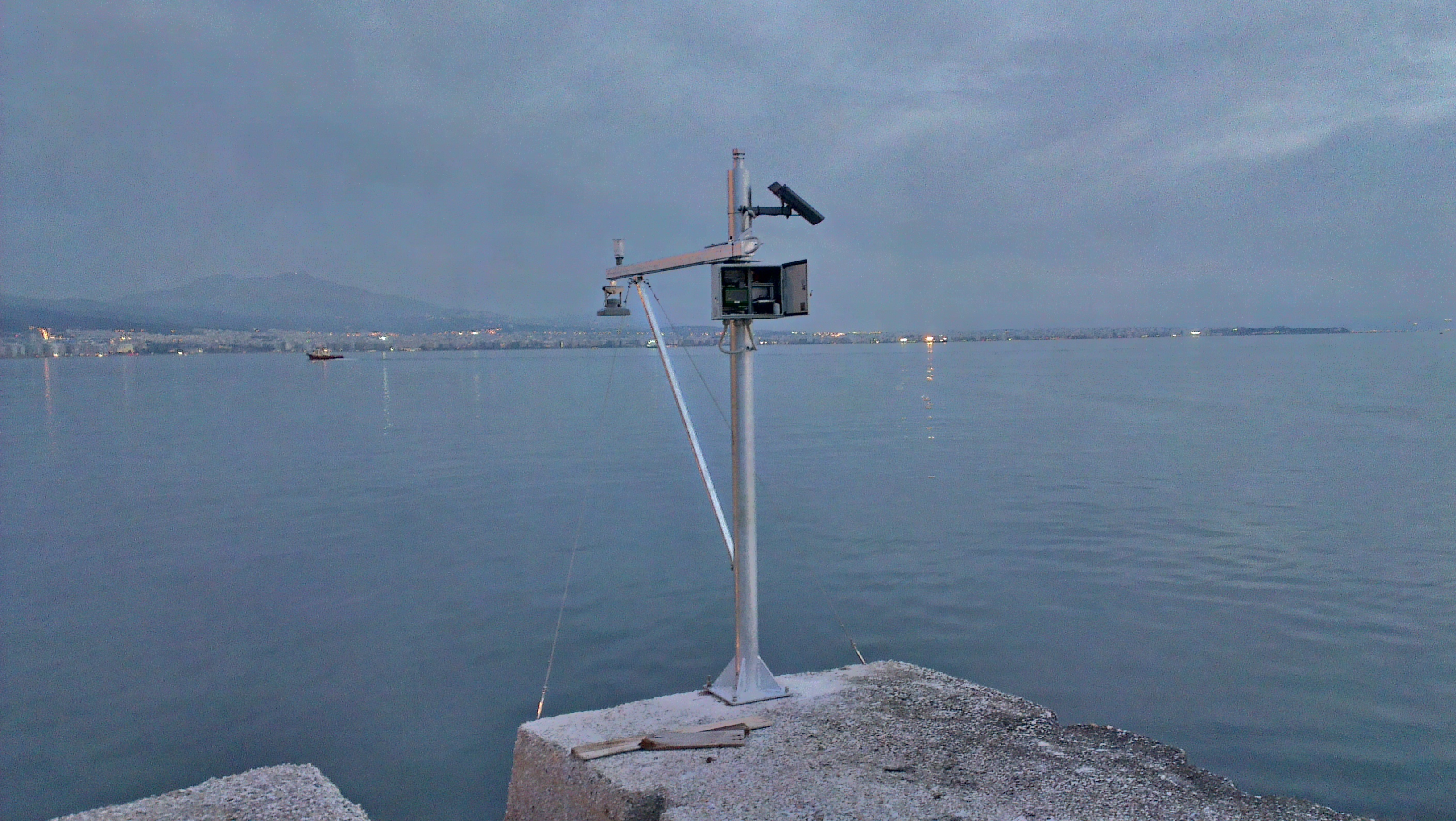
JPEG File tide gauge.jpg |
1.82 MB |
Christopher Oligschläger |
Jun 10, 2020 12:43 |
Jun 10, 2020 12:43 |
|
Page: INnovative multi-sensor network for DEformation and Seismic Monitoring of Urban Subsidence-prone Areas
|
|
JPEG File logo.jpg |
2 kB |
Christopher Oligschläger |
Jun 10, 2020 12:43 |
Jun 10, 2020 12:43 |
|
Page: INnovative multi-sensor network for DEformation and Seismic Monitoring of Urban Subsidence-prone Areas
|
|
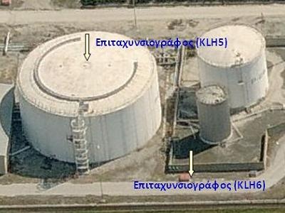
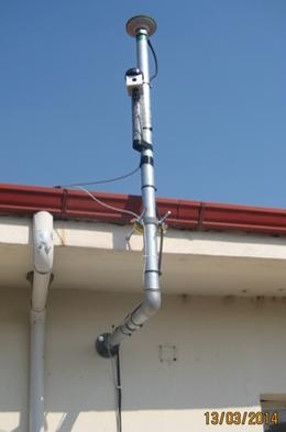
JPEG File tanks.jpg |
25 kB |
Christopher Oligschläger |
Jun 10, 2020 12:43 |
Jun 10, 2020 12:43 |
|
Page: INnovative multi-sensor network for DEformation and Seismic Monitoring of Urban Subsidence-prone Areas
|
|
JPEG File lidas.jpg |
117 kB |
Christopher Oligschläger |
Jun 10, 2020 12:43 |
Jun 10, 2020 12:43 |
|
Page: INnovative multi-sensor network for DEformation and Seismic Monitoring of Urban Subsidence-prone Areas
|
|
JPEG File gnss.jpg |
10 kB |
Christopher Oligschläger |
Jun 10, 2020 12:43 |
Jun 10, 2020 12:43 |
|
Page: INnovative multi-sensor network for DEformation and Seismic Monitoring of Urban Subsidence-prone Areas
|
|
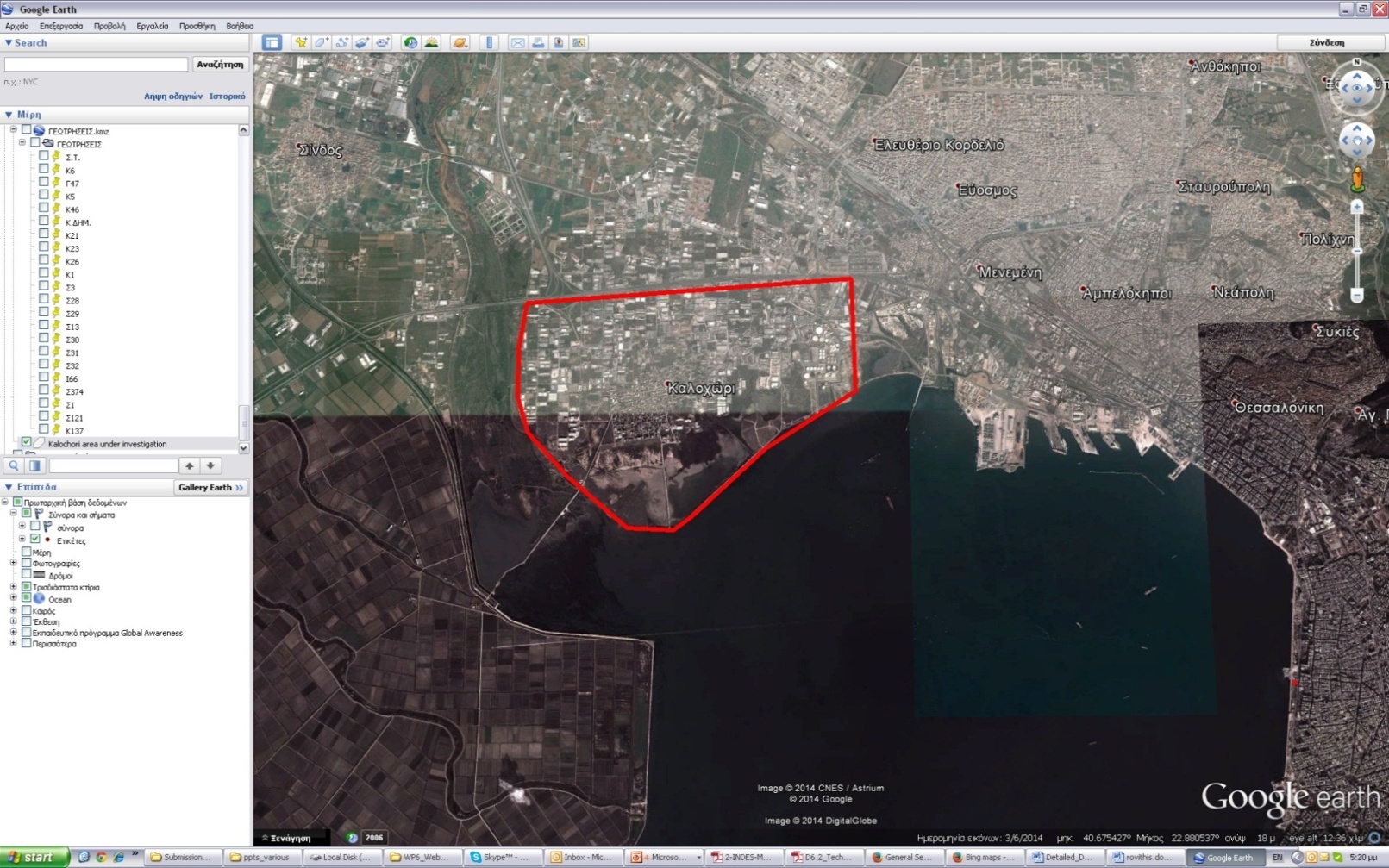
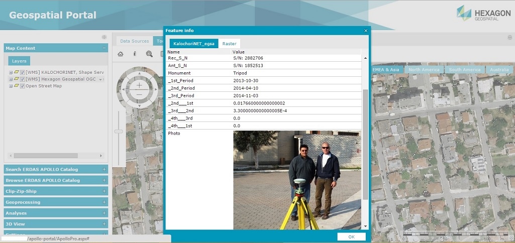
JPEG File kalochorinet.jpg |
173 kB |
Christopher Oligschläger |
Jun 10, 2020 12:43 |
Jun 10, 2020 12:43 |
|
Page: INnovative multi-sensor network for DEformation and Seismic Monitoring of Urban Subsidence-prone Areas
|
|
JPEG File lidar2.jpg |
34 kB |
Christopher Oligschläger |
Jun 10, 2020 12:43 |
Jun 10, 2020 12:43 |
|
Page: INnovative multi-sensor network for DEformation and Seismic Monitoring of Urban Subsidence-prone Areas
|
|
JPEG File lidar1.jpg |
94 kB |
Christopher Oligschläger |
Jun 10, 2020 12:43 |
Jun 10, 2020 12:43 |
|
Page: INnovative multi-sensor network for DEformation and Seismic Monitoring of Urban Subsidence-prone Areas
|
|
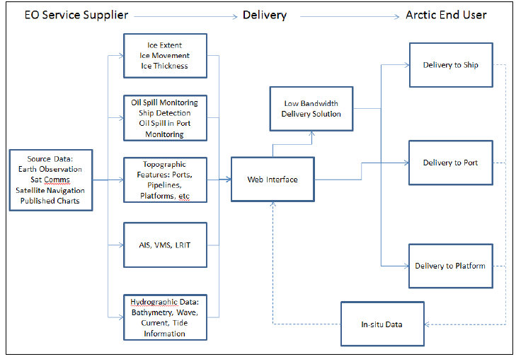
PNG File Artic Situational Awareness Service Solution.png |
36 kB |
Christopher Oligschläger |
Jun 10, 2020 12:43 |
Jun 10, 2020 12:43 |
|
Page: ARCTIC IAP - Improved Situational Awareness in the Artic
|
|
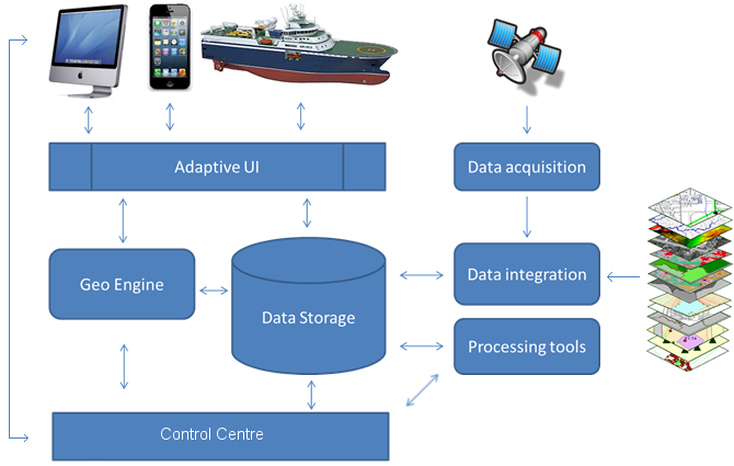
PNG File Components of INtegrated Situational Awareness Ser… |
106 kB |
Christopher Oligschläger |
Jun 10, 2020 12:43 |
Jun 10, 2020 12:43 |
|
Page: ARCTIC IAP - Improved Situational Awareness in the Artic
|
|
PNG File image001.png |
23 kB |
Christopher Oligschläger |
Jun 10, 2020 12:43 |
Jun 10, 2020 12:43 |
|
Page: ARCTIC IAP - Improved Situational Awareness in the Artic
|
|
PDF File 9th PTC - Pipeline Integrity Management from Space… |
1.56 MB |
Christopher Oligschläger |
Jun 10, 2020 12:43 |
Jun 10, 2020 12:43 |
|
Page: Pipeline Integrity Management from Space
|
|
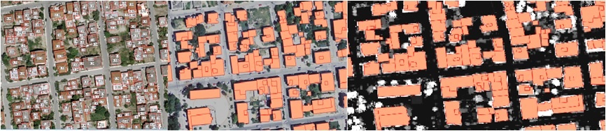
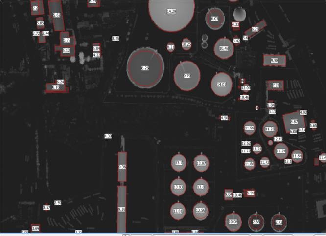
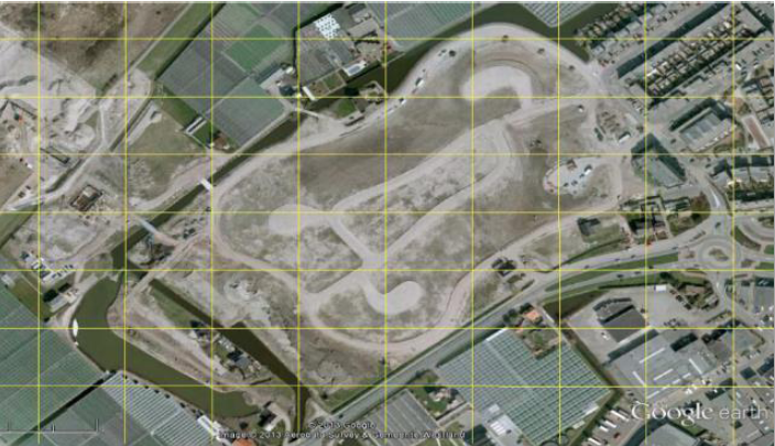
PNG File targetdetection.PNG |
1.19 MB |
Christopher Oligschläger |
Jun 10, 2020 12:43 |
Jun 10, 2020 12:43 |
|
Page: Pipeline Integrity Management from Space
|
|
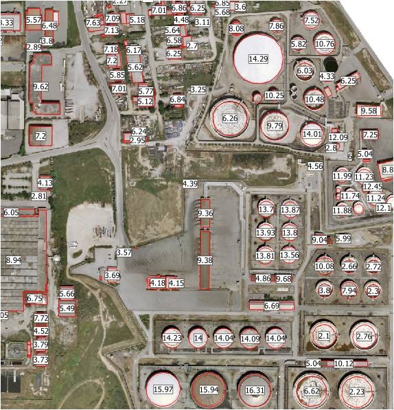
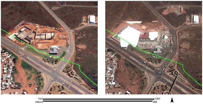
PNG File groundtruthtestsite1.PNG |
1.17 MB |
Christopher Oligschläger |
Jun 10, 2020 12:43 |
Jun 10, 2020 12:43 |
|
Page: Pipeline Integrity Management from Space
|
|
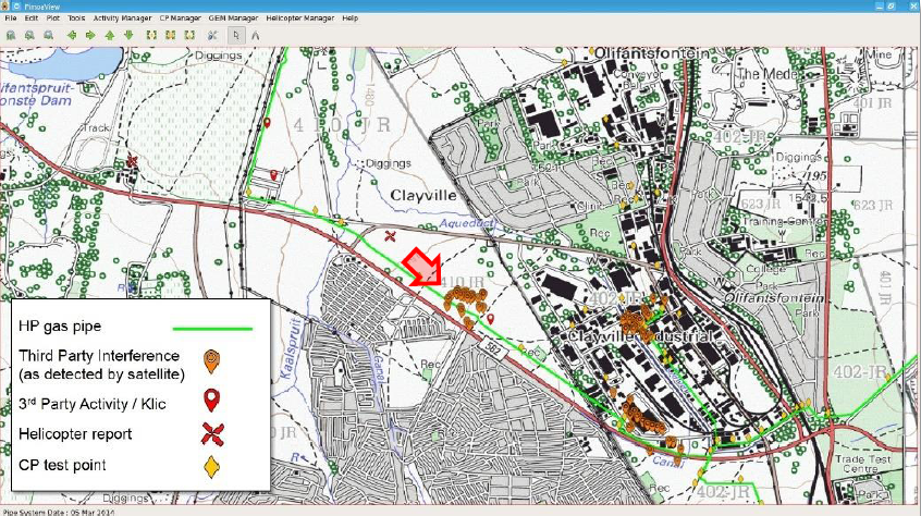
PNG File monstertestsite.PNG |
768 kB |
Christopher Oligschläger |
Jun 10, 2020 12:43 |
Jun 10, 2020 12:43 |
|
Page: Pipeline Integrity Management from Space
|
|
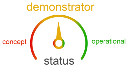
PNG File speedometer_status_demonstrator_rs.png |
30 kB |
Christopher Oligschläger |
Jun 10, 2020 12:43 |
Jun 10, 2020 12:43 |
|
Page: Pipeline Integrity Management from Space
|
|
PNG File pimsis_examples.PNG |
576 kB |
Christopher Oligschläger |
Jun 10, 2020 12:43 |
Jun 10, 2020 12:43 |
|
Page: Pipeline Integrity Management from Space
|
|
PNG File pimsis_viewer.PNG |
838 kB |
Christopher Oligschläger |
Jun 10, 2020 12:43 |
Jun 10, 2020 12:43 |
|
Page: Pipeline Integrity Management from Space
|