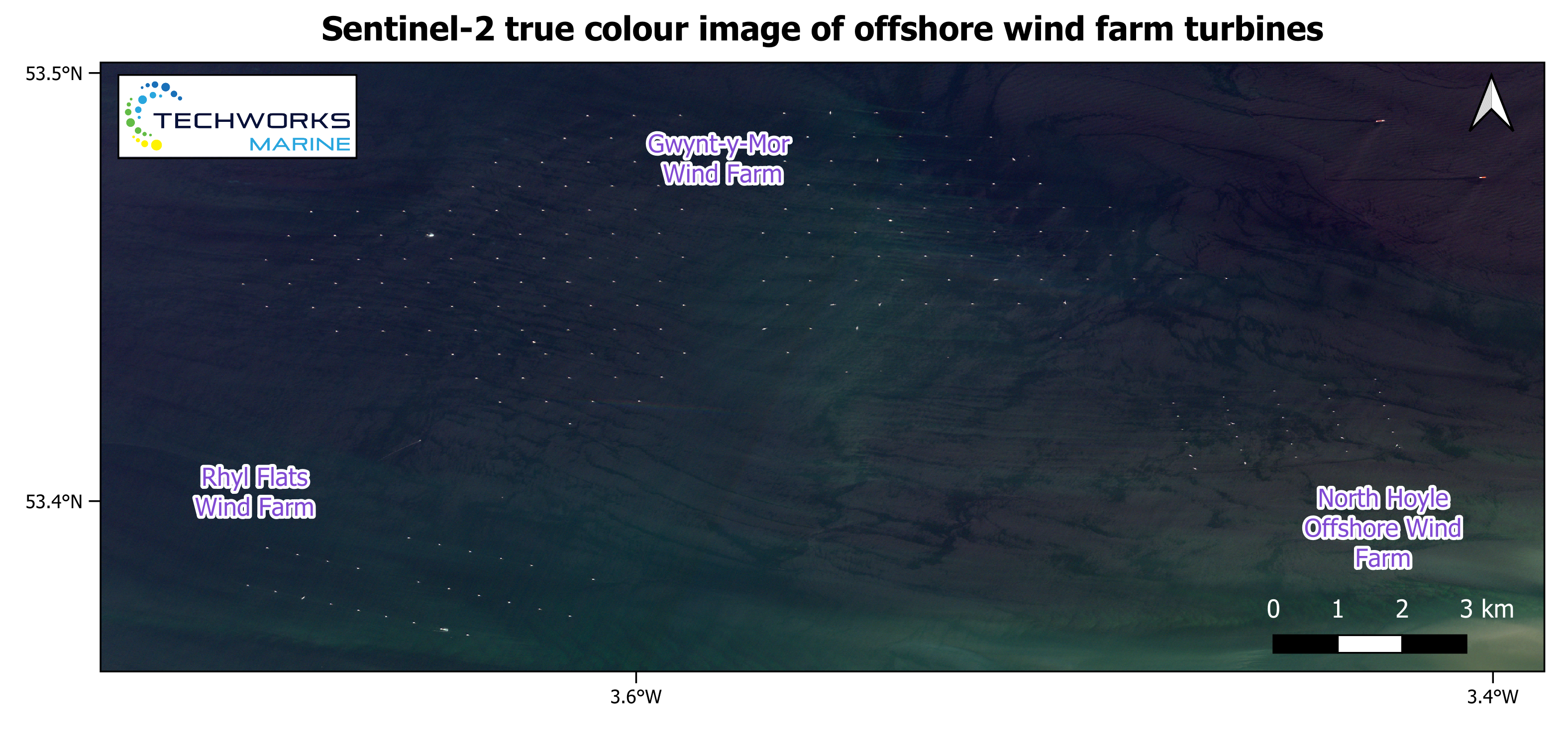
TGS (https://www.tgs.com/), headquartered in Oslo, provides data and intelligence solutions to the energy sector. They access Sentinel-2 imagery via the ESRI Sentinel2Explorer. They inspect this data to verify the locations of recently constructed offshore turbines.
Satellite Description
The Sentinel-2 satellite mission consists of a constellation of two satellites, namely Sentinel-2A (launched in 2015) and Sentinel-2B (launched in 2017). A third satellite, Sentinel-2C is planned to launch in late 2024. This is the second mission of the Copernicus Program. The multispectral imager onboard is capable of imaging in 13 spectral bands covering the visible, near infrared (NIR) and shortwave infrared (SWIR) wavelengths. This mission was designed to provide high resolution observations of land and ocean characteristics such as vegetation, soil, waterways and coastal zones.
Observation Scenario
• Swath width: 290 km
• Orbit: Sun-synchronous
• Inclination: 98.6°
• Altitude: 786 km
• Lifetime: 7.25 years
Sensor Characteristics
13 spectral bands from visible to shortwave infrared (SWIR).
Spatial Resolution
• 10 m: Blue, green, red and NIR bands.
• 20 m: 4 vegetation red edge bands and 2 SWIR bands.
• 60 m: Coastal aerosol, water vapour and cirrus bands.
Temporal Resolution
5 days for two satellites but varies with latitude.
Data Products
• Level 1C (L1C) – Top of atmosphere (TOA) reflectance, not atmospherically corrected.
• Level 2A (L2A) – Bottom of atmosphere (BOA) reflectance, atmospherically corrected.
Archive Availability
Data is freely available:
- • Period: 2015 – present
- • Latency: 24 hours
- • Sources:
Data Continuity
Sentinel-2 complements the SPOT and Landsat missions. Currently there are three Sentinel-2 satellites in orbit. Sentinel-2A and B are operating nominally. Sentinel-2C was recently launched and will soon become similarly operational. Sentinel-2C was launched to eventually replace Sentinel-2A. At a later stage, Sentinel-2D will be launched to replace Sentinel-2B. Sentinel-2 data is employed in a broad range of data products provided by the various Copernicus Services. There are also increasing examples of interoperability and harmonization with Landsat data. For further reading on the Sentinel-2 missions and data products see here.
This page has no comments.