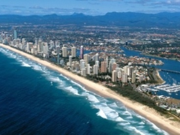
"People have been managing uses of marine and coastal ecosystems for centuries — from tribal authorities establishing marine tenure and taboos on resource use, to the modern era of complex governance. Yet today, the degraded condition of many seas and the overall decline in their diversity and productivity threaten our coastal communities and human well-being. The oceans' ability to maintain their diversity and productivity, and to provide a wide array of valuable services to people, are being compromised." [1]. For humans coastal areas are most important because they provide opportunities for tourism and recreation, transportation, fisheries, and mining, hence greatly contributing to the economy. Our growing reliance on coastal waters for food, trade and tourism requires these delicate ecosystems to be more closely monitored in order to guarantee their future sustainability. Quantitative and qualitative assessment of coastal areas is necessary to ensure their ecological richness and economic importance. Extent (spatial variability) and quality are key parameters in assessing coastal waters for development of management strategies by governmental institutions and environmental organizations. Coastal areas are constantly subject to natural and anthropogenic stresses. Coastlines are highly dynamic and do not lend themselves well to be defined by strict spatial boundaries. The extent or spatial area may be influenced by several factors; natural events such as erosion or sediment supply from rivers, and the transportation and redistribution of sediments along the coast by tides, currents and storms (cyclones). Human stressors can alter these patterns. Draining, dredging, filling of wetlands for development and the construction of dikes for example, can lead to subsidence in coastal areas. Coastal waters being physically, chemically and biologically affected must be assessed and monitored, providing the necessary information for management strategies. Traditionally this is done by analysis of water samples taken from monitoring stations and boats along the coast, but because of high costs and time constraints, in-situ monitoring is not carried out frequently enough. Satellite imagery, however, has proven to complement these in-situ measurements, providing a more detailed and accurate overview of the water quality encompassing a wider area. |