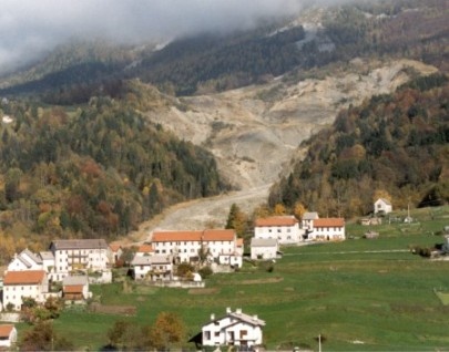
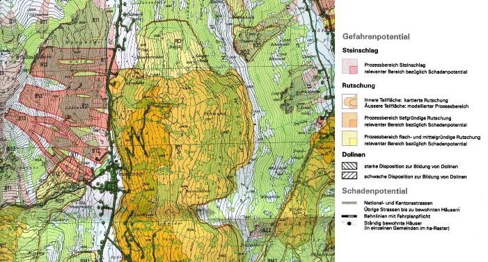
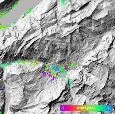
Landslides Land slides represent one of the major global natural hazards, causing threat to human life, property, infrastructure and the natural environment. Every year slope instabilities significantly impact societies and economies and since ground surveys are very costly and time consuming, satellite remote sensing is increasingly used to mitigate damage resulting from land slides. Satellite imagery allows for multitemporal and spatial mapping, offering detailed monitoring of changes in the ground surface. Remote sensing technology can be used in detection, classification and monitoring of landslides and the analysis and prediction of slope failures in space and time. In order to adequately detect and classify landslides, various parameters should be studied including the type of movement and depth to which it has occurred and the degree of present activity of the landslide. Satellite remote sensing enables mapping of size, contrasts, topography and morphology of landslides. In addition it is very useful for monitoring landslide movement by comparing landslide conditions and extent over time, the speed of movement, and the change in the surface topography. |