Water managers (combined: EMÜ and others) appreciate the maps for: · cheap and automated monitoring for under-sampled lakes, combined with targeted sampling in case of unexpected changes · systems analysis, for which the spatial component is key · evaluation of the spatial effect of measures taken to improve water quality for the WFD as input for spatial ecological models
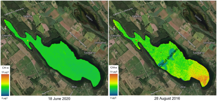 Image Added Image Added
Figure 1Satellite-based EO maps confirm that Saadjärv is usually a lake with low Chl a concentrations over the whole surface (example from June 18th 2020). Still, sometimes slightly elevated concentrations of Chl a can be detected in a spatial pattern (example from 28th August 2016).
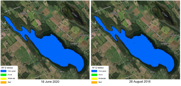 Image Added Image Added
Figure 2Satellite-based WFD classification maps based on satellite EO Chl a concentrations. Although for most of the times lake WFD class is ‘very good’, for a few pixels the class changed from ‘very good’ to ‘good’ on 28th August 2016.  Image Removed Image Removed
Wind map retrieved over the German Bight on June 6, 2019. Winds are from the southeast and lee effects of several offshore wind farms in the area can be seen. |