| Section |
|---|
| Column |
|---|
| As acknowledged by international institutions, among which the World Health Organisation, the emergence and re-emergence of epidemic diseases represent an "on-going threat to global health security". Prevention from them to arise and early intervention are crucial to both reducing the impact on affected population and limiting their international spread. |
| Column |
|---|
| 
|
|
| Section |
|---|
| Column |
|---|
| 
|
| Column |
|---|
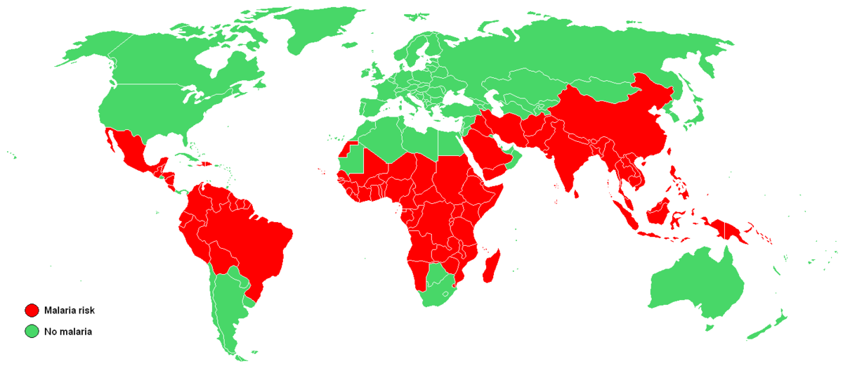
| Remote sensing technologies cannot directly monitor the causes of diseases, but they are very useful in monitoring variables to predict disease outbreaks: straightforward examples are those variables which describe climatic and environmental changes. Other factors to be monitored are those that breed diseases, such as stagnant water or humidity (1). Data about monitored variables become inputs in disease-spreading models: temperature rise, rainfalls, cloud cover, humid and warm air are for example important factors that increase the presence of mosquitos which can spread the disease. This information can be merged with entomological data on the mosquitos’ life cycle, and human and animal clinical data to produce epidemic risk maps (2). |
|
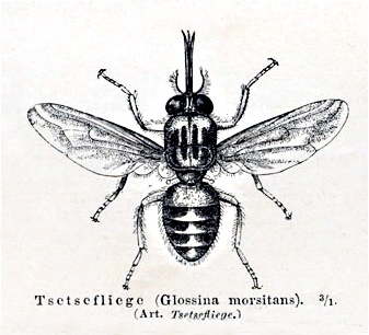
The combination of remote sensing information about temperature, precipitation, vegetation cover, health, moisture content and chlorophyll of the plants makes the forecasting of epidemics and diseases a much cheaper and effective activity. Photosynthesis levels detected from satellites were for example associated to the size of a vein in the wings of the tsetse flies of West Africa by Prof. Rogers, an ecology and disease expert of Oxford University, showing the health and size of fly population (1). Another example is the possibility satellites offer to monitor small water bodies in urban suburbs: their longevity, salinity and mud content can help understanding how breeding-friendly ponds and puddles can be. As in other fields of application, satellites have a clear advantage on ground-field analyses because they provide a large scale monitoring tool which is cheaper and faster. The wide variety of parameters needed to forecast epidemics correspond to a large range of satellite inputs: they come from weather satellites, optical imagery for vegetation status, scientific missions such as Envisat and the coming Copernicus Sentinels. References (1) Can satellites forecast epidemics? http://www.fishersci.com (2) http://www.cnes.fr/web/CNES-en/5074-satellite-monitoring-of-epidemics.php |