Water quality monitoring
Monitoring the temporal and spatial dynamics of coastal water quality is essential for the improved understanding of aquatic ecosystems. Water quality is affected by increasing pressures from land use change, agri- and aquaculture, and water related recreation activities. Remote sensing is an efficient and cost-effective tool to assess a variety of physical and biological parameters in aquatic ecosystems over large areas.
Physics based retrieval algorithms ensure the consistent and operational generation of quantitative water quality maps. Additionally, flexible client defined temporal and spatial resolutions and back-up solutions can be implemented if satellite sensor independent processing technologies are applied [1].
Satellite sensors: MODIS, MERIS, SENTINEL 2/3, THEOS, SPOT and RapidEye.
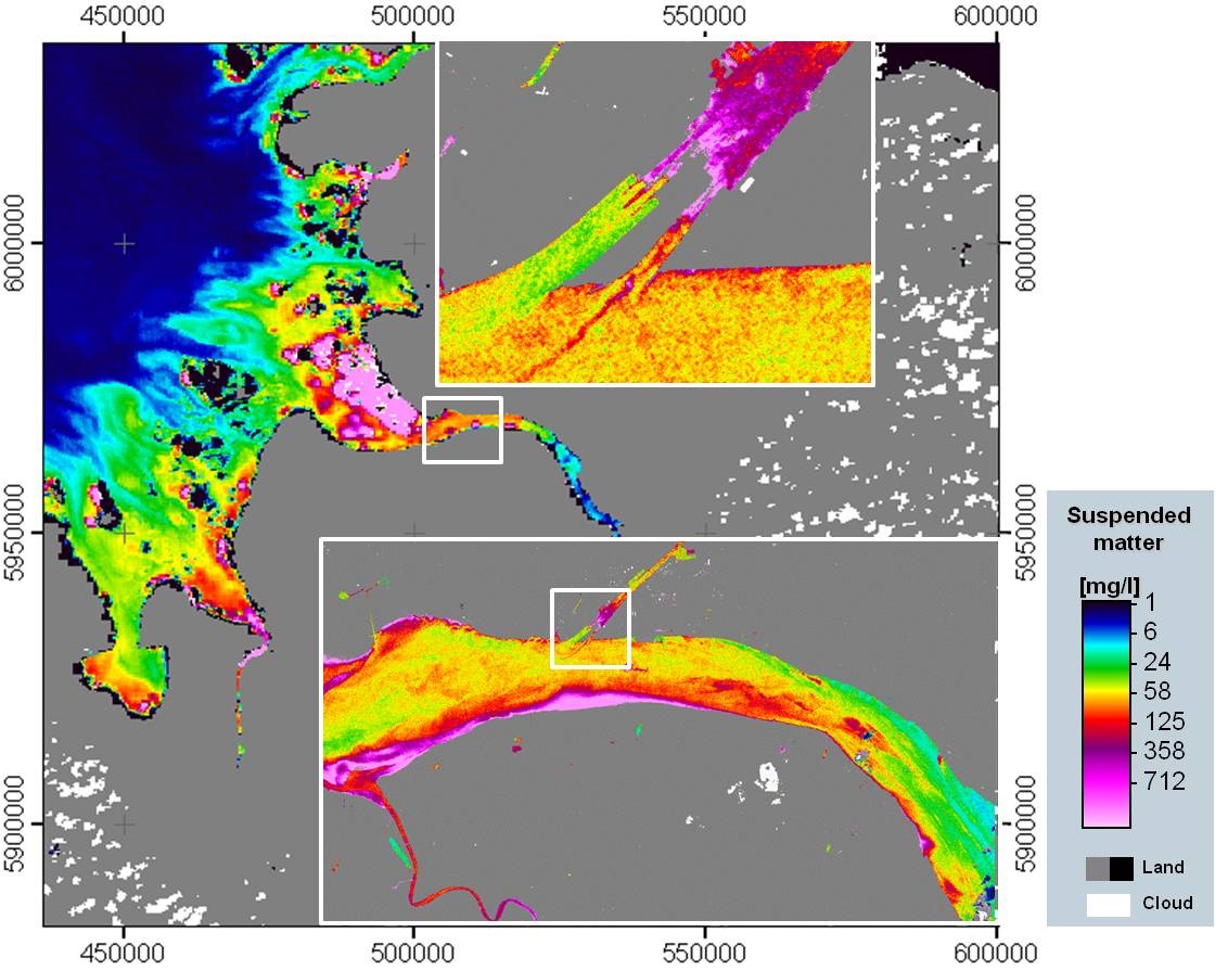
Suspended matter monitoring River Elbe,Germany, using different sensors: MODIS Aqua 250m in the background, RapidEye 5m in front
Multi-sensor water quality monitoring |
Phytoplankton, turbidity, suspended matter, water quality, baseline, impact monitoring |
|
Dredge plume monitoring |
Dredging, turbitity, suspended matter, water quality |
References:
[1] Heege, T., Viacheslav, K., Odermatt, D., Heblinski, J., Schmieder, K., Khac, T.V., Long, T.T. (2009): “Retrieval of water constituents from multiple earth observation sensors in lakes, rivers and coastal zones, Proc. IEEE Int. Geoscience and Rem. Sens. Symp., Cape Town, 4 p
This page has no comments.