Application details page.
Surveying in Glacial moraines
In the foothills of the Austrian Alps, Rohöl-Aufsuchungs Aktiengesellschaft (RAG) has a concession to explore an area with a complex geological history. A 200-km [XX-mi] long Tertiary channel was formed before and during the forming of the mountains. The Alpine folding left the channel intact, although it is segmented by north-south faults. From south to north, the foothills comprise a limestone foldbelt, folded and imbrecciated conglomerates called molasse, glacial moraines and postglacial erosional features.
The area is highly cultivated on the flat terrain, with dense forest on hills and steep slopes and swamps in former glacial lakes and along rivers. In addition, it is covered densely with infrastructure, including villages and cities. These cultural and ecological observations are indicators of operational difficulties and risks. In addition, there are data-quality risks for seismic acquisition: the gravel ridges require large static corrections and poor coupling; swamps will have resonance from trapped surface waves; sources will have to vary, since vibrators cannot be used in swamps; and the surface features can generate substantial levels of noise from surface waves scattered from escarpments.
RAG invested in a remote sensing study to identify and mitigate potential problems before beginning seismic acquisition. A LiDAR DEM survey provided the most accurate surface map available from remote sensing (figure 13 Austrian moraine). Using this and working with geoscientists from WesternGeco, the company was able to reconstruct the glacial and post-glacial history of the survey area. From this survey, the geoscientists developed an elastic model for velocities, layer depths and thicknesses, and attenuation, and thence model-based surface static corrections and coupling corrections for the source and receivers.
Typically, a coupling correction only includes amplitude variation, but that may increase noise in certain frequencies. Instead, the method used for the RAG study also included the spectral distortion at source and receiver that resulted from the strong coupling conditions here. Half of the survey area was used to obtain the remote sensing attributes for the surface consistent method using the seismic cube, and the prediction in the other half was validated against the data there.
The LiDAR evaluation also identified locations of increased scattering risk from abrupt changes in level. Such steep slopes represent boundaries that scatter surface seismic-wave modes. Identifying the type and location of such surface changes helps geoscientists design a filter that eliminates scattered noise from a specific direction.
By loading the DEM survey, the seismic survey and field data into a GIS database, RAG was able to improve the quality of the data. Geomorphology maps from the remote sensing study were correlated to attribute maps from the field and from seismic cubes in the post-processing steps. This process validated the surface effects from static corrections and coupling resulting from the elastic model. Because of the detail and areal extent of the remote sensing study, the company could assure the consistency of corrections across the entire concession.
The area is highly cultivated on the flat terrain, with dense forest on hills and steep slopes and swamps in former glacial lakes and along rivers. In addition, it is covered densely with infrastructure, including villages and cities. These cultural and ecological observations are indicators of operational difficulties and risks. In addition, there are data-quality risks for seismic acquisition: the gravel ridges require large static corrections and poor coupling; swamps will have resonance from trapped surface waves; sources will have to vary, since vibrators cannot be used in swamps; and the surface features can generate substantial levels of noise from surface waves scattered from escarpments.
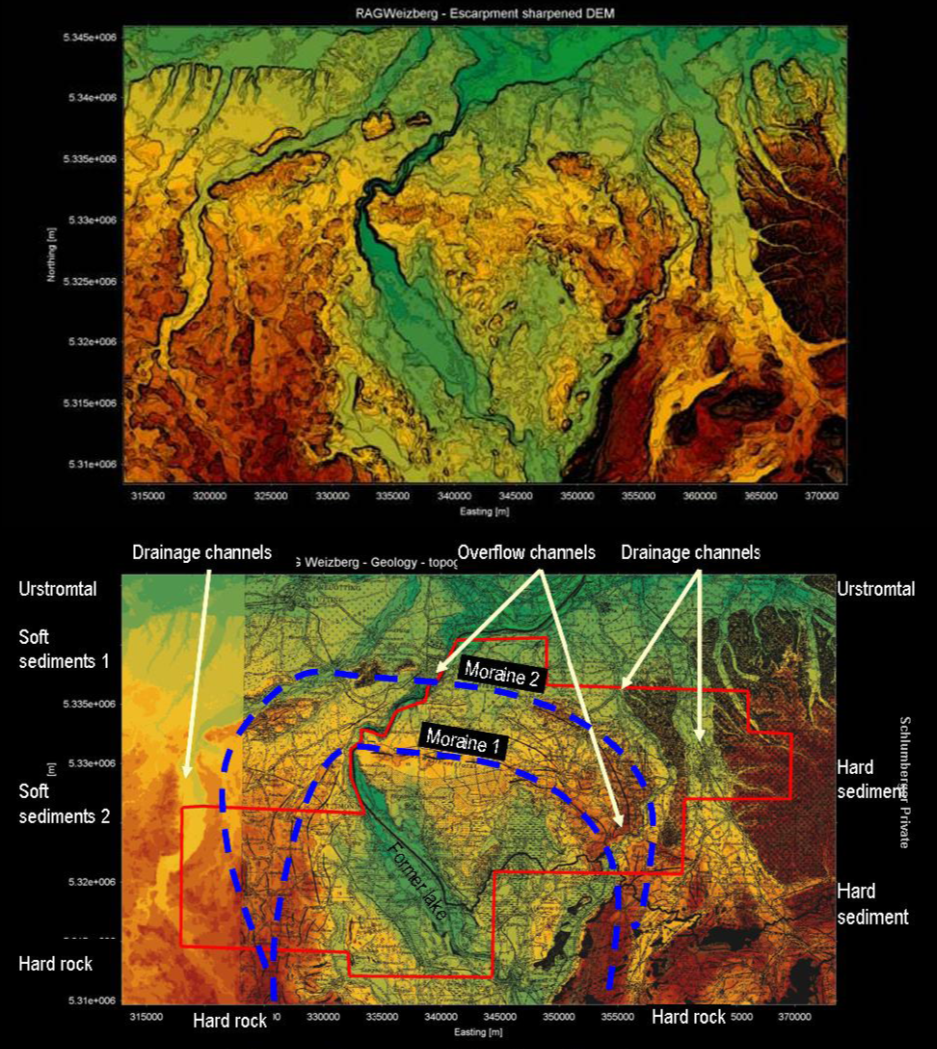
Austrian moraines. A LiDAR DEM survey shows the variation in elevation in this area of the Alpine foothills (top). The black lines indicate escarpments. Using the GIS, interpretation of the lithology and surface features can be overlain with cultural data (bottom). The glacial extent is shown in the two moraine lines. 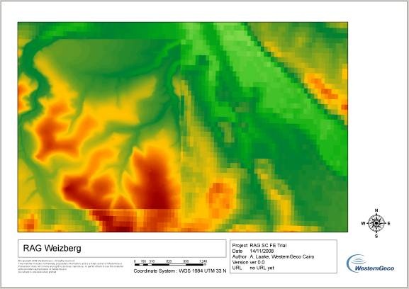
Comparison of spatial resolution of LiDAR (left helf) to SRTM DEM (right half)
This page has no comments.