In the Congo River basin, loading tankers can be dangerous due to the strong current shear caused by the river plume. In this study, the position of the Congo river plume is determined through the use of Ocean Colour data and the statistical calculation of a threshold value enabling a differentiation between water within and outside the plume. This leads to a monthly climatology of the river extent and position.
The Congo River plume is unique in that the low salinity river water form a very shallow layer that extend well beyond the river mouth. The end result is the creation of a very strong current shear at the interface that can be problematic for operations in the area such as the loading of tankers.
A good understanding of the spread of the plume and its variability allows a better planning of all operations and can be included in the determination of suitable metocean windows.
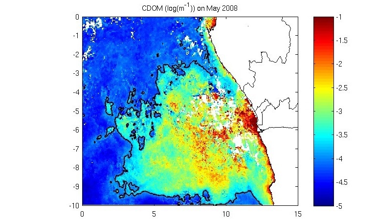
Figure 1: Congo plume CDOM signature
CLS acquires daily EO Ocean color images which contain chlorophyll, total suspended matter and concentration of dissolved organic matter. These data are then processed using an algorithm to determine a threshold value differentiating plume waters and open ocean waters, thus resulting in daily maps of the plume extent.
These maps can be then be averaged over a month to get monthly maps of the plume extent. This can be done for successive years and hence create a monthly climatology of the plume extent, which can be used in ocean models.
Solution
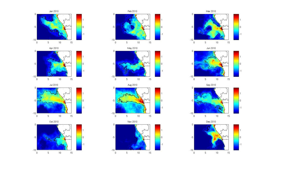
Figure 2: Monthly maps of the plume extent for 2010
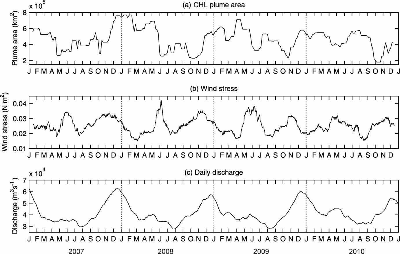
Figure 3: Time series of plume area, wind stress and daily discharge
EO data allows the production of daily maps of the Congo River plume.
In addition, CLS can determine a clear relationship between wind strength and plume area (Figure 3): maximum wind stress coincides with a reduction in the plume area, suggesting that the wind induced mixing is one of the main drivers of the plume extent.
CLS has over 25 years of experience in delivering data and services to customers all over the world. With a staff of 470, in France and abroad, CLS offers services in environmental monitoring, maritime security, and management of marine resources to a broad range of professionals including government, industry and the scientific community, and maintains an operational center with expert support 24/7. Since 2001, CLS has developed services for the oil & gas industry based on its built-in expertise on data collection, radar imagery or numerical modelling. For the EO4OG Project, CLS leads a consortium composed of METEO GROUP and NERSC. Tullow Oil kindly supports the team as a consultant.
Contact
Dr. Marc Lucas, mlucas@cls.fr
This page has no comments.