Application details page.
Biodiversity
Biodiversity or biological diversity is defined in Article 2 of the Convention on Biological Diversity (CBD): "biological diversity means the variability among living organisms from all sources including, inter alia, terrestrial, marine and other aquatic ecosystems and the ecological complexes of which they are part; this includes diversity within species, between species and of ecosystems".
Coastal environments contain highly diverse habitats and are very valuable for providing a large variety of ecosystem services such as food, industrial products, climate regulation and tourism. These services highly depend on the biodiversity. We are however facing biodiversity crises, with very high rates of biodiversity loss. Increasing pressure from natural and anthropogenic stressors, including pollution, unsustainable harvesting of natural resources, invasive alien species, global climate change, and the loss, degradation and fragmentation of ecosystems through land conversion for agriculture and forest clearing for example, all severely impact upon the diversity of species and ecosystems. Conservation of biodiversity has therefore become high priority and requires improved monitoring of coastal ecosystems.
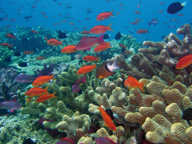
Rainbow Reef, Fiji. Photo by David Burdick, 2006
There is a global need for interdisciplinary, multi-scale studies taking advantage of remote-sensing capacities for biodiversity management and conservation. Large international collaborative networks and programs involved in biodiversity monitoring and management include the CBD, Group on Earth Observations (GEO), Global Earth Observation System of Systems(GEOSS), the Biodiversity Observation Network (GEO-BON), Chlorophyll Globally-Integrated Network (ChloroGIN), GOOS, POGO, the Land Ocean Interaction in the Coastal Zone (LOIZ), United Nations Environment Program (UNEP), Global Mangrove Database and Information System (GLOMIS).
Remote-sensing has become a cost-effective method for collecting environmental data at a range of spatial scales. It enables mapping of various aspects of biodiversity which is not possible and much more expensive with in situ methods. According to the CBD remote sensing can contribute to biodiversity monitoring through analysis of various aspects such as trends in extent of selected biomes, ecosystems and habitats; coverage of protected areas; threats to biodiversity such as invasive alien species; connectivity or fragmentation of ecosystems; trends in populations of selected species; and potential human development indicators. Indirectly remote sensing can facilitate assessments of biodiversity elements through analysis of environmental parameters such as land cover, geology, elevation, and human disturbance. Dense coverage, repeatability and homogeneity of data is possible with the use of optical multi- or hyperspectral sensors. However, remotely sensed generated information needs to be validated with in-situ data. In addition it is required to use models and algorithms in order to accurately interpret remote sensing observations. Atmospheric corrections and water column corrections for example, should be applied when appropriate.
Coarse to high-resolution data can be used to develop baseline maps of extent, diversity, and condition of coral reefs, sea grasses and mangroves. When aiming to distinguish a smaller number of habitat classes, moderate-scale multispectral sensors such as Landsat TM, ASTER, and SPOT, can be used. For intermediate and fine scale mapping to, for example, distinguish between coral reef communities rather than broader habitat classes, higher-resolution optical sensors such as IKONOS or Quickbird are required. This type of sensors together with spectral reflectance information from the Normalized Difference Vegetation Index (NDVI) can also be used to detect the mangrove Leaf Area Index (LAI) which is related to growth and change in canopy structure.
Remotely sensed imagery is very useful to measure connectivity in coastal environments as well. As many species depend on specific habitats e.g., mangroves, sea grasses, and coral reefs for one or more of their life stages, changes in these habitats can be observed with the use of Landsat, ASTER, and MODIS. Reef fishes for example, migrate from mangrove nurseries to adult reef habitats. The strength of mangrove and reef connectivity can be assessed by combining maps of mangrove nursery habitats with reef locations.

Using both IKONOS and in situ LAI-2000 sensor data, a map of estimated LAI, based on NDVI, was created for the Agua Brava Lagoon, Mexican Pacific. The LAI values were then aggregated according to four classes; red mangrove (Rhizophora mangle), healthy white mangrove (Laguncularia racemosa), poor condition white mangrove and dead mangrove. Credit : Elsevier 2005
This page has no comments.