Oil seepage detection
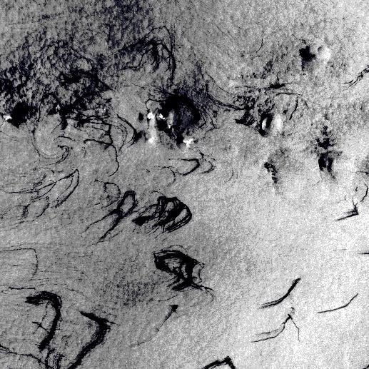
Oil spill is not caused just by accidents or as a consequence of extreme weather events disrupting infrastructurse: the ocean's floor also naturally releases oil. Active seepage takes place when subsurface hydrocarbons penetrate into shallow sediments and the overlying water column; this happens in basins where hydrocarbons are actively generating or contain migration pathways (1). Oil naturally migrates through cracks from deep deposits below the ocean floor, reaching in some cases surface waters, generating oil slicks.
Seepage in the Gulf of Mexico © ESA
The phenomenon could pass unnoticed but satellite imagery offers the possibility of detecting it to monitor environmental pollution, to differentiate natural from man-made oil spills and eventually select areas to exploit since it offers clues on where oil deposits lay in ocean basins. Studying the shape, the displacement, the rate and frequency of oil seeps is important to better understand the phenomenon and its causes. The key to the success of satellite imagery analysis to identify oil seeps is the integration with collateral data like multi-beam swath bathymetry, seismic, weather data, gravity and petroleum geology and chemistry, to create a global database of natural oil seepage. (2)
The traditional techniques are based on radar technologies. Visible, infrared, microwave and radar sensors have all been used, with synthetic aperture radar (SAR) being the most popular and reliable method in recent years (3). It is based on the analysis of the amount of energy that is backscattered by the oceans' surface: in radar imagery, the rougher and more textured surfaces appear brighter. SAR imagery has the drawback that it does not always provide timely and repeated coverage while oil seepage may be a quick phenomenon and thus pass unobserved.
Recent studies have been focusing on optical imagery interpretation. (4) Oil decreases the roughness of the ocean surface resulting in darker or lighter colours depending on the angle of the camera and on light reflection. The slicks are visible not becaue they actually change the colour of the ocean but because they dampen the surface waves, making the oil-covered areas more or less reflective than surrounding water. Optical imagery analysis still suffer though from cloud coverage and missing sunlight related issues. The two types of images can be used together to obtain the best rate of detection of natural oil seepage. Thermal imagery as well can play an important role in identifying potential onshore seeps (2).
References
(1) Victoria V. Zatyagalova , Andrei Yu. Ivanov , Boris N. Golubov, Application of Envisat SAR imagery for mapping and estimation of natural oil seeps in the South Caspian Sea
(2) ESA 2010, Abstract book, Oil and Gas workshop. Satellite EO for the Oil and Gas sector: new technologies and opportunities.
(3) http://www.nasa.gov/topics/earth/features/oilslick.html
(4) Hu, C., Li, X., Pichel, W.G., and Muller-Karger, F. E. (2009). Detection of natural oil slicks in the NW Gulf of Mexico using MODIS imagery. Geophysical Research Letters, 36, L01604.


This page has no comments.