Applications
Beside meteorological satellite, the study and forecast of Earth's weather, and extreme climate events, is also supported by Earth Observation satellites. Parameters that can provide information to understand and predict extreme events are storm and surface winds speed and direction, sea surface temperatures, rainfall, water vapour, clous' features, humidity... The prediction, early detection and monitoring of events as hurricanes and typhoons has clear benefits in terms of improved preparedness and emergency management when they reach populated areas.
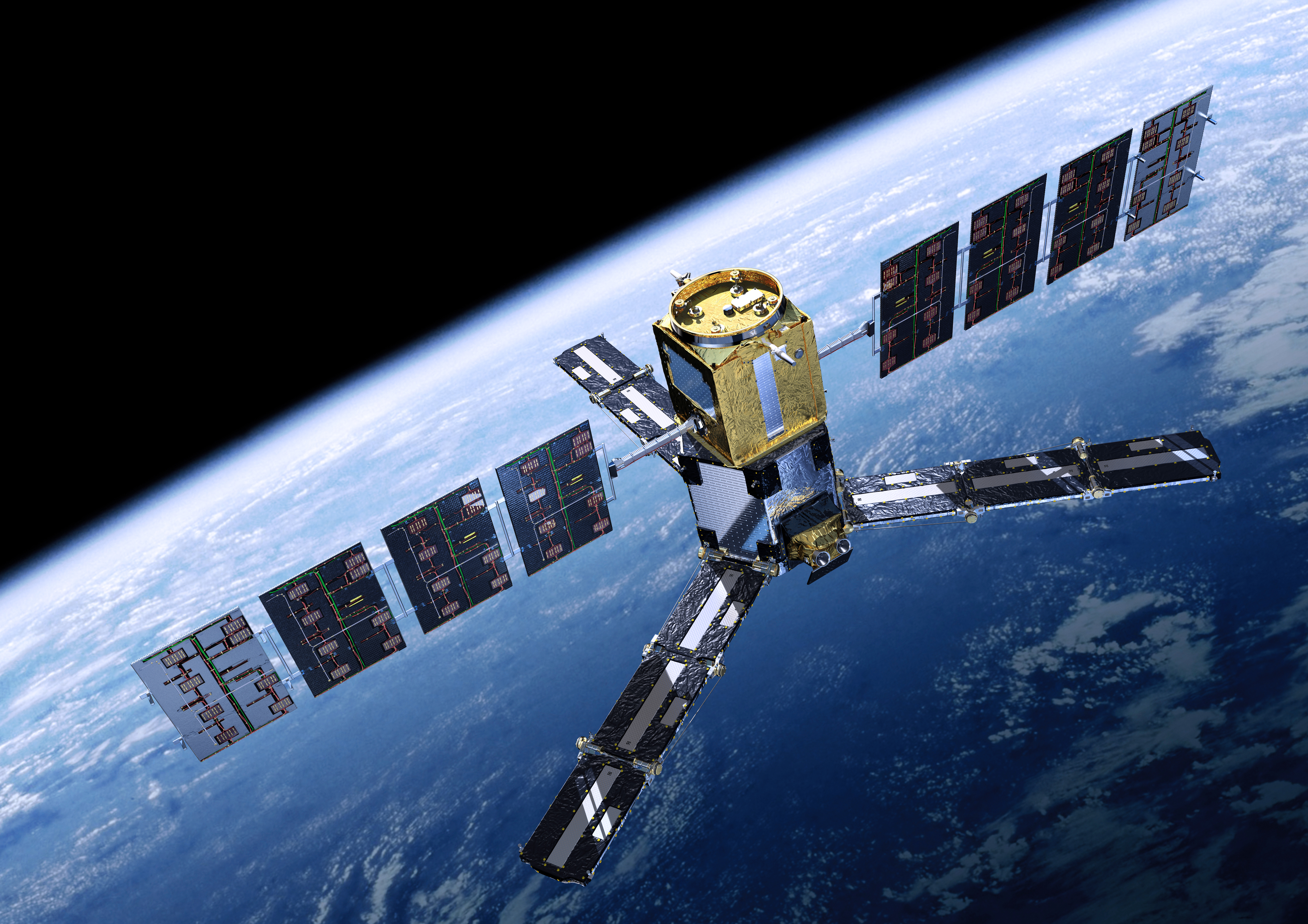
The SMOS (Soil Moistrure and Ocean Salinity) satellite has been designed by ESA to observe soil moisture over the Earth's landmasses and salinity over the oceans, critical factors to understand ocean circulation patterns (1). It brings onboard a microwave radiometer (L-band frequency 1.4 GHz) which allows the estimation of the quantity of water in the soil and of that of salt in the surface oceans' water; it is the first-ever, polar-orbiting, space-borne, 2D interferometric radiometer. This sensor can detect radiation changes over oceans being generated by tropical storms, also in situations in which this datum can be overlooked by other satellites (2). One of the specific feature of SMOS instrument is that it can see through clouds, hence providing estimates of surface winds' speed under intense storms.
ESA's SMOS satellite © ESA
It captures images of 'brightness temperature': radiation from the Earth's surface which let derive soil moisture and oceans' salinity. These data are useful for the better understanding of Eart's water cycle and allow better weather and extreme-event forecasting, also contributing to seasonal-climate forecasting. Even if the satellite was not built with storm detection objective, the demonstration of the viability of estimation methods, has pulled for the data provision on an operational basis.
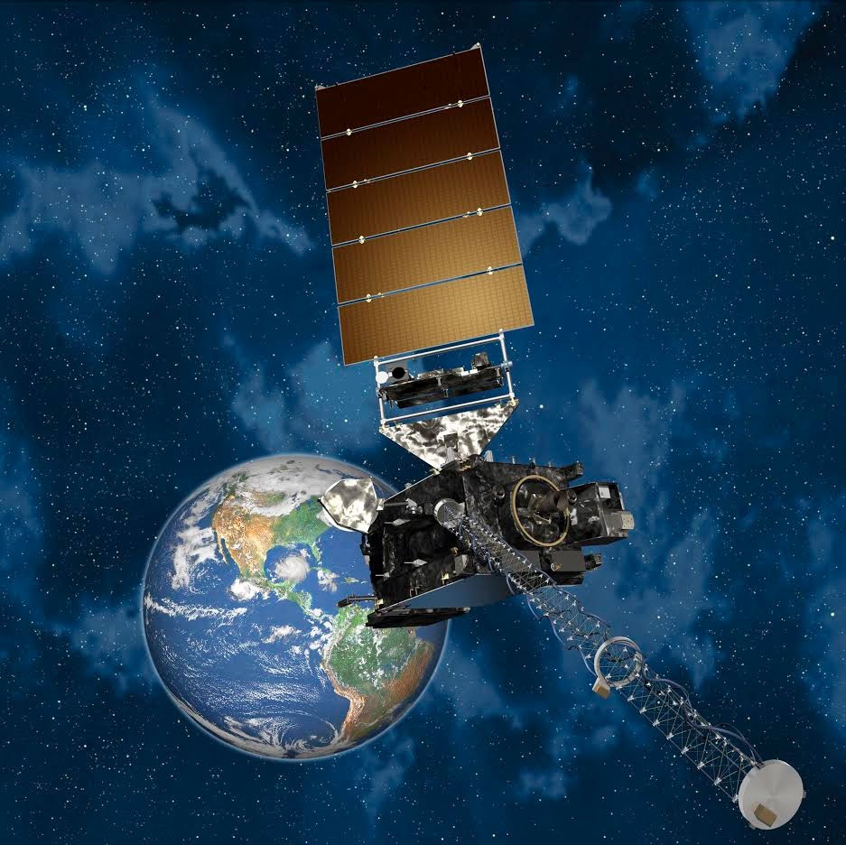
The Geostationary Operational Environmental Satellite R-Series is another satellite which is being built by NASA and would provide more data on hurricanes and typhoon: while current satellite provide storm imagery once every 15 to 30 minutes, the GOES-R promises to provide images every 30 seconds and with a zoom to within 0.3 of a mile from the storm (with respect to the actual 0.6 of a mile). The launch of the first satellite of this fleet is scheduled for 2016, but some of the instruments that will be hosted are already finalised. An Advanced Baseline Imager (ABI) will provide data on Earth's weather, oceans ad environment with 16 different spectral bands (3). Unmanned aircraft, or drones, are instead experimented by NASA to improve storms sensing for longer periods of time (2).
Geostationary Operational Environmental Satellite R-Series (GOES-R) spacecraft. Credit: Lockheed Martin
References
(2) http://blog.urthecast.com/updates/hurricane-watch-cue-the-earth-observation-satellites/
(3) http://www.nesdis.noaa.gov/news_archives/goes-r_instruments_delivered.html
Products | Ext. Source | Descriptions | Product Standards | Ref. Project |
|---|---|---|---|---|
|
|
|
|
|
|
|
|
|
|---|---|---|---|
|
|
|
|
Topic | Description | Keywords | Reference |
|---|---|---|---|
|
|
|
|


This page has no comments.