Application details page.
An accurate assessment of ice conditions is essential for the safe and reliable planning of operations and the design of offshore structures in ice covered waters, in both Arctic and sub-Arctic locales. This includes mean and median conditions and extremes, as driven by seasonal and inter-annual variability. Parameters of importance to design include ice type, ice concentration by type, extreme ice feature dimensions (e.g., diameter and thickness of multiyear ice floes), ice velocity, ice season length and others, as described in the industry standard: ISO 19906[1]. Historically, data to define these parameters and their probability distribution functions have been derived from field measurements with support from earth observation. There is now an opportunity for satellite earth observation to play an enhanced role in establishing these design parameters and to ultimately enhance the probabilistic design practice described in ISO 19906. Benefits include a more accurate assessment of ice conditions, due to higher spatial and temporal coverage as compared to field measurements, faster data collection due to the ability to draw upon decadal archives of satellite imagery, simplification of the data acquisition process due to reduced reliance on logistical support for field activities, and keeping people out of harm's way [2]. Archives of earth observation data now exist which extend back years and even decades, depending on the type of data required, providing in some cases temporal coverage that may be considered representative of recent climatological conditions, and in some cases sampling extreme ice conditions.

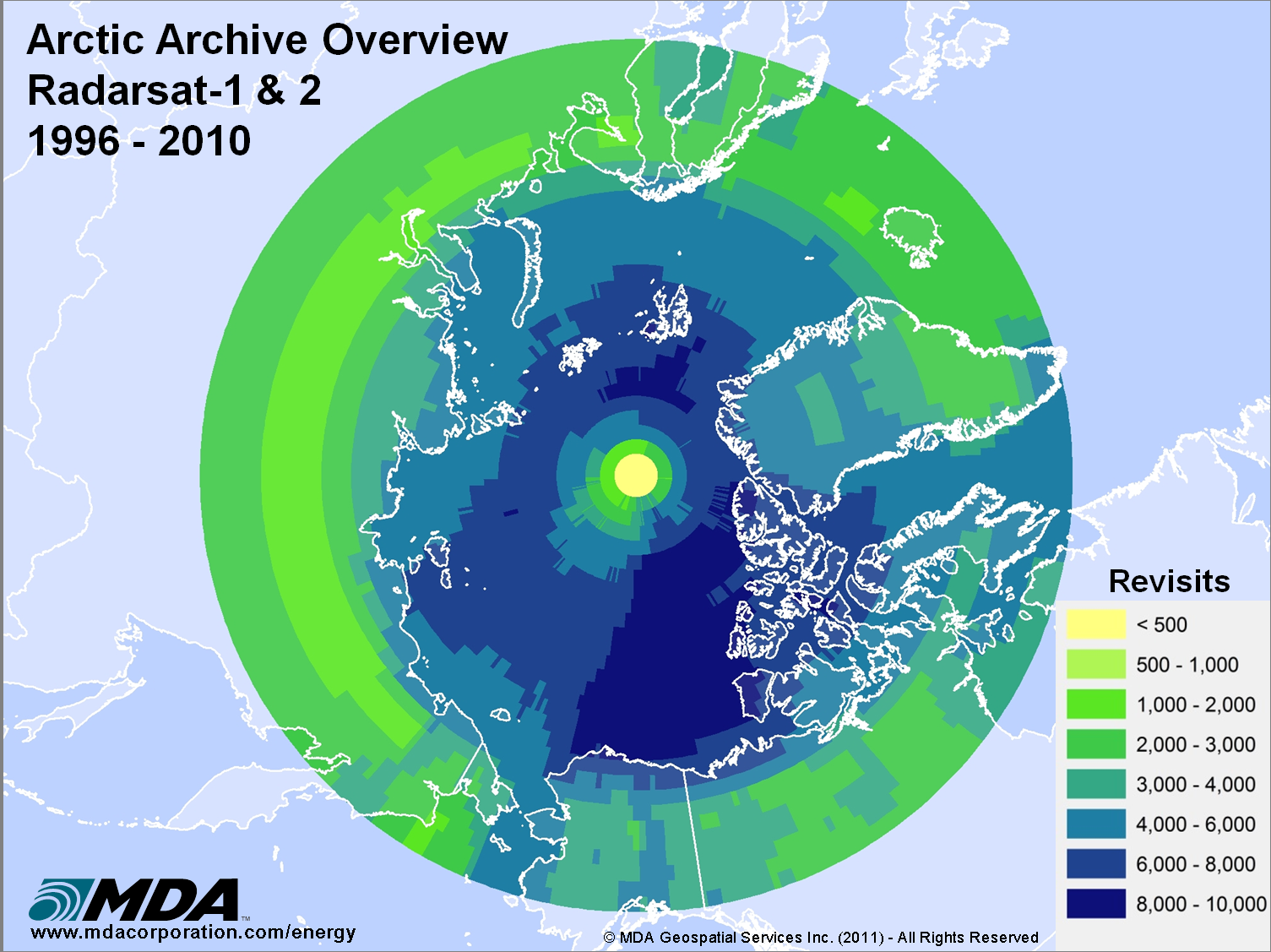
There are now excellent archives of synthetic aperture radar available to carry out studies of design parameters for offshore structures including from ESA (above) and MDA (below).
This includes a significant body of radar data, which is insensitive to atmospheric or natural lighting conditions. In some cases, the data may be used directly to sample ice parameters for an area of interest. In other cases, reprocessing may be required, as in the case of ice thicknesses derived from altimetry. Although the higher resolution data is required to sample the ice parameters, the lower resolution data is useful for evaluating drift trajectories and hence the probabilities of ice-structure interactions.
With significantly enhanced observation capabilities associated with the new generation satellite imaging sensors, there is the opportunity to build up new archives of high resolution observations of ice conditions to add to existing archives.
References:
[1] ISO/FDIS 19906: 2010(E), 2010, Petroleum and natural gas industries – Arctic offshore structures, International Organisation for Standardization, Geneva, Switzerland, http://www.iso.org/iso/catalogue_detail.htm?csnumber=33690, 2010-12-14.
[2] Partington, K.C., Winkler, M. and Fournier, N., 2011, "The Potential of Satellite Earth Observation of Ice Conditions in Supporting ISO 19906", Proceedings of the 21st International Conference on Port and Ocean Engineering under Arctic Conditions, July 10-14, 2011, Montreal, Canada, http://www.poac.com/www.poac.com.
This page has no comments.