Earth observation (EO) technologies are useful in providing environmental context while conducting marine studies. For ship-based studies in particular, EO can help make day-to-day decisions as to when and where to collect samples, and especially when trying to understand more ephemeral ecosystem features such polynyas, the ice edge, eddies, or predator-prey hotspots.
Being able to review these data as they are relayed in near-real time to the ship allows for safer and more efficient research operations and thus represents a critical tool many researchers have come to rely on.
The Bering Sea Project was funded by the North Pacific Research Board in Alaska and the National Science Foundation (NSF). The aim of this $52 million Project, which took place between 2008-2013 on the Bering Sea shelf and involved over a hundred investigators from over 30 institutions, was to understand the interplay between climate forcing, key physical and biological ocean features, marine resources (particularly fish, birds and mammals), and the people that live and use this region. Part of the work was focused on better understanding the relationship between spring sea ice dynamics, pelagic and benthic productivity, and its implications for walrus and spectacled eiders. For this purpose, the project conducted research cruises aboard the USCG ice-breaker Healy in March of 2008 - 2010.
An important part of this project was to study the benthos underneath polynyas, in locations where spectacle eiders were feeding, as well as to carry out ice stations (i.e. drill ice cores, take snow measurements, measure primary production in and underneath the ice, etc.). Some local reconnaissance was carried out with a helicopter, but a broader scale search pattern was needed to direct the ice breaker within the ice field in the northern Bering Sea and thus efficiently accomplish these goals.
The solution came from the ability of the US Coast Guard Cutter Healy to receive near-real time satellite observations of key parameters while at sea, and from the partnership of the project and NSF with the Earth Observing Laboratory (EOL). Formed in 2005, EOL is one of the five laboratories of the National Center for Atmospheric Research (NCAR), the US National Science Foundation’s Federally Funded Research and Development Center. As the successor of NCAR’s Atmospheric Technology Division (ATD), the mission of EOL is to provide leadership in observing facilities and field project support, as well as research and data services needed to advance the scientific understanding of the Earth system.
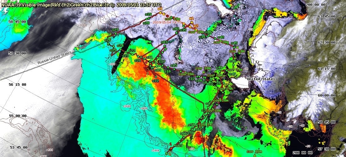
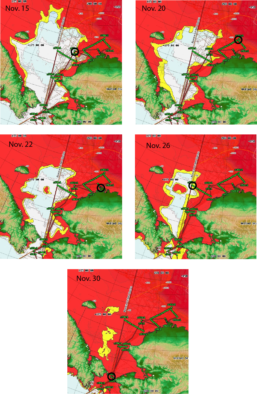
During all spring and summer Healy cruises between 2008 and 2010, EOL made available on the Healy MapServer as much useful satellite imagery as possible, including AVHRR sea ice, National Ice Center ice extent for the various dates, ocean colour and ARGOS telemetered spectacle eider and walrus locations, all overlaid with the real-time ship track (see example images below). RadarSat imagery was also imported where available through one of the university researchers.
Sea ice from AVHRR, ocean colour and the ship track.
National Ice Center ice extent for the various dates. The location of the ship at the time of the ice extent map is circled. The cruise track of Healy is shown (these maps were generated by Steve Roberts, UAF).
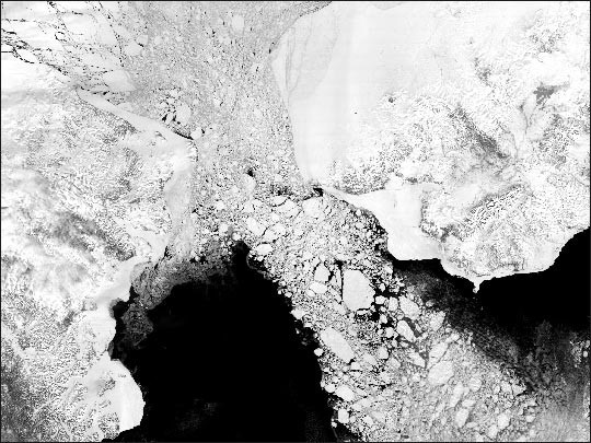
MODIS sensor on Terra sending images of sea ice distribution in the Bering Strait between Siberia and western Alaska.
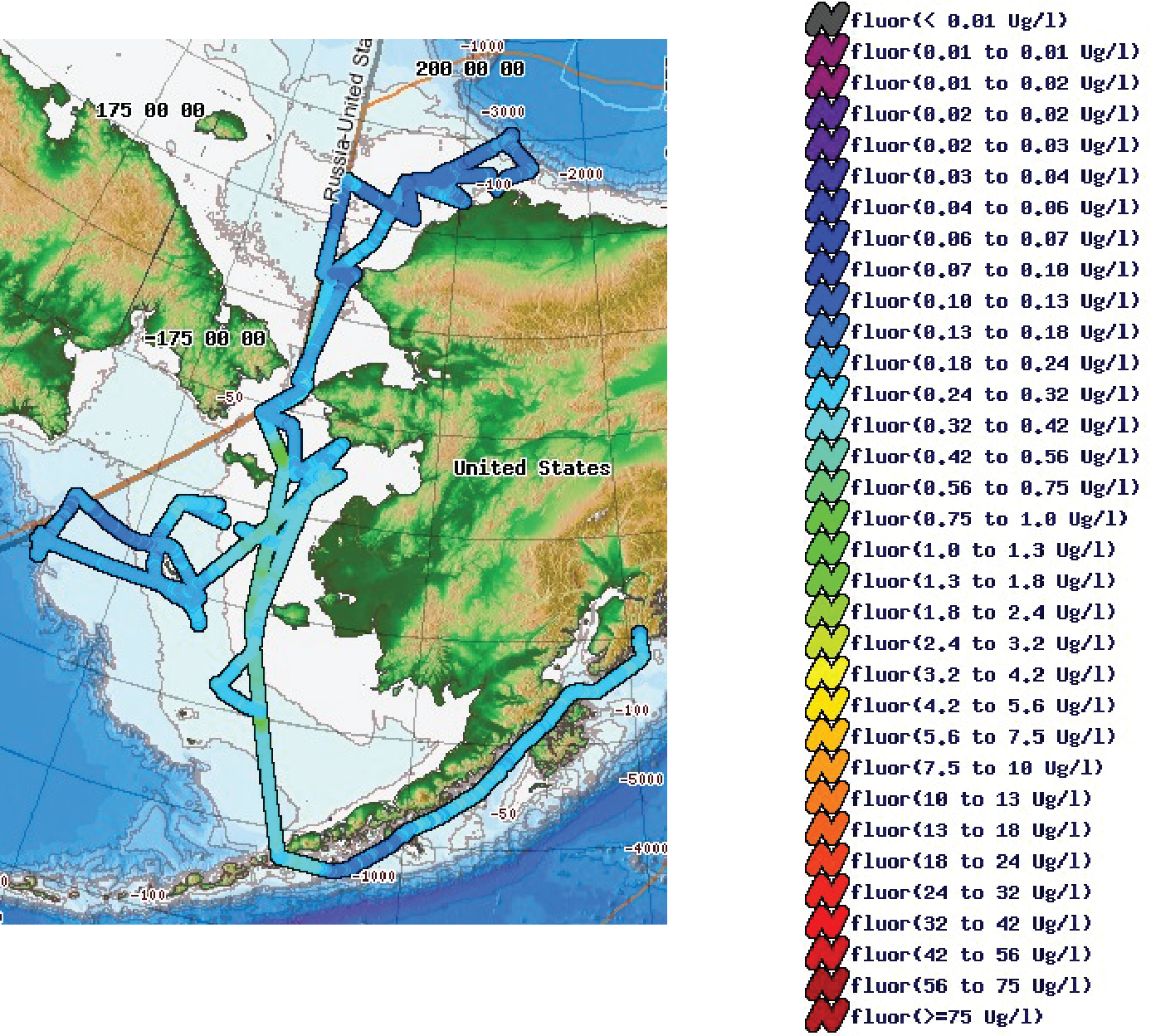
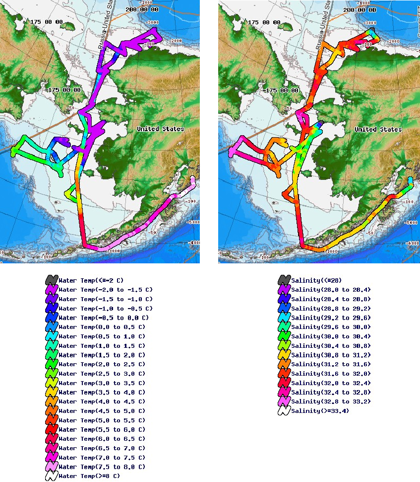
Although not satellite imagery, researchers could also graphically display the following during the cruise (see figure below):
- Location – present, future, past occupied stations
- Cruise track
- Underway seawater temperature, fluorescence, salinity, etc.
- Multibeam data, both historic and real time
- Meteorological data
- pCO2, oxygen
- ADCP data
- Bottom depth
All together, the in situ observations at select stations, the underway data from the ships sensors and the large scale satellite imagery for context complemented each other perfectly to provide the researchers the proper and necessary physical and biological context to interpret their data and address their research goals.
It is clear from this project and other efforts like it, that EO information plays a critical role in helping us understand the marine ecosystem. Marine researchers around the world will continue to use the available data streams; and likely increasingly so, as the bandwidth of ships improves and is able to receive increasing amounts of data like the ones shown, and as more EO sensors come online to provide new, higher resolution and more frequent imagery of the physical and biological environment that surrounds us.
See http://www.nprb.org/bering-sea-project for more information on this project and related publications.
PDF

This page has no comments.