Success Story on the use of EO for oil & gas exploration
In 2010, Qatar Shell Upstream International B.V. re-entered exploration in Qatar by focusing on the relatively deep conventional Pre-Khuff gas. In order to support Qatar Shell with the execution of onshore and offshore seismic programs, extensive use was made of satellite imagery to derived added values products such as shallow water bathymetry, seabed classification and onshore digital elevation models.
Mapping the 740 sq km offshore area using satellite derived bathymetry resoluted in significant time and cost savings, and mitigated HSSE risks. The satellite imagery products were revealed as a key technology in aiding the planning and preparation of the seismic surveys.
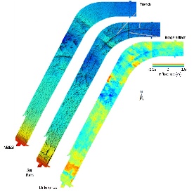
Figure: Hillshaded view of the Multi-beam echosounding survey data (left MBES, acquisition year: 2003) and overlapping subset of the satellite bathymetry data (middle, acquisition year 2010) and the colour coded difference values between the two datasets (right). Blue to red indicates -ve to +ve elevation change. Annotations indicate features of interest, such as the pipeline trench. © Qatar Shell Upstream International B.V and EOmap
In 2010, Qatar Shell Upstream International B.V. (QSUI) re-entered exploration in Qatar by focusing on the relatively deep conventional Pre-Khuff gas. In order to support Qatar Shell with the execution of onshore and offshore seismic programs, extensive use was made of satellite imagery to derive added value products such as shallow water bathymetry, seabed classification and onshore digital elevation models (DEM).
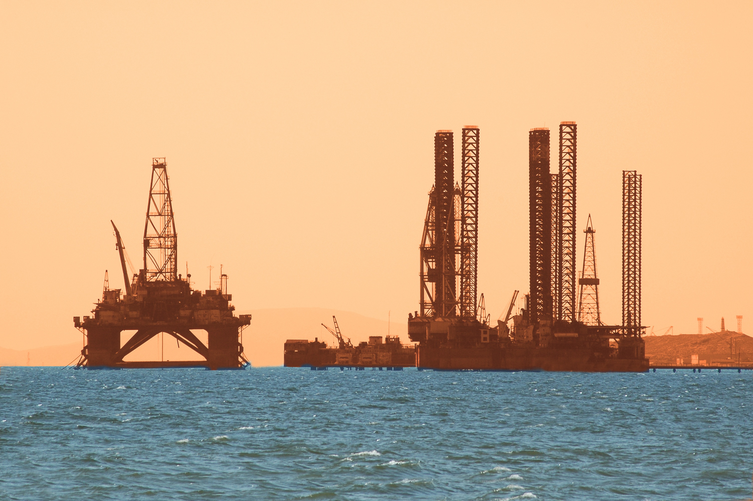
©Fotolia
Information about water depth and geomorphological properties is regularly required for offshore explorations, but is frequently not available for the area of interest;.hydrographical surveys to date cover only a fraction of coastal areas worldwide. Furthermore, the most up-to-date maps possible are required in rapidly changing environments such as the coastline around Qatar in order to reduce temporal uncertainties. However, LIDAR and echosounding surveys are cost-intensive, require extensive and long-term planning and permissions and have significant HSSE exposure. As is often the case, data from these methodologies are not available area wide or at the required resolution, for the location.
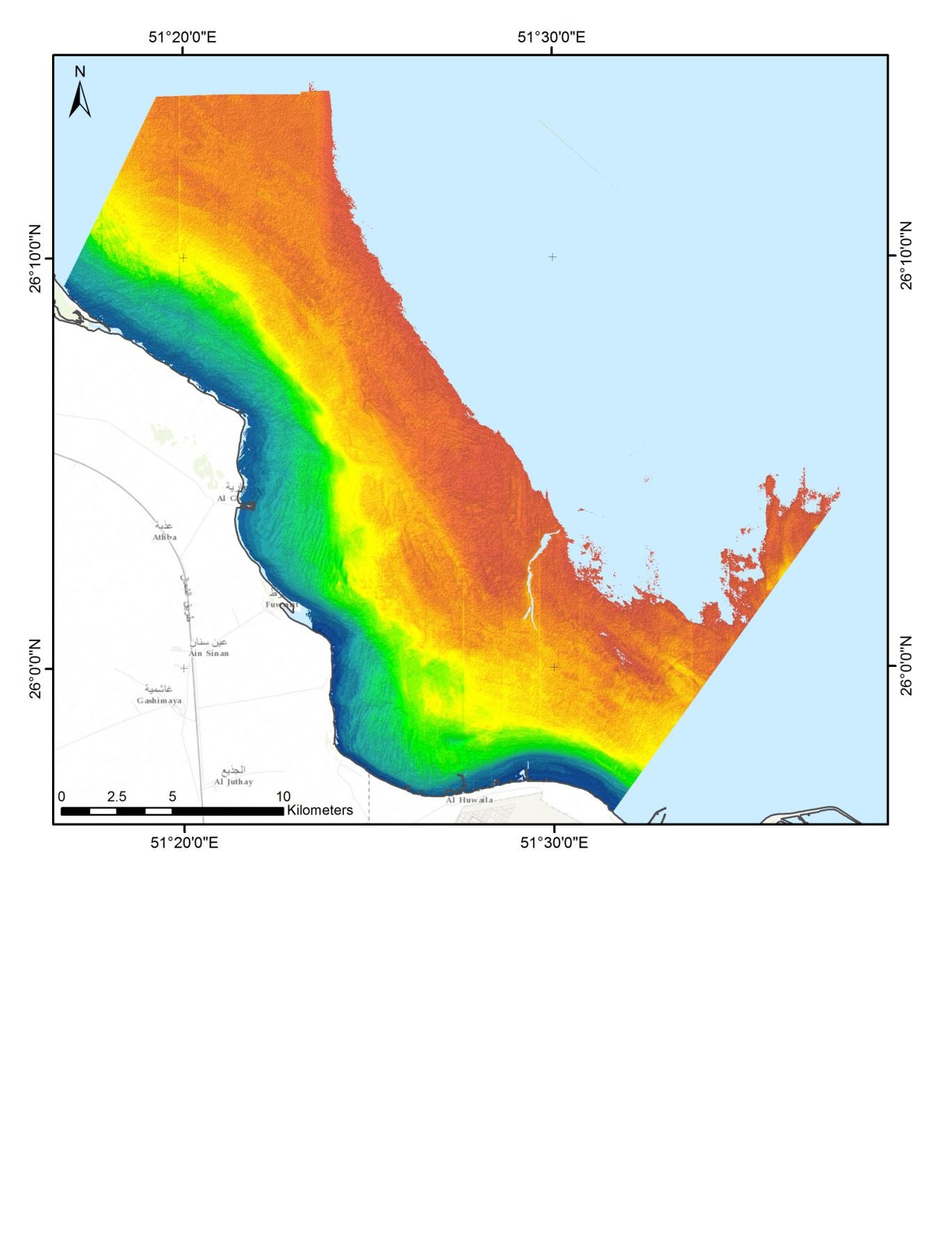
Figure: Satellite derived bathymetry shown with hillshade and pseudocolour coding. Blue = shallow water, Red = deeper water (acquisition year: 2010). © Qatar Shell Upstream International B.V and EOmap.
For this project, satellite derived bathymetry (SDB) and complementary seafloor products were generated for an area of 740 sqkm, at 4m horizontal resolution. The independent, physics-based process to generate bathymetry from satellite imagery resulted in an RMSQE error of 70cm and 50 cm, in comparison to the main reference dataset (LiDAR) and multi-beam survey of 2003, respectively. The results also displayed a good correspondence with known features such as trenches.
Mapping this 740 sq km area using SDB resulted in cost savings of over 1 M USD, when compared to traditional acquisition methods. The HSSE risks were significantly mitigated due to minimizing the use of traditional survey methodologies. In addition to this, SDB production time of only 2 weeks efficiently supported the project schedule. The satellite imagery products were revealed as a key technology in aiding the planning and preparation of the seismic surveys.
The EOMAP GmbH & Co.KG. technology is operational and standardized across a range of satellite sensors, typically offering horizontal spatial resolutions of between 2m and 30m. It is currently being implemented as an off-the-shelf product for various regions worldwide, which allows for very fast deliveries and cost savings for clients. Of course, as with the application described in this article, project-specific solutions are readily accommodated.
Reference:
- Siermann, J., Morgan, G., Heege, T., & Harvey, C. (2014, January 19). Satellite derived Bathymetry and Digital Elevation Models (DEM). International Petroleum Technology Conference. doi:10.2523/17346-MS, https://www.onepetro.org/conference-paper/IPTC-17346-MS
- Key words: Oil and Gas, Offshore, Bathymetry, Seafloor, Environmental baseline Service provider: EOMAP GmbH & Co. KG / Germany/Singapore
- User/ Customer: Qatar Shell Upstream International


This page has no comments.