Assess soil water and run off
The vast majority of the water present in the Earth System is retained in stores such as oceans and aquifers. Only the 0.003% of the total globe's surface water falls on land in the form of precipitation each year. It then returns to the atmosphere through evapotranspiration, infiltrates the soil to add to soil moisture and groundwater or runs off in streams and rivers. Runoff is the portion of the precipitation which flows over land surfaces towards larger bodies of water. Groundwater occurrence is greatly determined by the geological conditions as well as the available water for storage. While groundwater is very important for agriculture, it is the runoff that can be most readily captured and managed for the betterment of society. Freshwater availability and use are key to human well-being. Being it a finite and vulnerable resource, management of freshwater is expected to emerge as one of the greatest challenges in achieving the goal of sustainable development during the 21st century.
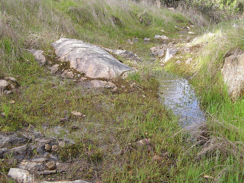
Surface runoff from a hillside after soil is saturated
Owing to the complexity of the global water cycle, long-term observational datasets are needed to characterise its behaviour. Earth observation satellites play a major role in the provision of information for the study and monitoring of the water cycle and represent an important element of the observation strategy. Currently, new integrated, multi-year datasets are being generated, taking advantage of the opportunity presented by the simultaneous operation of key satellites by Europe, Japan and the USA. The global nature of satellite data is important in tackling the problems of data continuity in trans-boundary basins where complete, consolidated, and consistent information may be difficult to obtain.
Atmospheric temperature, water vapour and cloud data have been provided operationally by polar-orbiting meteorological satellites for decades, provided by the USA (NOAA series) and more recently Europe (EUMETSAT’s MetOp series), as well as China and Russia. The use of high-resolution infrared soundings (IASI), radio occultation techniques (which look at the interaction of radio signals with the atmosphere to derive characteristics of the atmosphere), and the Global Positioning Satellite (GPS) signal (e.g. by the COSMIC satellite constellations and GRAS on MetOp) have further augmented the contribution from space. In 2011, Megha-Tropiques was launched, devoted to the study of the water cycle and energy exchanges in the atmosphere. Its low-inclination orbit focuses observations on the tropics, using microwave radiometers to monitor precipitation, clouds and water vapour on a frequent basis. Megha-Tropiques increases the sampling rate of the GPM constellation in this crucial region of the globe. This will be complimented by JAXA’s Global Change Observation Water Mission series (GCOM-W). All these missions apply microwave-based techniques (using either passive remote sensors, or weather radars) to provide the next generation of rainfall measurements. Precipitation is clearly a key parameter in the water cycle. Traditionally, visible/infrared images from geostationary meteorological satellites like GOES, GMS and Meteosat provided the best source of satellite information, with indirect but frequent estimates of rainfall derived from measurements of cloud top temperature. Evapotranspiration is generally estimated from satellite data using a range of models, with model inputs from the visual and thermal bands from the GEO, MODIS and Landsat satellites. [1]
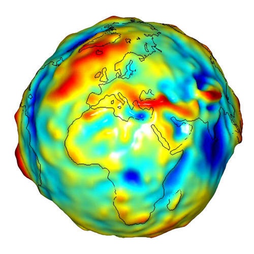
A Grace gravity model, showing Europe and Africa
An emerging application area is the use of GRACE, and its gravimetric measurements, which are being used to quantify groundwater changes. Plans are currently being formulated for GRACE Follow On and GRACE-II missions, and it is expected this area of research will continue to expand. Other areas of emerging interest include the exploration of radar altimetry to measure water levels in lakes and rivers. The GRACE satellite mission, launched by NASA and the German Aerospace Centre (DLR) in 2002, measures temporal variation in the gravity field, which is used to estimate changes in terrestrial water storage (TWS)[2]. This is the first satellite remote sensing mission which is directly applicable to the assessment of TWS under all types of terrestrial conditions. The GRACE satellites measure variations in water storage indirectly, by measuring temporal variation of gravity field of the Earth. GRACE is the first Earth-monitoring mission in the history of space flight whose key measurement is not derived from electromagnetic waves either reflected off, emitted by, or transmitted through Earth's surface and/or atmosphere. Instead, the mission uses a microwave ranging system to accurately measure changes in the speed and distance between two identical spacecraft flying in a polar orbit about 220 kilometers (140 mi) apart, 500 kilometers (310 mi) above Earth. The ranging system is sensitive enough to detect separation changes as small as 10 micrometres (approximately one-tenth the width of a human hair) over a distance of 220 kilometers.[3]
Products
Products | Ext. Source | Descriptions | Product Standards | Ref. Project |
|---|---|---|---|---|
|
|
|
|
|
Success Stories
|
|
|
|
|---|---|---|---|
|
|
|
|
References
Topic | Description | Key words | References |
|---|---|---|---|
|
|
|
|


This page has no comments.