Sediments and plumes
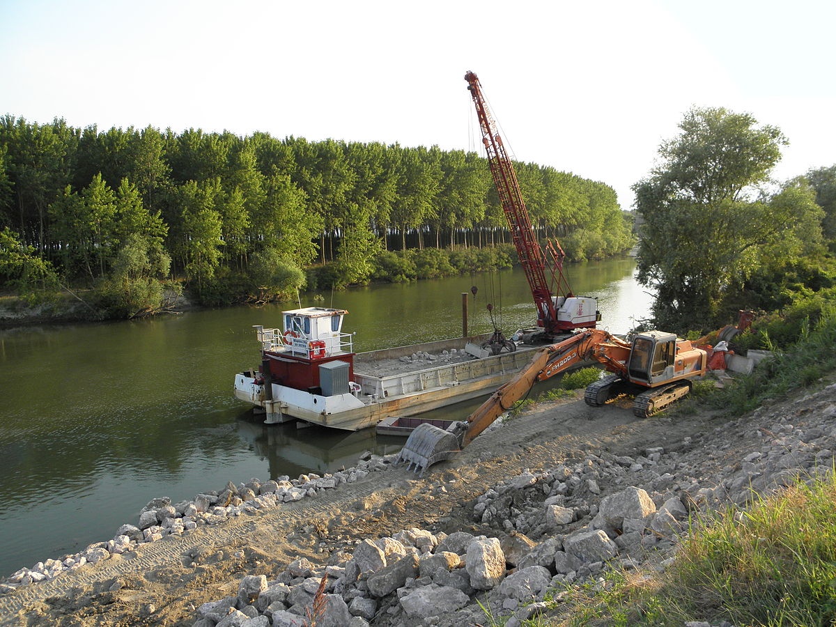 Dredging is the excavation activity which removes sand from the bottom ground of harbours, lakes or rivers, counterbalancing the effect of natural sedimentation. It is used for maintenance reasons, to keep waterways navigable, which is very important for global trade, but also to prevent floods. Other reasons are to provide materials for construction or sand for beaches, to counterbalance coastal erosion. It is also a fishing and harvesting technique.
Negative impacts are mainly on aquatic ecosystems, due to disturbance and increase turbidity in general, but also to toxic chemicals that can be contained in spoils. Moreover dislodged chemicals are released from benthic substrates into the water column: heavy metals and other organic toxins can reach humans via food chain uptake.
Topography changes from accumulated spoils also impact natural environment, as well as alteration of water currents and waves, and water quality contamination. On the other end, environmental dredging, has exactly the opposite objective, which is to reduce the exposure of fish, wildlife, and people to contaminants and to prevent the spread of contaminants to other areas of the water body (1).
Environmental impact assessments have to be carried out, and the related industry is regulated and monitored. The factors influencing the impact of dredging have been identified by the UK Marine SACs project (2):
- Magnitude and frequency of dredging activity
- Method of dredging and disposal
- Channel size and depth
- Size, density and quality of the material
- Intertidal area
- Background levels of water and sediment quality, suspended sediment and turbidity
- Tidal range
- Current direction and speed
- Rate of mixing
- Seasonal variability and meteorological conditions, affecting wave conditions and freshwater discharges
- Proximity of the marine feature to the dredging or disposal activity
- Presence and sensitivity of animal and plant communities (including birds, sensitive benthic communities, fish and shellfish)
Temporal and spatial analysis of remote sensing satellite images can differentiate the acute sediment impacts of dredging from sediment attributable to other natural causes (e.g. river discharge, tide influence). Clearly the higher the resolution of the image the better its interpretation; validation of images with ongoing water, turbidity and soil parameters data collection makes the assessment more reliable. Archived optical imagery is an asset to carry out long-term analyses and comparisons.
Dredging information systems are under development for compliance monitoring, but near-real-time high resolution images would be needed to feed these models. Other potential applications, which do not require images to be delivered on such a fast basis, are forecasting tools for the project preparation phases, to analyse critical dispersion dynamics, and post dredging assessment tools, for environmental compliance issues or for restoration of natural sites. Earth observation data provide information on the background Total Suspended Solid (TSS) concentration, on the concentration of a plume in the case of dredging activity during project preparation and post-project evaluation phases (3).
References
(1) http://oceanservice.noaa.gov/facts/dredging.html
(2) http://www.ukmarinesac.org.uk/activities/ports/ph5_2.htm
(3) Tatman, et al - New Dredging Information System for Assessment of Turbidity.pdf
This page has no comments.