Assess crop damages due to extreme climate events
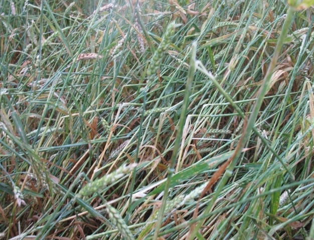
It is difficult to overestimate the importance of crop production and the impact of extreme climate events. Among the most sensitive crops to hail damage there are wheat, corn, soybeans, and tobacco.
Consequences of production losses pass through the value chain from farmers to consumers, affecting world prices and food security. The prospect of crop damage raises supply concerns and extreme weather increases costs for consumers, sending up world food prices and affecting social stability. Reliable and timely data are thus very important in this area for a variety of actors: farmers have to estimate yield losses, insurance companies need to assess claimed damages and investigate suspicious ones, governments and authorities have to guide their intervention and recovery strategies. A thorough assessment of climate damage to agricultural production is also important in preventing food crises and improving relief strategies..
The crop-loss assessment procedure has been now used for several decades, but for it to be accurate a lot of assumptions have to be met: an average crop prior to the storm, accurate staging of the crop, accurate measurements during the loss adjustment, and average growing conditions for the remainder of the crop season (2). Crop-loss assessment is physically demanding and time consuming, and the size of the crop and topography may preclude long-distance visual perception. This procedure is claimed to be highly subjective and error prone. Remote sensing and geographic information systems bring the advantages of standardizing the sampling procedure, speeding the selection and location of damages and estimating areas of similar damage. Considerable improvements and cost savings could be made with the assistance of satellite based technology. Recent technological and communication developments have also made it possible for farmers to observe images of their field and quickly adjust their farming decisions: this means not just detecting problems and assessing damages, but also monitoring the success of production strategies.
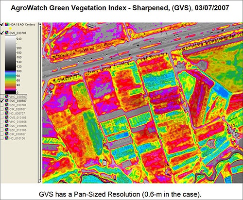
Credits:ASTER Satellite Images (Satellite Imaging Corporation)
Damage assessment based on airborne remote sensing is being demonstrated to be faster and more accurate than field-oriented, hail-damage adjustment procedures. Multispectral imagery at very high resolution makes possible to detect the ground area and relative level of damage, but also lower resolution imagery let determine the extent of storm damages (2).
The vegetation’s "spectral signature" is a particular way in which plants reflect the electromagnetic radiation. Reflectance of vegetation is very low in the blue and red regions of the electromagnetic spectrum, slightly higher in the green region and high in the near infra-red. Stressed or damaged crops experience a decrease in chlorophyll content and changes to the internal leaf structure. The reduction in chlorophyll content results in a decrease in reflectance in the green region and internal leaf damage results in a decrease in near-infrared reflectance. Some of these symptoms are not visible to the human eye, but may be captured by satellites (3).
References
(1) Bloomberg
(2) IGF Insurance Company & University of Nebraska - Lincoln Affiliated Research Center, Integration of Remotely Sensed Data in a Geographic Information System for Assessing Crop Hail Damage, 1999
Products | Source | Descriptions | Product Standards | Ref. Project |
|---|---|---|---|---|
|
|
|
|
|
| Topic | Description | Key Words | References |
|---|---|---|---|
| Awareness article | An eye on Earth: satellite Earth Observation for agriculture insurance. | agriculture insurance | GEO Blog |


This page has no comments.