Image Source: EOMAP
Product Description
Knowledge of the topography of the marine environment is required for industrial developments in near and offshore areas. Industrial activity can also have negative impacts on these environments. Therefore, any changes or potential changes need to be understood as part of environmental impact assessments.
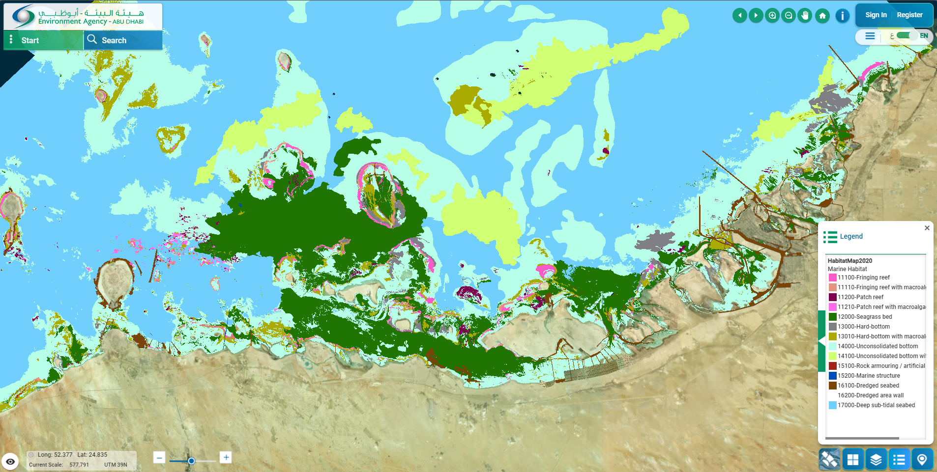
Seafloor classification generates a map of seabed habitats including classes such as coral, hard and unconsolidated bottom, seagrass, sand. Traditional field survey approaches can be very thorough but are limited in their spatial coverage. Different types of acoustic surveys have been implemented to deal with this, but they are costly and require a huge amount of planning and coordination.
Multispectral satellite data provides an alternative in depths up to 30 m. Combining this data with ground truths and machine learning techniques, low-cost habitat classifications covering a large area can be achieved.
Input Data Sources
Optical multispectral:
- • Medium resolution: Sentinel-2, Landsat
- • High resolution: WorldView, Pleiades
Required Processing
The following image corrections and adjustments may be applied during image pre-processing prior to seafloor classification:
- • Radiometric correction (remove haze and object scattering)
- • Reflectance correction
- • Water column correction
- • Land masking and cropping
- • Image sharpening – band transformation using bands with highest penetrative ability
Supervised classification techniques can be applied provided sufficient ground truth data is available. A maximum likelihood classifier will assign classes to image pixels.
Coverage and Frequency
• Coverage:
- • Global with freely available satellite data from Sentinel platforms or Landsat. Data availability extents as far back as 2015 with Sentinel-2 and further back with Landsat.
- • Commercial high-resolution satellites such as Pleiades and WorldView also have global coverage, but real-time data requires tasking.
• Frequency:
- • Freely available data varies in frequency from 3 days to 16 days.
- • Commercial satellites have a higher revisit capacity but require tasking for specific areas of interest.
Resolutions
The spatial resolution of seafloor classification products is generally close to that of the resolution of the satellite sensor used to make the measurement:
- • Landsat: 30 m
- • Sentinel-2: 10 – 20 m
- • Pleiades, WorldView: 1 – 2 m
Accuracy and Validations
Validated seafloor classifications using dives and transect methods have achieved accuracies in the range of 85-90%.
Limitations
• Limited to shallow coastal areas with clear water.
• Cloud cover significantly impacts the usefulness of optical satellite data.
Delivery Format
• Various GIS formats
• User interface
• API
Accessibility and Cost
Commercial providers determine costs on a per client basis depending on area of interest and resolution requirements.
- • For example, see: https://www.eomap.com/services/benthic/
This page has no comments.