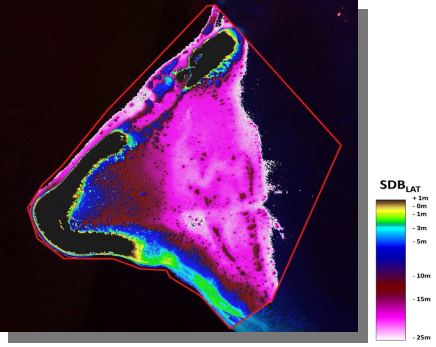
Image Source: EOMAP
Product Description
During the siting, design and construction phases of offshore wind farms, consideration must be made for how the turbines will be connected to the grid. This includes the routing of cables on the seabed. Remote areas with complex underwater environments present difficulties when conducting hydrographic surveys. Risks include loss of equipment and even human life. The availability of high-resolution satellite data has allowed for recent improvements in seabed topography mapping from space.
Multispectral satellite data is the most common source for producing satellite derived bathymetry (SDB). Spectral radiance measurements are used to derive water column depth at varying resolutions from sensors such as Sentinel-2, Landsat and Pleiades. WorldView data can be used to derive photogrammetric SBD from a stereo pair of images. IceSat-2 is a space-based laser altimeter. The travel time of the signal is used to derive depth measurements. SAR data such as that from Sentinel-1 or TerraSAR-X can be used to derive depth based on relationships between water surface and topography of the seabed.
Maximum mapping depths for SDB are 20 – 30 m.
Input Data Sources
Optical multispectral:
- • Sentinel-2, Landsat, WorldView, Pleiades
Synthetic Aperture Radar:
- • Sentinel-1, TerraSAR-X
Spaceborne LiDAR:
- • IceSat-2
Required Processing
With multispectral data being the most used data source for SBD, the techniques for achieving this are discussed here. Recent approaches use analytical techniques that describe the interaction between components such as sunlight, water surface and optical properties of water. These techniques require that images are very accurately pre-processed. One of these techniques is the inversion of radiative transfer models. Other empirical approaches use machine learning techniques to establish a relationship between remotely sensed reflectance data and water depth. This requires a ground truth of in-situ measurements for model training.
General pre-processing steps to prepare optical imagery for SDB retrieval include:
- • Atmospheric correction to ensure reflectance contributions are from the bottom of the atmosphere only.
- • Land, cloud and sun-glint masking/correction.
- • Bright object filtering.
Coverage and Frequency
• Coverage:
• Global with freely available satellite data from Sentinel platforms or Landsat. Data availability extents as far back as 2015 with Sentinel-2 and further back with Landsat.
• Frequency:
- • Freely available data varies in frequency from 3 days to 16 days.
- • Commercial satellites have a higher revisit capacity but require tasking for specific areas of interest.
Resolutions
The spatial resolution of SDB products is generally close to that of the resolution of the satellite sensor used to make the measurement:
- • Landsat: 30 m
- • Sentinel-2: 10 – 20 m
- • Pleiades, WorldView: 1 – 3 m
Accuracy and Validations
Vertical uncertainty:
- • Since the penetration of sunlight decrease as depth increases, vertical uncertainty cannot be described by a single value. In general, the shallower the area, the better the vertical uncertainty will be. In some cases, uncertainty values will be given based on validation from in-situ sources. It is advised to request details on the locations and depth range used in the validation campaign.
- • IceSat-2 data is used for SDB validation in cases where in-situ data is not available. However, this is also a remote measurement and is not as accurate as in-situ measurements.
Horizontal uncertainty:
- • Horizontal uncertainty is dependent on the satellite imagery used. This is generally high, meaning that the location of features is accurate.
Limitations
• Dark substrates can pose problems for SDB. Vegetation giving similar spectral signatures to deeper water can lead to depth overestimation and higher uncertainties.
• SDB is limited to maximum depths of around 30 m.
• SDB is problematic in turbid waters where light is absorbed by the suspended matter.
Delivery Format
• Various GIS formats
• User interface
• API
Accessibility and Cost
There are many commercially available SDB products:
This page has no comments.