GMES Urban Atlas
An operational example of consistent and large-scale urban monitoring effort is the GMES Urban Atlas, a GMES project funded by the European Commission (DG REGIO) presently providing reliable and inter-comparable detailed and cost-effective land use maps for 305 EU Large Urban Zones with more than 100000 inhabitants. It comprises 22 thematic classes, with a MMU of 0.25 ha for the urban areas and 1.00 ha for other surrounding areas. Because the Urban Atlas classifies urban functional zones, i.e. the dominant use of city blocks, it opens the way for fruitful inter-city comparisons on factors such as industrial or residential density, green areas, and urban sprawl.
Future editions of Urban Atlas are planned every three to five years, communicating on the evolution of cities. Maps, GIS data and metadata reports can be downloaded for each covered area at www.eea.europa.eu/data-and-maps/data/urban-atlas
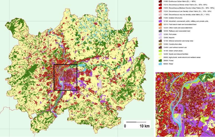
Urban mapping example for the city of Lyon, France. Credits: Urban Atlas
References:
ESA 2013, Earth Observation for Green Growth: An overview of European and Canadian Industrial Capability
This page has no comments.