| Name
|
Size
|
Creator |
Creation Date
|
Last Modification Date
|
Labels |
Attached To |
|
PNG File icon kenya.png |
451 kB |
Christopher Oligschläger |
Jun 10, 2020 12:43 |
Jun 10, 2020 12:43 |
|
Page: Seismic Planning and Flood Assessment in Kenya
|
|
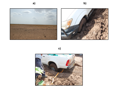
PNG File text case flood kenya.png |
26 kB |
Christopher Oligschläger |
Jun 10, 2020 12:43 |
Jun 10, 2020 12:43 |
|
Page: Seismic Planning and Flood Assessment in Kenya
|
|
PNG File ICON Seismic Planning and Flood Assessment in Keny… |
502 kB |
Christopher Oligschläger |
Jun 10, 2020 12:43 |
Jun 10, 2020 12:43 |
|
Page: Seismic Planning and Flood Assessment in Kenya
|
|
PNG File icon flood assessment kenya.png |
244 kB |
Christopher Oligschläger |
Jun 10, 2020 12:43 |
Jun 10, 2020 12:43 |
|
Page: Seismic Planning and Flood Assessment in Kenya
|
|
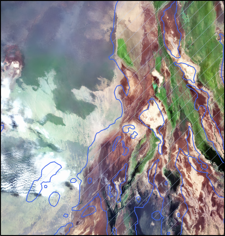
PNG File SCKenya2.png |
1.83 MB |
Christopher Oligschläger |
Jun 10, 2020 12:43 |
Jun 10, 2020 12:43 |
|
Page: Seismic Planning and Flood Assessment in Kenya
|
|
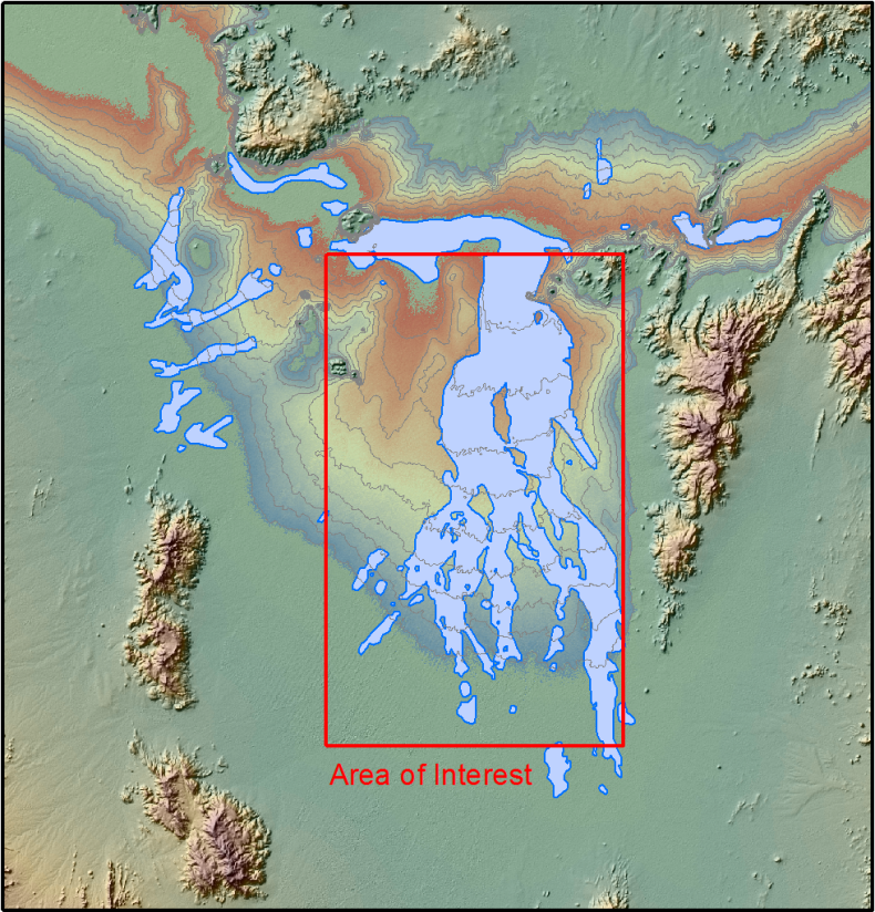
PNG File SCkenya1.png |
1.31 MB |
Christopher Oligschläger |
Jun 10, 2020 12:43 |
Jun 10, 2020 12:43 |
|
Page: Seismic Planning and Flood Assessment in Kenya
|
|
PNG File SCFlood-Kenya3.PNG |
132 kB |
Christopher Oligschläger |
Jun 10, 2020 12:43 |
Jun 10, 2020 12:43 |
|
Page: Seismic Planning and Flood Assessment in Kenya
|
|
PDF File 5_EO4OG_Case_Study_Kenya_FloodSeismicPlanning_2014… |
502 kB |
Christopher Oligschläger |
Jun 10, 2020 12:43 |
Jun 10, 2020 12:43 |
|
Page: Seismic Planning and Flood Assessment in Kenya
|
|
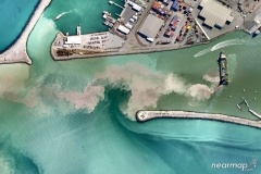
JPEG File Planetek_Nearmap_Dredge240.jpg |
33 kB |
Christopher Oligschläger |
Jun 10, 2020 12:43 |
Jun 10, 2020 12:43 |
|
Page: Sea turbidity monitoring
|
|
JPEG File índice.jpg |
12 kB |
Christopher Oligschläger |
Jun 10, 2020 12:43 |
Jun 10, 2020 12:43 |
|
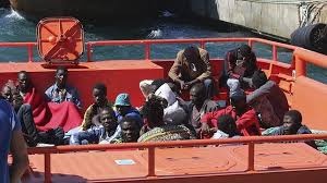
Page: Satellite images contributing to rescue persons
|
|
JPEG File Satellite based vessel detection (Ksat) - Copia.jp… |
458 kB |
Christopher Oligschläger |
Jun 10, 2020 12:43 |
Jun 10, 2020 12:43 |
|
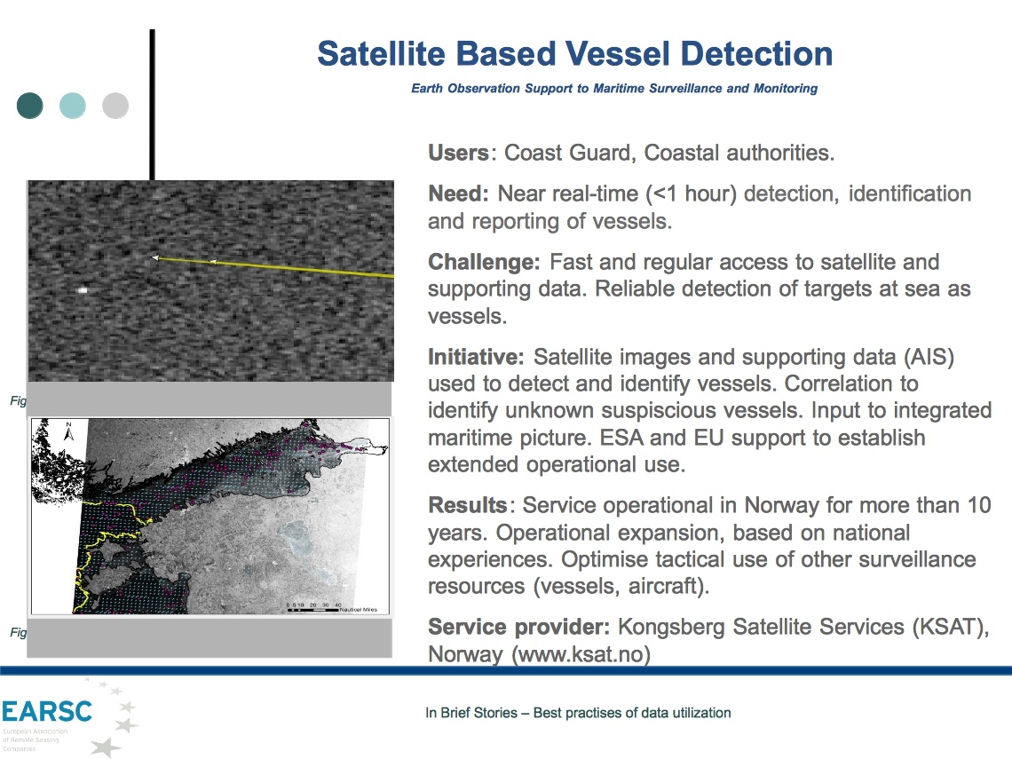
Page: Satellite based vessel detection
|
|
JPEG File OilSpill_perHabitat_Graph(660).jpg |
26 kB |
Christopher Oligschläger |
Jun 10, 2020 12:43 |
Jun 10, 2020 12:43 |
|
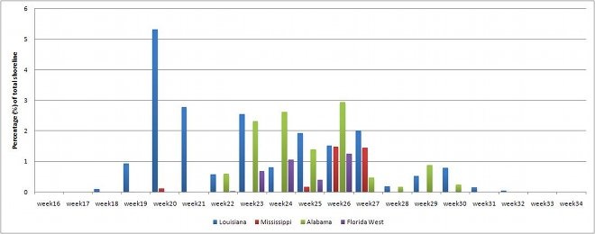
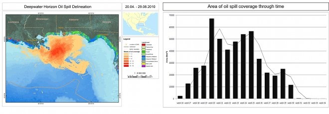
Page: Satellite based oil spill detection and impact assessment – The chronology of the Deepwater Horizon Accident
|
|
JPEG File OilSpill_Frequency_Area(660).jpg |
36 kB |
Christopher Oligschläger |
Jun 10, 2020 12:43 |
Jun 10, 2020 12:43 |
|
Page: Satellite based oil spill detection and impact assessment – The chronology of the Deepwater Horizon Accident
|
|
JPEG File OilSpill_Chronology(660).jpg |
16 kB |
Christopher Oligschläger |
Jun 10, 2020 12:43 |
Jun 10, 2020 12:43 |
|
Page: Satellite based oil spill detection and impact assessment – The chronology of the Deepwater Horizon Accident
|
|
JPEG File Satellite based oceanography (Scisys) - Copia.jpg |
181 kB |
Christopher Oligschläger |
Jun 10, 2020 12:43 |
Jun 10, 2020 12:43 |
|
Page: Satellite based oceanography
|
|
JPEG File Satellite based detection of oil spills (Ksat) - C… |
208 kB |
Christopher Oligschläger |
Jun 10, 2020 12:43 |
Jun 10, 2020 12:43 |
|
Page: Satellite based detection of oil spills
|
|
PNG File Temporal evolution.png |
59 kB |
Christopher Oligschläger |
Jun 10, 2020 12:43 |
Jun 10, 2020 12:43 |
|
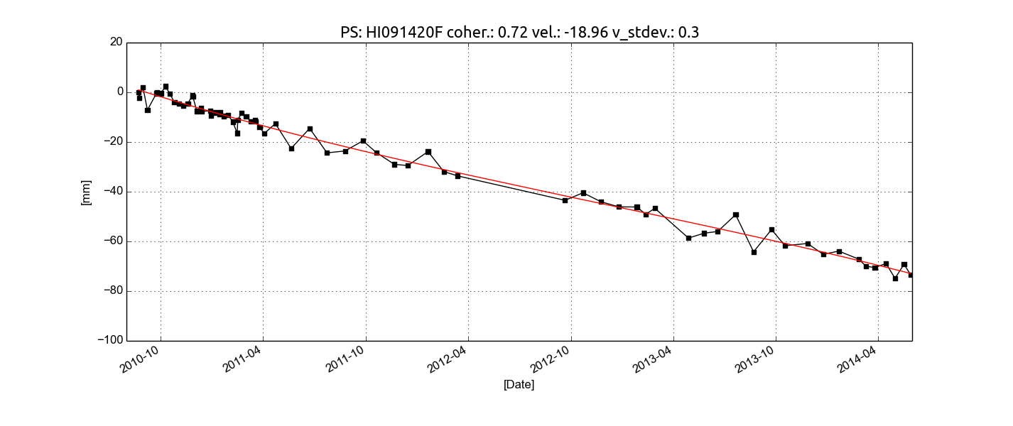
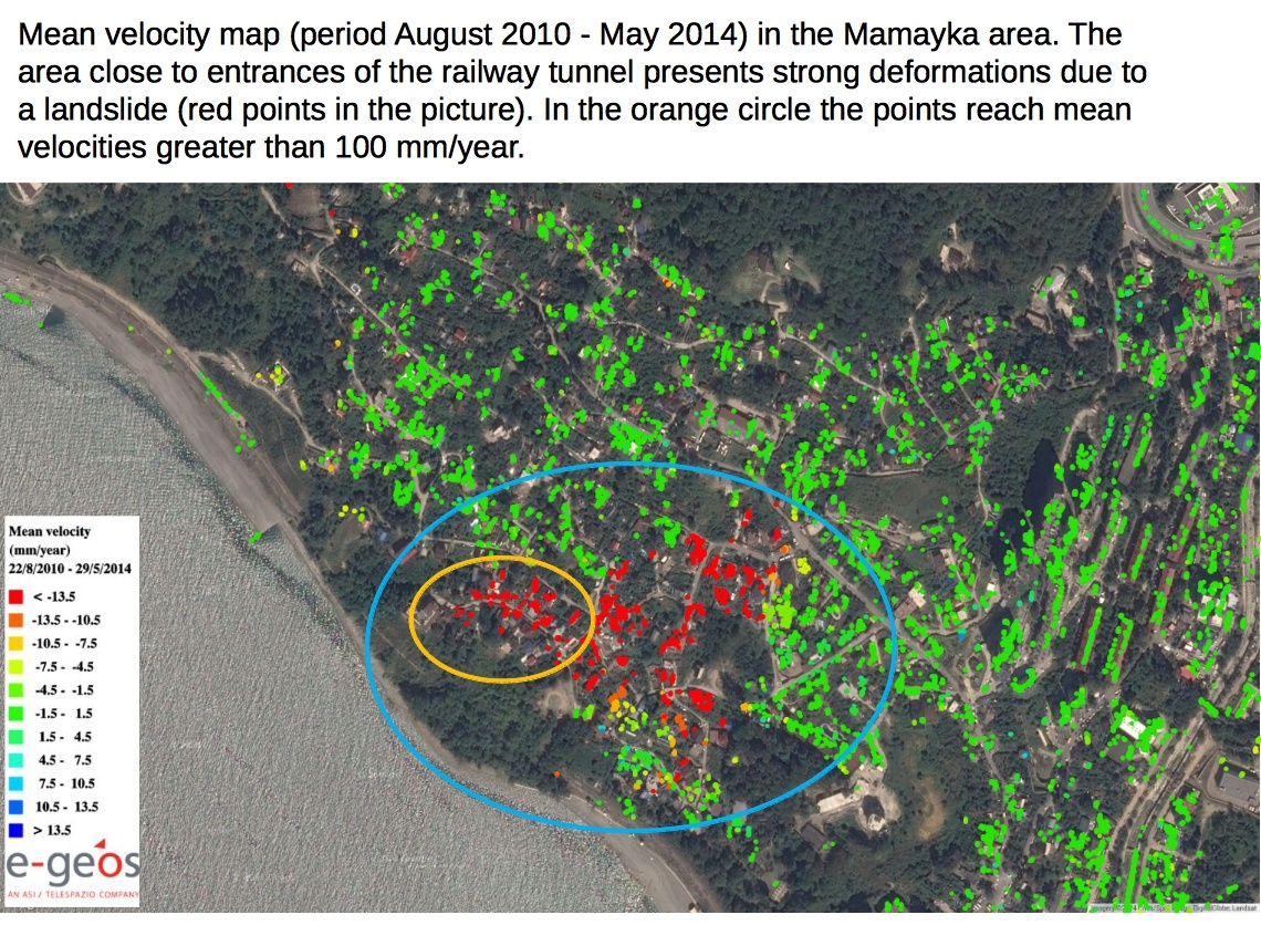
Page: Railway Line Monitoring
|
|
JPEG File Mamayka_Imgages.jpg |
851 kB |
Christopher Oligschläger |
Jun 10, 2020 12:43 |
Jun 10, 2020 12:43 |
|
Page: Railway Line Monitoring
|
|
JPEG File tab.jpg |
28 kB |
Christopher Oligschläger |
Jun 10, 2020 12:43 |
Jun 10, 2020 12:43 |
|
Page: Railway Line Monitoring
|
|
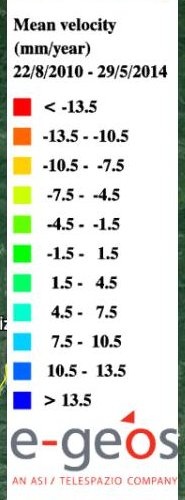
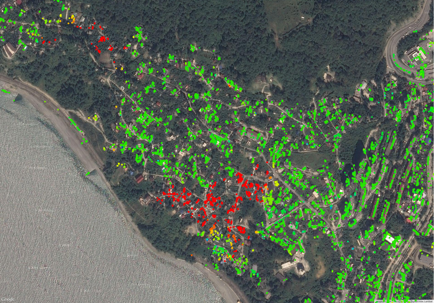
PNG File Main velocity map.png |
2.89 MB |
Christopher Oligschläger |
Jun 10, 2020 12:43 |
Jun 10, 2020 12:43 |
|
Page: Railway Line Monitoring
|