ROV operations require a good understanding of local dynamics and an accurate positioning of high intensity dynamic features. In this case study, along track sea surface height data provides the key to locating the Agulhas current off the Cape of Good Hope.
ROV operations require a precise understanding of the local dynamics and an accurate positioning of high intensity dynamic feature such as the Agulhas current. At present, Ocean models are unable to properly position these features. EO data provides a means to improve their positioning in order to insure that operations are conducted in a safe environment.
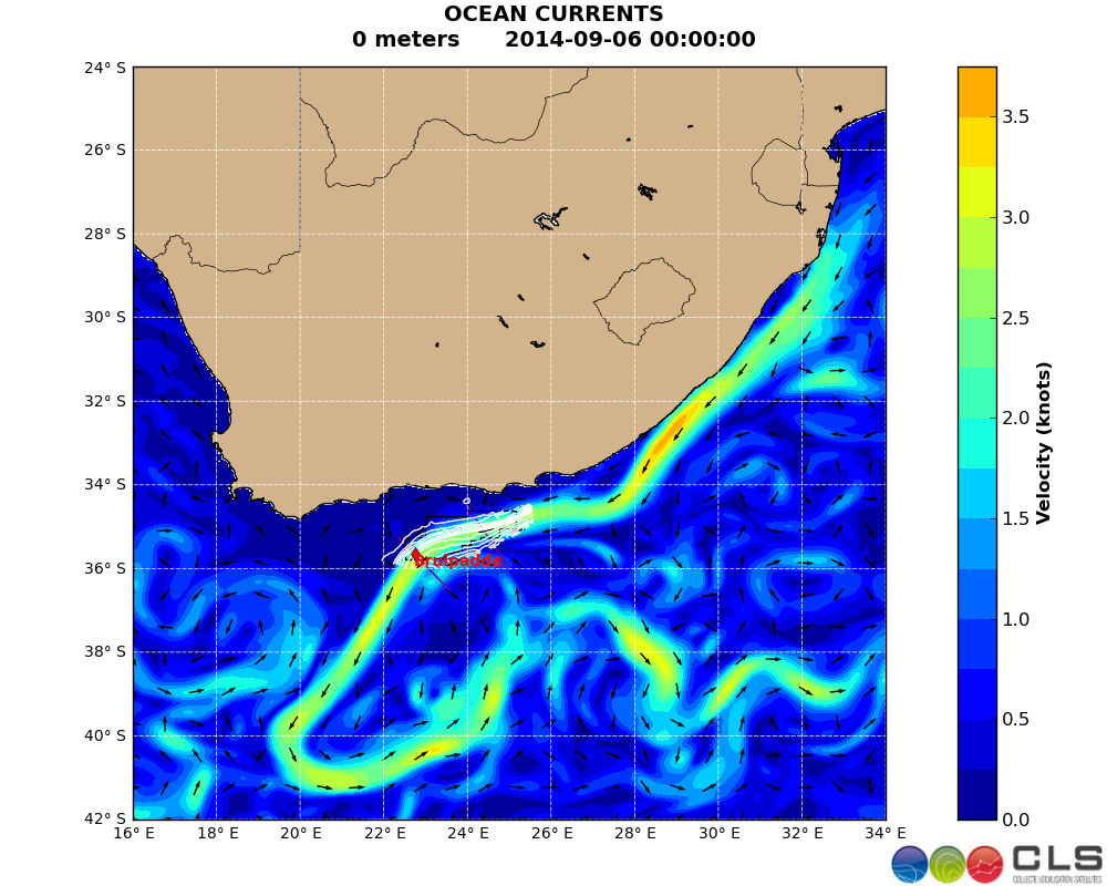
Figure 1: Southern Africa Model Surface Current map
EO altimetry data provides an accurate picture of the position of highly dynamic features.
In this case study, CLS experts downloaded and plotted altimetry on a daily basis They then computed across track geostrophic estimations from the data super imposed them on the model surface velocity data in order to check the position of the Agulhas current. The results of the analysis were then provided to the oil and gas customer.
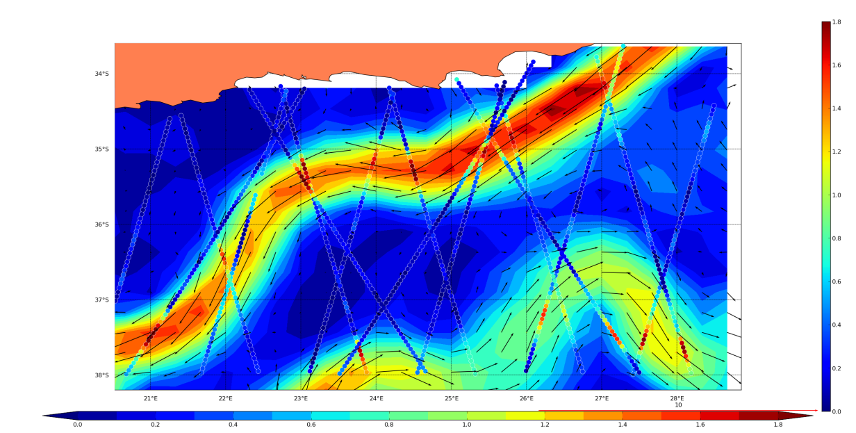
Figure 2 : Across-track geostrophic velocities computed from 2008, Feb 5th until 2008, Feb 21st along Envisat and Jason-1 mission track (vertical colorbar: ||Ucrosstrack||) ) overimposed on to Ocean Model data (horizontal colorbar : sqrt(U**2+V**2))
The along track data shows that the Agulhas current representation is often too wide and that the velocities at the core are sometimes underestimated. In particular, the strength of the Agulhas retroflection in the southern part of the domain is much weaker in the model compared to the values obtained from the EO data.
These maps allow the operation manager to determine the level of accuracy of the model on a daily basis. He thus has the tools to plan his daily operations.
CLS sàrl has over 25 years of experience in delivering data and services to customers all over the world. With a staff of 470, in France and abroad, CLS offers services in environmental monitoring, maritime security, and management of marine resources to a broad range of professionals including government, industry and the scientific community, and maintains an operational center with expert support 24/7. Since 2001, CLS has developed services for the oil & gas industry based on its built-in expertise on data collection, radar imagery or numerical modelling. For the EO4OG Project, CLS leads a consortium composed of METEO GROUP and NERSC. Tullow Oil kindly supports the team as a consultant.
Contact
Dr. Marc Lucas, mlucas@cls.fr
This page has no comments.