The use of satellites to monitor and forecast weather conditions has a long history: more than 30 years of consistent data makes it one of the most established sectors of applications of satellite data.
At the international level several programmes are coordinated by WMO (the World Meteorological Organization) with the aim of establishing and maintaining an operational observation network for weather and climate; it also favours the free and open exchange of weather data, fostering global cooperation in the domain. Many of these data and records come from satellite measurements; in particular the Global Earth Observation System of Systems (GEOSS) fosters the development of a "comprehensive, coordinated and sustained Earth observation system of systems to understand and address global environmental and economic challenges". The Global Observing System (GOS) coordinates surface-based and space-based infrastructures and methods for meteorological and environmental observations. The facilities are owned and operated by the Member countries of WMO each of which undertakes to meet certain responsibilities in the agreed global scheme so that all countries can benefit from the consolidated efforts (1).
The international commitment to provide and maintain consistent and comparable time series requires scientists and operators to take into account different satellite characteristics (e.g. sensitivity to Earth signals, evolution of performance over time, orbit stability) to reprocess and calibrate primary data (1).
Weather satellites can be polar orbiting or geostationary. Polar orbits are characterised by satellites passing above both poles on each revolution, while their passage over the eqator is at each time at a different longitude. A geostationary satellite has instead the same rotation period as the Earth and it stays above the equator, in the same area of the sky from the poinf of view of an observer on the Earth.
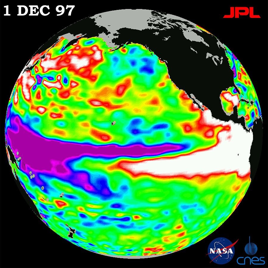
Environmental satellites, used to monitor the Earth environment, also collect useful meteorological and climate data. For example el Niño and its impacts on weather are constantly monitored via satellite images: it is a band of warm water temperatures that cyclically drops from the Pacific coast of South America, generating extreme climate events such as floods and droughts.
The 1997 El Nino seen by the US/French TOPEX/Poseidon satellite
Data recalibration and reprocessing is the step to make those information available to downstream applications for business and science. Meteorological data can also be reprocessed to fit into climate change models and Essential Climate Variables (ECV) measurements.
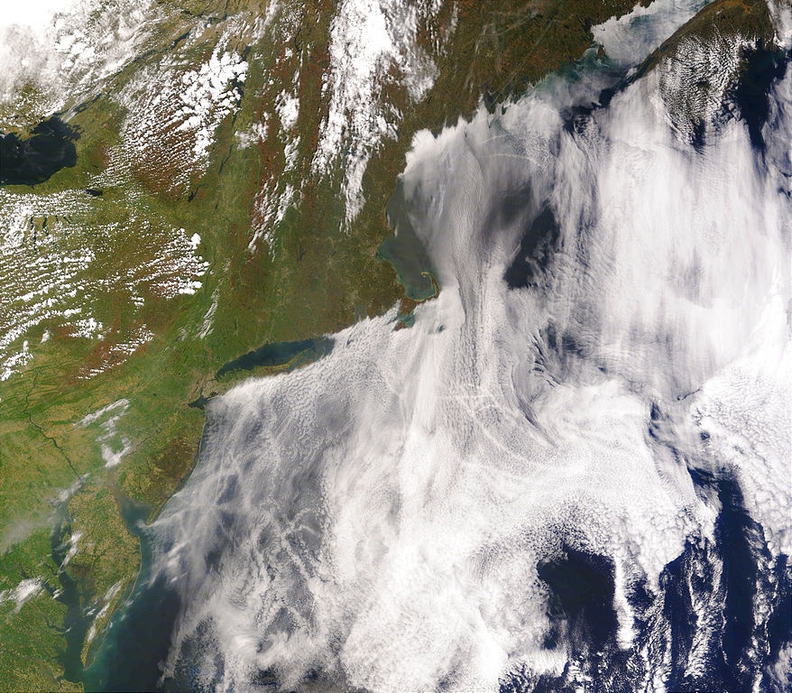
The applications of this study and analysis of atmospherical variables, temperature and precipitation are well known to everybody: everybody is a final user of such information for everyday life, while more precise products are for example used in agriculture and in the stock markets. Other domains of applications are hydrometeorology, aviation, maritime navigation, and the military and nuclear sectors.
References
(1) http://www.wmo.int/pages/prog/www/OSY/GOS.html
(2) http://www.eumetsat.int/website/home/AboutUs/WhatWeDo/MonitoringClimate/index.html
Products | Ext. Source | Descriptions | Product Standards | Ref. Project |
|---|---|---|---|---|
|
| meteorological variables: |
|
|
|
|
|
|
|---|---|---|---|
|
|
|
|
Topic | Description | Key words | Reference |
|---|---|---|---|
Research paper to evaluate the effects of spatial variation in climate and soils on forest productivity across broad regions requires an approach that can be widely applied and tested (requires purchasing to view full text) | Ecosystem remote sensing; AVHRR; Eucalypt forest; Net primary productivity (NPP); Fraction of photosynthetic active radiation (fPAR) | ScienceDirect | |
Extrapolation of synoptic meteorological data in moutainous terrain and its use for simulating forest evapotranspiration and photosynthesis | Research paper presenting a model for calculating daily microclimate conditions in mountainous terrain | Satellite data, Meteorological data, Mountainous terrain | secure.ntsg |
Predicting malaria seasons in Kenya using multitemporal meteorological satellite sensor data | Article describes research that predicts the seasonality of malaria in Kenya using remotely sensed images from satellite sensors (requires purchasing to view full text) | Meteorological data, Satellite sensor data | ScienceDirect |
Research article investigating relationships between yearly malaria incidence and (1) climate data from weather station and (2) satellite-based vegetation health (VH) indices for prediction of malaria vector activities in Bangladesh | Meteorological data, Climate, Malaria | Hindawi | |
Applicability of Space Derived Meteorological Data to Atmospheric Correction of Satellite Infrared Measurements | Research paper performing A comparative analysis of vertical temperature and humidity profiles, retrieved from MODIS and test radiosonde data from RAOB inventories | Satellite data, Meteorological data, Remote sensing | Springlink |
Characterizing a cyanobacterial bloom in western Lake Erie using satellite imagery and meteorological data | Research paper - The distribution and intensity of a bloom of the toxic cyanobacterium, Microcystis aeruginosa, in western Lake Erie was characterized using a combination of satellite ocean-color imagery, field data, and meteorological | Satellite data, Meteorological data | ASLO |
Remotely sensed surrogates of meteorological data for the study of the distribution and abundance of arthropod vectors of disease | Research paper giving an overview of how certain meteorological data used in studies of the population dynamics of arthropod vectors of disease maybe predicted using remotely sensed satellite data | Satellite data, Meteorologica data, Remote sensing | Oxford University press |
Research paper presents a general overview of satellite systems and characteristics of different satellite orbits viz. polar, and geostationary orbits | Satellite data, Meteorological data, Remote sensing, GIS | WAMIS | |
News article on Russia satellite launch | Russia, Meteorological, Satellite | Spacemart | |
Report on meteorological satellites | Meteorological data, satellite | RAMMB | |
A History of the Military Polar Orbiting Meteorological Satellite Program | Report on the polae orbiting meteorological satellite program | Satellite, Meteorological | NRO |
News article on meteorological satellite in China | Satellite, Meteorological, China | PeopleDailyOnline | |
China: Meteorological satellite monitors snow cover in drought-hit areas | Report on the National Satellite Meteorological Center of China Meteorological Administration (CMA) finding snow covered in North China and Yellow-Huaihe River valley since Feb. 11, the most-hit areas by drought. | Satellite, Meteorological data, China | CMA |
News article on NPOESS weather satellites | Satellite, Meteorological data | Defence Industry Daily | |
Defense Meteorological Satellite Program (DMSP) Satellite F13 | Document describes the DMSP mission, the satellite, and its environment | Satellite, Meteorological data, DMSP mission | NSIDC |
CGMS Directory of Meteorological Satellite Application | Directory - Publication meant to reflect the capabilities of the global system of meteorological satellites coordinated informally by the CGMS and has contributions from a wide range of establishments located in many countries around the world | Satellite, Meteorological data | WMO |
Progress on meteorological satellite and satellite meteorogy in China | Research article providing a brief introduction to the latest activities of Chinese meteorological satellite system, its products and applications | Satellite, Meteorological data | IUGG |
KMA's Geostationary Meteorological Satellite | Presentation on COMS (Communication, Ocean, Meteorological Satellite) | Satellite, Meteorological data | Goes-R |
Geostationary Meteorological Satellite Data Processing System | Research paper (requires purchasing to view full text) | Satellite, Meteorological data, Geostationary | Scientific.net |
News article on reception of meteorological satellites in Hong Kong |
This page has no comments.