Page tree

Versions Compared

Key

  • This line was added.
  • This line was removed.
  • Formatting was changed.

Content Layer
id1053574521
Content Column
tabbed-blockstrue
width100.00002%
id1053574523
Content Block
not-tabbedfalse
nameSummary
id1053574522


Column

Winter navigation in the Baltic has an outstanding importance for Finnish economy. Satellite radar (SAR) imagery is used to observe ice conditions in the Baltic by Finland and Sweden. With their synoptic view, satellites allow icebreakers to keep sea-lanes (“Motorways of the Sea”) and ports open more effectively. Copernicus Sentinel-1 data contributes to make it more efficient. This allows reducing transit times and uncertainties, which in turn has positive impacts on ports operations and down to goods transportation and availability for the local population.


Column


Content Block
nameBackground
id1053826210

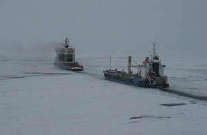
The Case Study of winter navigation in the Baltic has been published in October 2015. This report is the first of a series of three cases in the frame of the study “Assessing the detailed economic benefits derived from Copernicus Earth Observation (EO) data within selected value chains”, undertaken by EARSC under an assignment from the European Space Agency (ESA).

It uses a methodology which traces the impact of such usage on the information and services through several steps in the value chain. At each step, the benefits are assessed and the value calculated. 

Content Block
nameIssues & Needs
id1053836886

Finland is 90% dependent on sea transport for its exports and imports and so keeping the factories open and local populations supplied with goods throughout the year has a significant value.  In 1971 it was decided that all major Finnish ports (25) should be kept open throughout the winter.

In 2003, it was decided to use Satellite imagery to replace helicopters on board ice-breakers.

Content Block
nameSolution
id1054127569
 Finnish and Swedish icebreakers use satellite radar images (which replaced the use of helicopters) to help find the best routes through the ice. Thanks to the wide-area view provided by the satellites, they are able to find better routes through the ice saving time, saving fuel and reducing the uncertainty in the ship arrival times in the ports. This has a positive impact on the various activities downstream and the wider economy.
Content Block
nameResults & Perspectives
id1054097976

 This allows reducing transit times and uncertainties, which in turn has positive impacts on ports operations and down to goods transportation and availability for the local population. Between €24m and €116m of economic benefit is made each year.

The study covers Finland and Sweden but does not extend to other Baltic states. It will be interesting to extend the analysis by extrapolation to the other countries with ports on the Baltic. 

Content Block
nameRelated Info
id1054147402

 The report is available online.