| Section |
|---|
| Column |
|---|
| Worldwide there is growing interest in forests. The attention drawn by the problem of global warming has led to a greater understanding and appreciation of forests because of their role in the global carbon cycle. The possibility of mitigating climate change by reducing deforestation and forest degradation together with enhanced afforestation in order to increase carbon uptake, shows the forest’s essential role in the interlinked network of Earth’s ecosystems. Next to that forests belong to the most diverse ecosystems on Earth and provide employment, and livelihoods for many people. As stated in the Food and Agriculture Organization (FAO) Global Forest Resources Assessment (FRA) in 2010, the forests were estimated to cover 31 percent of total land area which corresponded to just over 4 billion hectares, an average of 0.6 ha per capita. Deforestation was concluded to be in decline in some countries but continued to show high rates in others. Reduction in forest area can result from deforestation and natural disasters. Deforestation refers to the clearing of forests and land conversion to benefit other land uses such as agriculture or infrastructure. Natural disasters such as fires resulting from drought may also destroy forests and cause change of land cover when the area is incapable of regenerating naturally. |
| Column |
|---|
| Remote sensing has become an important tool to gain data and information needed to support policies, decisions and negotiations in all matters where forests play a part. FAO, its member countries and the EC Joint Research Centre and other partners have been undertaking a global remote sensing survey of forests since 2008. This survey improves the knowledge on forest land use change dynamics over time, including deforestation, afforestation and natural expansion of forests. An important tool in this regard is the FRA Remote sensing Portal. Many organizations and programs are actively involved in forest management such as the CBD, FAO, UNEP, WMO, IPCC, United Nations Development Program (UNDP), and the four Global Objectives on Forests of the Non-Legally Binding Instrument on All Types of Forests adopted by the United Nations General Assembly in January 2008, Department for International Development (DfID) Forest Governance Markets and Climate (FGMC) Framework Agreement, the United Nations program Reducing Emissions from Deforestation and forest Degradation (REDD). |
|
| Section |
|---|
| Column |
|---|
| For the FRA 2010, the net change of forest area was calculated by the net change of the sum of all negative changes due to deforestation and natural disasters and all positive changes due to afforestation and natural expansion of forests. Net loss of forest area gives an indication of land use dynamics including forest loss due to deforestation and natural disasters or forest gains from planting and natural expansion. This information however should be complemented with data that show detailed characteristics. |
| Column |
|---|
| 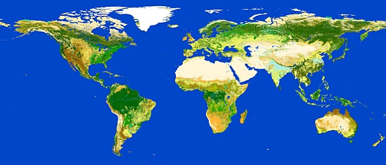
Illustration of Globcover. Credits: ESA 2010 and Université Catholique de Louvain; source: http://due.esrin.esa.int/globcover |
|
Therefore the results published in that FRA have been based on national forest inventories and remote sensing data. The latter has provided complementary information on the spatial distribution of forests and land-use dynamics at the biome, regional and global level. It has been proven that in most cases, cross-referencing remote sensing data with field assessments can improve the quality and between-year standardization for national assessments. As most national ecosystem assessments are based on in situ measurements, remote sensing data are complementary because they cover large areas with high frequency. The combination of national ground assessments with remote sensing technology greatly improves the monitoring of our forests. Remote sensing of forests is based on the fact that forest ecosystems reflect sunlight in the visible, near-infrared, and middle infrared regions of the light spectrum in ways that are easily distinguished from other types of land cover such as soil, leaves, wood, ash, water, and snow. Satellite sensors can detect these wavelengths and even longer ones such as in the microwave region. Moderate resolution sensors, including Landsat, MERIS, MODIS, ASTER, SPOT HRV, and IRS have been used to map forests at large scales. Modern high-resolution optical sensors such as IKONOS and QuickBird provide enough spatial and spectral detail to map individual trees. Most remote sensors are referred to as “passive” because they only capture reflected light emitted from the sun. Next to this type of passive sensors there are active sensors which emit pulse energy off a surface and then capture the return. Examples of these are the radar which emits microwave pulses and lidar that emits laser pulses. Both sensors are particularly useful in mapping forest characteristics such as age, density, and biomass. As opposed to most remote sensors that can only monitor features as viewed from above, while data from the understory must be inferred, lidar and radar can directly observe the understory characteristics. They are also advantageous over optical systems because they can be used to: track seasonally inundated forests; generate data in regions with continuous cloud cover; deduct better estimates of forest biomass. Active remote sensing however is more cost-prohibitive but integration of in-situ measurements with optical sensors and active remote sensing systems seems a very accurate method to achieve third dimension forest mapping. Remote sensing in combination with field surveys is the most accurate and cost-effective solution to monitoring the status of many aspects of deforestation at regular intervals. Satellite imagery is a vital tool for establishing up-to-date mapping and accurate, irrefutable measurements to monitor change in forests and evaluate the effectiveness of forest conservation programmes. Assigned by Brazil’s National Institute for Space Research (INPE), the UK satellite imaging company DMCii has successfully carried out a survey to identify the extent of deforestation with the use of constellation of remote Earth observation satellites. This imaging service has been employed by INPE since 2005 and has helped the authorities to better manage the Amazon forests and intervene to deter illegal logging. | 

