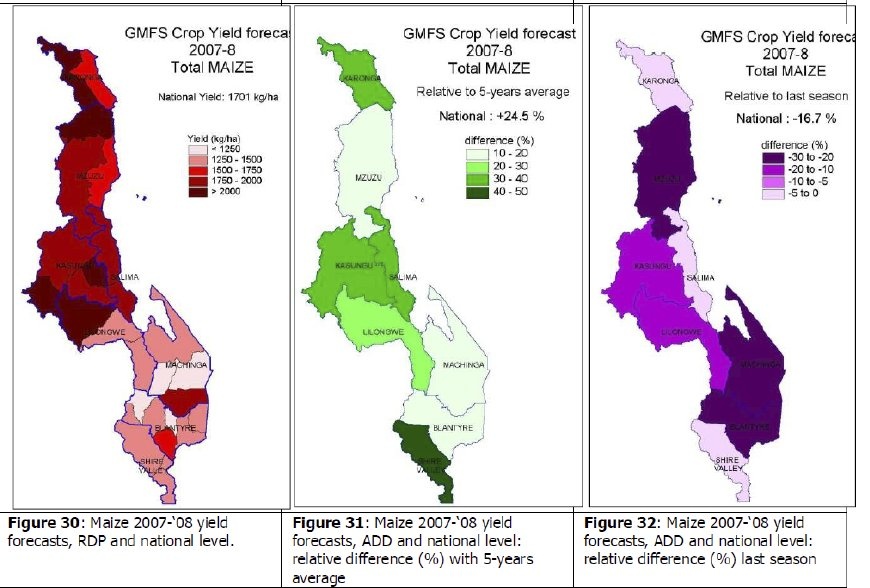
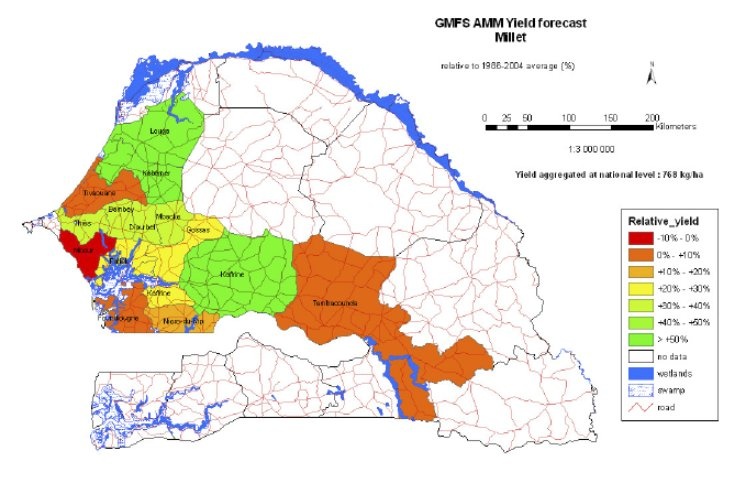
Operational crop yield estimates are multiplied by the cultivated area, providing the crop production estimate at national/regional level. This service uses medium resolution optical satellite data. Agricultural yields are traditionally estimated using Crop Growth Models or Agro-Meteorological Models (AMM) with different levels of complexity, using several data sources. Today, these crop growth models can be improved and also simplified by using EO data that can be input to various stages of the modeling process (parameters, input or driving variable).
Yield values for each crop are provided at sub-national level and then aggregated at country level, either post-harvest or a forecast during the growing season. The model makes use of several input variables (e.g. phenological, meteorological), not all derived from EO sources. Availability of local data might differ among countries. Similarly to the Early Warning service, another constraint is associated, in some countries, with reliability of historical yield values provided by public authorities in charge of collecting such data. Such yield values are in fact used to calibrate the service. |