Land use/Land cover/Land cover change maps
In line with the launch of better satellite sensors and improvement in analysis methods the production of Land Use/Land Cover maps derived from satellite images has become a standard service of most EO companies. The maps typically provide information of basic forest types, major agricultural surface types, conservation areas, settlements, infrastructure, primary roads, bare soil, water bodies, rivers, wetlands following standard classification schemes according to CORINE or FAO LCCS.
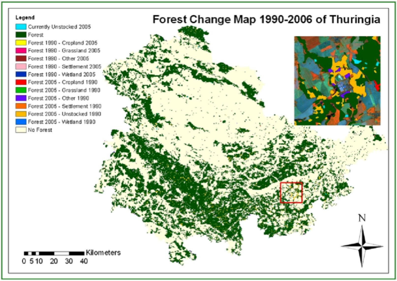
Using the availability of satellite archive data Land Cover Change maps track and quantify developments in land use/land cover over time and can among other things be useful for M&E activities in international development projects.
Typically the maps reflect changes from one year to another and are usually provided with a resolution (spatial accuracy) of 10–30 metres. In tropical rain forest areas frequent cloud cover can be an issue for the production of the maps but may be mitigated by combing radar and optical satellite images.
Land Use/Land Cover and change maps from Thuringia, Germany of GSE FM. Credits: GAF AG
The accuracy of the maps are related to the annual/seasonal variability on ground as well as the possibility to use ground data to validate and update the map contents. The geometric accuracy is less than 1 pixel which in the case of land cover is on the order of 10-20 m and typically accuracies of 80–90% are reached for the classifications.
For forestry the land cover maps provide a visual overview of the area of interest. However, since the statistical information on the land cover can be extracted, they can also assist in more economic assessments of land use and change.
The change detection maps can be used to track forestry logging activities and detect violations against regulations as well as natural changes caused by fires or storms.
The Sentinels will provide high-resolution optical and radar images globally with a very high frequency (day to weeks). This will allow to produce Land Use/Land Cover/ Land Cover Change maps with high frequency, high thematic accuracy, high precision (down to 10m) at a lower cost due to the foreseen free data price.
References:
ESA 2013, Earth Observation for Green Growth: An overview of European and Canadian Industrial Capability
Products | Ext. Source | Descriptions | Product Standards | Ref. Project |
|---|---|---|---|---|
arid areas |
|
|
|
|
|---|---|---|---|
|
|
|
|
Topic | Description | Keywords | Reference |
|---|---|---|---|
|
|
|
|


This page has no comments.