Stem Volume, Biomass and Carbon Statistics
Determination of forest biomass and carbon stock has become increasingly more important in line with an increase in REDD and REDD+ activities2. At present this is mostly done from in situ measurements on tree types, volume and height estimates.
Customised EO products can be delivered on stem volume in tropical as well as boreal forests with typically 30 m resolution on a large spatial scale. The EO techniques use radar pulses to penetrate into the forest canopy where the return signal is used to derive information on stem volume. The EO derived stem volume can then be related to above ground biomass and carbon stock by calibrating and correlating with in situ data. In this way EO adds a spatial dimension to existing in situ estimates of biomass. Using EO change detection techniques, forest degradation by the decrease in forest biomass/diversity can also be estimated.
It should be noted that these services are customised solutions and accuracies must be estimated on a case by case basis. However, since few conventional methods can assess biomass on large spatial scales attention should be given to this product. The development of EO biomass estimations will be even more interesting to follow with the launch of the Sentinel-1 satellite which allows for more timely estimations of forest changes.
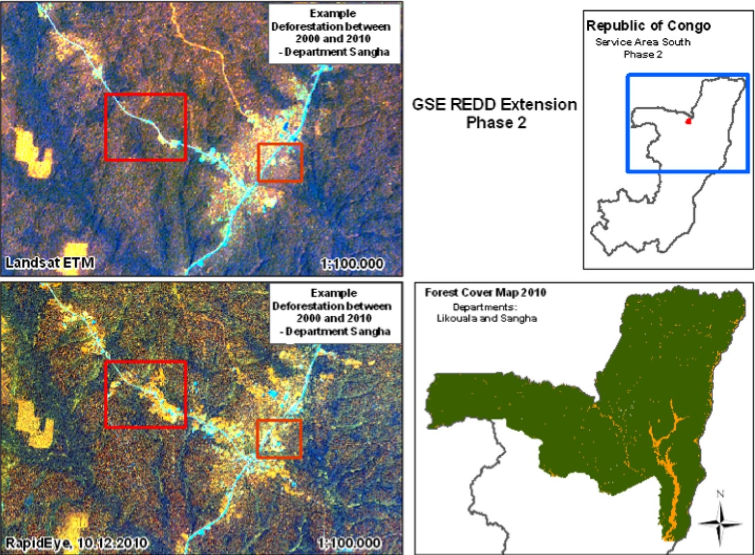 Deforestation in Congo between 2000 and 2010 as part of a REDD trial prokect led by ESA and GAF AG. Credits: GAF AG
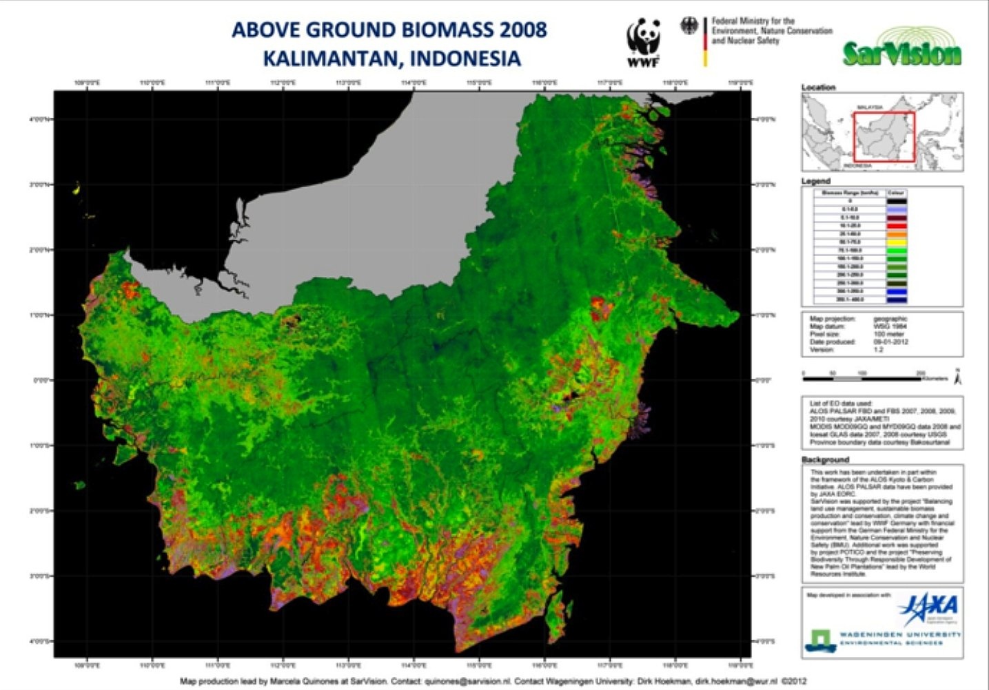 Biomass map over Kalimatan (Indonesia) for 2008. The 50m resolution derives from LIDAR and radar sources ICESat-GLAS & ALOS PALSAR. Credits: SarVision
References:
ESA 2013, Earth Observation for Green Growth: An overview of European and Canadian Industrial Capability
forest mapping services |
|
| ||
forest monitoring |
| climate change modelling |
| |
mapping biomass in forest |
| Provide maps of the net primary productivity and total stem of forested areas at European NUTS-3 level |
| |
| forest above-ground Biomass estimations | This product delivers maps or raster digital files that delineate and identify:
| |||
Forest Types: forest layer | forest area, type, cover density, area change, | |||
Forest Types: urban forest zoning maps |
| controlling land take and the preservation of urban green spaces (urban forest growth, control wind throw or disease infestation) |
|
|
Forest monitoring | FAO launches Open Foris to improve forest monitoring systems. | deforestation, climate change, REDD |
|
This page has no comments.