3D City ModelsHigh-resolution satellite images capture very detailed information of the terrain. Much of the imagery is at the resolution close to that of smallscale aerial photographs making it possible to apply photogrammetric methods to collect stereoscopic information about buildings and other urban objects using stereo pairs or multiple images. In addition to the cross-track (side-looking) stereo images acquired during different orbit overpasses, many sensors can acquire along-track (same-orbit) stereo images of the same region quasi simultaneously.
Successful solutions exist for semi-automated object extraction and modelling of built-up environments from satellite, aerial and terrestrial platforms. These allow modelling of not only buildings, but also terrain models and any other objects of interest which can be represented as a polyhedral model (bridges, industrial infrastructure and even ships or individual trees). |

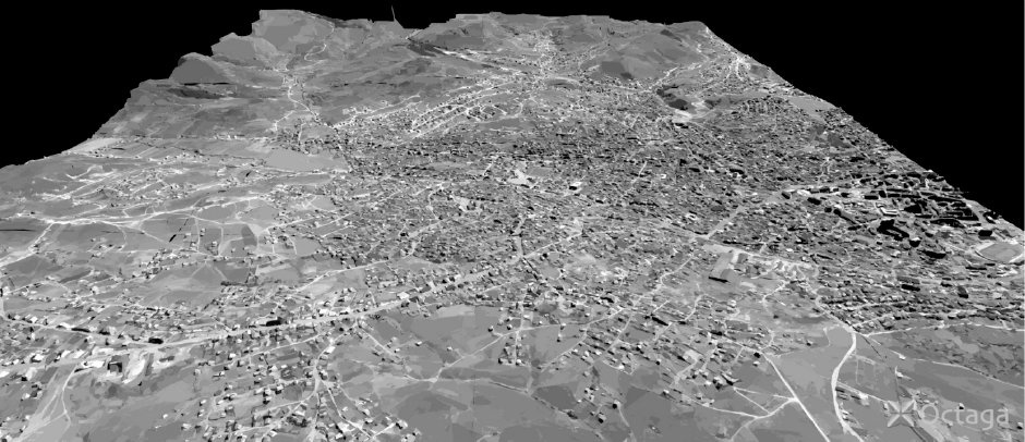
3d-view of Pristina (Kosovo), generated from two panchromatic Ikonos satellite scenes (1m resolution, 680 km altitude). Credits: ReVisitor AB (Sweden). |
|
Space-based sensors provide high resolution (0.6–5.0 m) multispectral data and multiple-view terrain coverage along the same satellite orbit, enabling the multi-image matching approach,
leading to higher measurement accuracies (reduced problems of occlusion, multiple solutions, surface discontinuities, etc.). The availability of data goes back to the last years of the 1990s, with frequency of coverage increasing in time. 
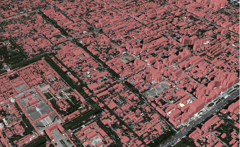
A 3-dimensional view of the city centre of Beijing derived from very high resolution stereo satellite imagery. Credits: GIM/Epsilon/EUSI. |
In general, the processing of very-high resolution satellite images poses a challenge for traditional photogrammetric algorithms. Processing methods need redesign and extension in order to accommodate the imaging geometry characterised by nearly parallel projection in along-track direction and perspective projection in cross-track direction. The benefits of satellite imagery as opposed to aerial photography lie in the possibility to consistently, frequently and efficiently map large areas at lower costs. With very high-resolution satellite data becoming increasingly available, the positive future prospects of 3D-modelling from satellite imagery are guaranteed (see also the Urban Mapping section). |
|
References: ESA 2013, Earth Observation for Green Growth: An overview of European and Canadian Industrial Capability |