
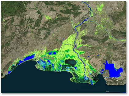
Detailed water and wetness classification (Source: GeoVille) | ||||||||||
Category | ||||||||||
PRODUCT DESCRIPTION | ||||||||||
This product identifies open water bodies, including natural lakes as well as man-made reservoirs such as ponds or lakes and wide rivers showing their extent. Furthermore, changes in water body outline can be monitored over a period of time to detect seasonal changes. Analysing the frequency in periodical water masks based on time series allows to monitor any changes of water body extents over time as well as the frequency of water occurrence. High accuracy is reached due to the contrast in radar backscatter from open water surfaces and land. This service may be used for product development, underwriting and loss adjustment purposes. | ||||||||||
PRODUCT SPECIFICATIONS | ||||||||||
Main processing stepsThe product is derived by applying a suite of dynamic water detection processing chains optimized for various target areas. The production workflows mainly operate on Sentinel-2 time-series imagery (optical) and Sentinel-1 Synthetic Aperture Radar (SAR) data but can also applied to many other optical and SAR data for historical analysis. Individual processing chains are applied to these data inputs and their results are combined using a rule-based fusion algorithm that ensures the detection strengths of each sensor are incorporated into the final product. | ||||||||||
Input data sourcesOptical: Landsat-8, Sentinel-2, VHR imagery Radar: Sentinel-1 Supporting data: | ||||||||||
Spatial resolution and coverageSpatial resolution: 10 – 500 m Coverage: global Availability: globally available | ||||||||||
Accuracy / constraintsThematic accuracy: > 95% accuracy / limitations for densely forested areas Spatial accuracy: Absolute geolocation is constantly monitored for S2A and S2B. The long-term performance is close to 11 m at 95% for both satellites. | ||||||||||
LimitationsTopography is a major issue in mountainous regions due to geometric and radiometric effects causing radar shadow and thus false detections. | ||||||||||
Frequency / timelinessFrequency: monthly to multi-annual; observation may be required over a specified period Timeliness: within 3 days after last satellite pass | ||||||||||
Delivery / output formatData type: raster and vector formats File format: GeoTIFF, Shapefile | ||||||||||
AccessibilityNear real time water and wetness information is commercially available on demand from EO service providers. A water and wetness layer for Europe showing for the status years 2015 and 2018 taking into account the occurrence of water and wet surfaces over the period from 2009 to 2015 for the status year 2015 the last 7 previous years is publicly available through the Copernicus Land Monitoring Service (https://land.copernicus.eu/pan-european/high-resolution-layers/water-wetness), an updated layer for the status year 2018 will be available soon. | ||||||||||
CHALLENGES ADDRESSED - USE CASE(S) | ||||||||||
Product Development:
Underwriting:
Loss Adjustment: | ||||||||||

...