
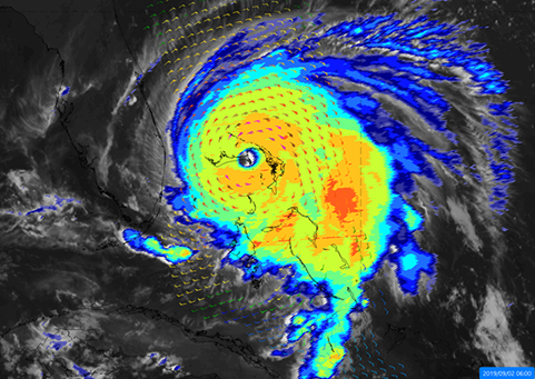
Hurricane Dorian, September 2019 (Source: EUMETSAT 2020) | ||||||||||
Category | ||||||||||
PRODUCT DESCRIPTION | ||||||||||
The monitoring and forecasting of weather events is important for agricultural business processes to take appropriate measures already in advance and for agro-insurance to correlate damages to certain risk events. Weather observations and forecasts are based on a continuous, global EO data on the weather events in Earth’s atmosphere and on surface. Observations made by special weather satellites are an important source for this application in agricultural insurance and crop monitoring. Two types of weather satellites are currently in operation, the geostationary and the polar orbiting satellites. To get the best results, a combination of both sources is ideal. Satellites with a geostationary orbit appear stationary when viewed from the earth, meaning they have the same rotation period as the Earth. They are located further away from the surface; therefore, the spatial resolution is lower; however, they provide a higher temporal resolution than polar orbiting satellites. The Meteosat Second Generation for example provides a baseline repeat cycle of 15 minutes. On the other hand, with each revolution polar / sun-synchronous / Lower Earth orbit satellites pass both poles while they pass the equator at a different longitude each time. Forecasts usually range from a few hours until 10 days ahead being a good tool for insurance portfolio monitoring and application of non-insurance measures by farmers to decrease the potential negative effects of the forecasted event on their crop yields. | ||||||||||
PRODUCT SPECIFICATIONS | ||||||||||
Main processing stepsInformation are derived from geostationary and polar orbiting satellites. | ||||||||||
Input data sourcesGeostationary satellites: Meteosat-8/-9/-10/-11, GOES Polar orbiting satellites: Metop-A/-B/-C Other satellites: Sentinel-3A/-3B, Jason-3 Supporting data: n.a. | ||||||||||
Spatial resolution and coverageSpatial resolution: > 1 km Coverage: global Availability: globally available | ||||||||||
Accuracy / constraintsThematic accuracy: > 85 % Spatial accuracy: Different data sources are combined to reach the highest accuracy possible. Higher resolution does NOT mean higher accuracy necessarily. It mainly means more spatial detail. This is especially true for precipitation accuracy, which might decline at higher resolution (below 5 km), see e.g. https://content.meteoblue.com/nl/specifications/data-sources. For a detailed analysis of weather forecasts, please refer e.g. to the evaluation of ECMWF forecasts: https://www.ecmwf.int/node/19277. | ||||||||||
LimitationsWeather predictions limited to 10 days in future; severe weather event warnings available 48 hours to 15 minutes prior to a weather event. | ||||||||||
Frequency / timelinessFrequency: depending on satellite Timeliness: near real-time | ||||||||||
Delivery / output formatData type: NetCDF File format: NetCDF; typically available also in web interfaces | ||||||||||
AccessibilityData is available through portals after registration, some products are subject to licence agreements., e.g. through the Copernicus Atmosphere Monitoring Service (https://atmosphere.copernicus.eu/). Available on demand from commercial service providers. | ||||||||||
CHALLENGES ADDRESSED - USE CASE(S) | ||||||||||
Product Development:
Product Sales:
Underwriting: Loss Adjustment:
| ||||||||||
...